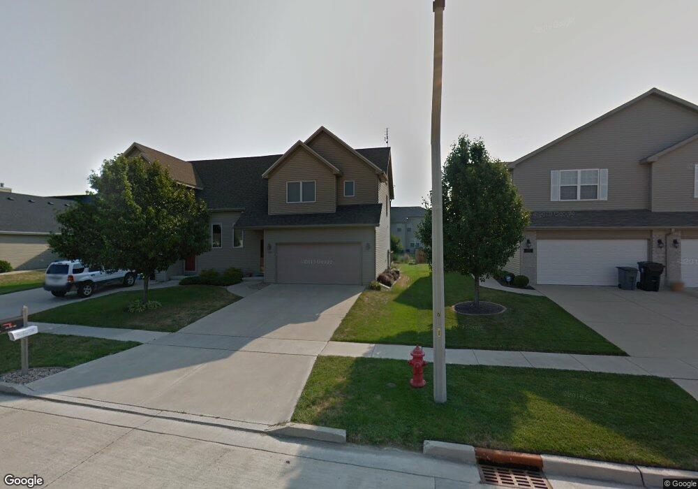
1204 Onyx Ln Normal, IL 61761
Eagles Landing NeighborhoodEstimated Value: $202,505 - $287,000
3
Beds
3
Baths
1,312
Sq Ft
$199/Sq Ft
Est. Value
About This Home
This home is located at 1204 Onyx Ln, Normal, IL 61761 and is currently estimated at $260,626, approximately $198 per square foot. 1204 Onyx Ln is a home located in McLean County with nearby schools including Grove Elementary School, Chiddix Junior High School, and Normal Community High School.
Ownership History
Date
Name
Owned For
Owner Type
Purchase Details
Closed on
Jul 12, 2018
Sold by
Olson Mark and Olson Kathie L
Bought by
Evans Otis H and Evans Joann
Current Estimated Value
Home Financials for this Owner
Home Financials are based on the most recent Mortgage that was taken out on this home.
Original Mortgage
$162,900
Outstanding Balance
$142,706
Interest Rate
5%
Estimated Equity
$117,920
Create a Home Valuation Report for This Property
The Home Valuation Report is an in-depth analysis detailing your home's value as well as a comparison with similar homes in the area
Home Values in the Area
Average Home Value in this Area
Purchase History
| Date | Buyer | Sale Price | Title Company |
|---|---|---|---|
| Evans Otis H | $181,000 | Mclean County Title |
Source: Public Records
Mortgage History
| Date | Status | Borrower | Loan Amount |
|---|---|---|---|
| Open | Evans Otis H | $162,900 |
Source: Public Records
Tax History
| Year | Tax Paid | Tax Assessment Tax Assessment Total Assessment is a certain percentage of the fair market value that is determined by local assessors to be the total taxable value of land and additions on the property. | Land | Improvement |
|---|---|---|---|---|
| 2024 | $3,461 | $51,864 | $11,323 | $40,541 |
| 2022 | $3,230 | $41,955 | $9,160 | $32,795 |
| 2021 | $3,089 | $39,584 | $8,642 | $30,942 |
| 2020 | $3,065 | $39,172 | $8,552 | $30,620 |
| 2019 | $2,959 | $38,962 | $8,506 | $30,456 |
| 2018 | $2,921 | $38,550 | $8,416 | $30,134 |
| 2017 | $2,817 | $38,550 | $8,416 | $30,134 |
| 2016 | $2,786 | $38,550 | $8,416 | $30,134 |
| 2015 | $3,210 | $37,647 | $8,219 | $29,428 |
| 2014 | $3,170 | $37,647 | $8,219 | $29,428 |
| 2013 | -- | $37,647 | $8,219 | $29,428 |
Source: Public Records
Map
Nearby Homes
- 1236 Blue Bill Way
- 3291 Red Jasper St
- 3551 Napa Ln
- 1170 Lynx Ln
- 3225 Marimarsh Ln
- Lot 8 Jehova
- 1300/1302 Henry Normal
- 3020 Wild Horse St
- 1260 Silver Oak Cir
- 2968 Wolf Creek Ln
- 3638 Napa Ln
- 3616 Cabernet Ct
- 3618 Cabernet Ct
- 3613 Cabernet Ct
- 2884 Three Eagles St
- Town ship 24 North SE (1 4) of Section 19
- Lot G Corner Fort Jesse & Towanda Barnes
- Lot H Towanda Barnes
- 2618 Limestone Ct
- 2625 Shale Rd
Your Personal Tour Guide
Ask me questions while you tour the home.