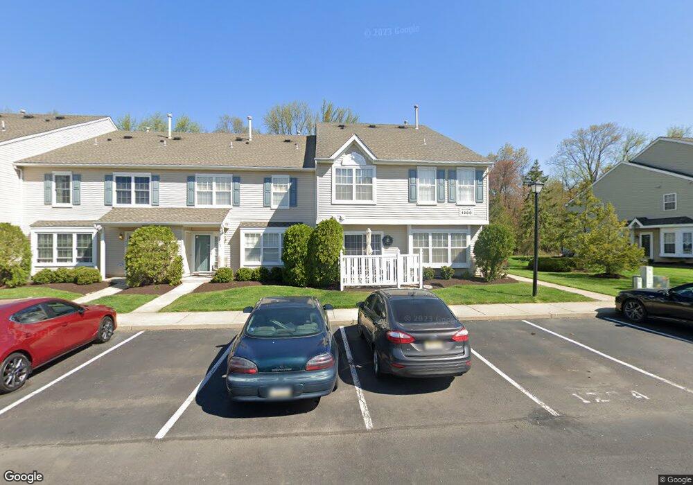
1204 Stokes Rd Unit 1204 Mount Laurel, NJ 08054
Estimated Value: $333,685 - $369,000
--
Bed
--
Bath
1,678
Sq Ft
$211/Sq Ft
Est. Value
About This Home
This home is located at 1204 Stokes Rd Unit 1204, Mount Laurel, NJ 08054 and is currently estimated at $354,671, approximately $211 per square foot. 1204 Stokes Rd Unit 1204 is a home located in Burlington County with nearby schools including Countryside Elementary School, T.E. Harrington Middle School, and Mount Laurel Hartford School.
Ownership History
Date
Name
Owned For
Owner Type
Purchase Details
Closed on
Jun 27, 1997
Sold by
Orleans Construction Corp
Bought by
Lombardo Sharon E
Current Estimated Value
Home Financials for this Owner
Home Financials are based on the most recent Mortgage that was taken out on this home.
Original Mortgage
$93,800
Outstanding Balance
$13,872
Interest Rate
7.86%
Mortgage Type
FHA
Estimated Equity
$340,799
Create a Home Valuation Report for This Property
The Home Valuation Report is an in-depth analysis detailing your home's value as well as a comparison with similar homes in the area
Home Values in the Area
Average Home Value in this Area
Purchase History
| Date | Buyer | Sale Price | Title Company |
|---|---|---|---|
| Lombardo Sharon E | $117,230 | First American Title Ins Co |
Source: Public Records
Mortgage History
| Date | Status | Borrower | Loan Amount |
|---|---|---|---|
| Open | Lombardo Sharon E | $93,800 |
Source: Public Records
Tax History Compared to Growth
Tax History
| Year | Tax Paid | Tax Assessment Tax Assessment Total Assessment is a certain percentage of the fair market value that is determined by local assessors to be the total taxable value of land and additions on the property. | Land | Improvement |
|---|---|---|---|---|
| 2025 | $5,850 | $185,300 | $45,000 | $140,300 |
| 2024 | $5,629 | $185,300 | $45,000 | $140,300 |
| 2023 | $5,629 | $185,300 | $45,000 | $140,300 |
| 2022 | $5,611 | $185,300 | $45,000 | $140,300 |
| 2021 | $5,096 | $185,300 | $45,000 | $140,300 |
| 2020 | $5,398 | $185,300 | $45,000 | $140,300 |
| 2019 | $5,342 | $185,300 | $45,000 | $140,300 |
| 2018 | $5,301 | $185,300 | $45,000 | $140,300 |
| 2017 | $5,164 | $185,300 | $45,000 | $140,300 |
| 2016 | $5,086 | $185,300 | $45,000 | $140,300 |
| 2015 | $5,027 | $185,300 | $45,000 | $140,300 |
| 2014 | $4,977 | $185,300 | $45,000 | $140,300 |
Source: Public Records
Map
Nearby Homes
- 603 Kirby Way Unit 603
- 205 Kirby Way Unit 205
- 6 Leighton Dr
- 27 Elkington Dr
- 907A Oliphant Ln Unit 907A
- 53 Saw Mill Dr
- 112B W Bluebell Ln Unit 112B
- 99 A W Bluebell Ln
- 21 Zinnia Ct
- 123A Birchfield Ct Unit 123A
- 78 Watson Dr
- 130B Birchfield Ct Unit 130B
- 167 Canterbury Rd
- 31 Quince Ct
- 3 Village Ct
- 2 Watson Dr
- 35 Sisters Farmstead Dr
- 23 E Oleander Dr
- 11 E Berwin Way
- 1201A Ginger Ct
- 1205 Stokes Rd Unit 1205
- 1206 Stokes Rd Unit 1206
- 1202 Stokes Rd Unit 1202
- 1207 Stokes Rd Unit 1207
- 1201 Stokes Rd Unit 1201
- 1208 Stokes Rd Unit 1208
- 64 Stokes Rd
- 62 Stokes Rd
- 1404 Stokes Rd Unit 1404
- 1405 Stokes Rd
- 60 Stokes Rd
- 801 Kirby Way Unit 801
- 808 Kirby Way Unit 808
- 808 Kirby Way Unit 808
- 1403 Stokes Rd Unit 1403
- 58 Stokes Rd
- 1406 Stokes Rd Unit 1406
- 802 Kirby Way Unit 802
- 807 Kirby Way Unit 807
- 1402 Stokes Rd Unit 1402