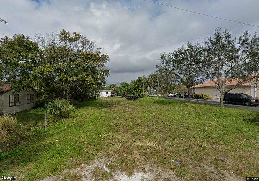
1205 52nd St West Palm Beach, FL 33407
Estimated Value: $162,884
--
Bed
1
Bath
912
Sq Ft
$179/Sq Ft
Est. Value
About This Home
This home is located at 1205 52nd St, West Palm Beach, FL 33407 and is currently estimated at $162,884, approximately $178 per square foot. 1205 52nd St is a home located in Palm Beach County with nearby schools including West Riviera Elementary School, John F. Kennedy Middle School, and Palm Beach Lakes Community High School.
Ownership History
Date
Name
Owned For
Owner Type
Purchase Details
Closed on
Aug 30, 2022
Sold by
Anna Lise Llc
Bought by
Loxahatchee 1690 Llc
Current Estimated Value
Purchase Details
Closed on
May 4, 2022
Sold by
Robert Smith Walter and Robert Evelyn
Bought by
Anna Lise Llc
Purchase Details
Closed on
Jul 6, 1999
Sold by
Turner Margaret
Bought by
Smith Walter R
Home Financials for this Owner
Home Financials are based on the most recent Mortgage that was taken out on this home.
Original Mortgage
$33,000
Interest Rate
7.27%
Create a Home Valuation Report for This Property
The Home Valuation Report is an in-depth analysis detailing your home's value as well as a comparison with similar homes in the area
Home Values in the Area
Average Home Value in this Area
Purchase History
| Date | Buyer | Sale Price | Title Company |
|---|---|---|---|
| Loxahatchee 1690 Llc | $150,000 | Clear Lake Title Services | |
| Anna Lise Llc | $115,000 | Gerson Law Firm | |
| Smith Walter R | $25,000 | -- |
Source: Public Records
Mortgage History
| Date | Status | Borrower | Loan Amount |
|---|---|---|---|
| Previous Owner | Smith Walter R | $33,000 |
Source: Public Records
Tax History Compared to Growth
Tax History
| Year | Tax Paid | Tax Assessment Tax Assessment Total Assessment is a certain percentage of the fair market value that is determined by local assessors to be the total taxable value of land and additions on the property. | Land | Improvement |
|---|---|---|---|---|
| 2024 | $294 | $26,400 | -- | -- |
| 2023 | $604 | $26,400 | $26,400 | $0 |
| 2022 | $566 | $41,428 | $0 | $0 |
| 2021 | $540 | $40,221 | $0 | $0 |
| 2020 | $525 | $39,666 | $0 | $0 |
| 2019 | $507 | $38,774 | $0 | $0 |
| 2018 | $482 | $38,051 | $0 | $0 |
| 2017 | $465 | $37,268 | $0 | $0 |
| 2016 | $450 | $36,501 | $0 | $0 |
| 2015 | $450 | $36,247 | $0 | $0 |
| 2014 | $451 | $35,959 | $0 | $0 |
Source: Public Records
Map
Nearby Homes
- 5707 Briarwood St
- 5646 Enclave Dr
- 5611 Enclave Dr
- 1653 Lindley St
- 5657 Mentmore Dr
- 4501 N Australian Ave
- 1654 43rd St
- 1705 Boardman Ave
- 840 W 1st St
- 5612 Mentmore Dr
- 0 W 2nd St
- 5633 Mentmore Dr
- W W 3rd St
- 1737 Lindley St
- 936 45th St
- 1637 40th St
- 958 W 4th St
- 817 W 3rd St
- 5677 Mentmore Dr Unit 5677
- 908 E Tiffany Dr Unit 2
- 1209 52nd St
- 1206 53rd St
- 1211 52nd St
- 1208 53rd St
- 1213 52nd St
- 1217 52nd St
- 1201 53rd St
- 5101 N Australian Ave Unit 2
- 5101 N Australian Ave Unit 1
- 5101 N Australian Ave
- 5101 N Australian Ave Unit 1-4
- 1219 52nd St
- 1126 53rd Ct N
- 1217 53rd St
- 1212 50th St
- 1211 50th St
- Tbd N Australian Ave
- 753 53rd St
- 53rd N 53rd Ct N
- 1107 53rd Ct S Unit 1107
