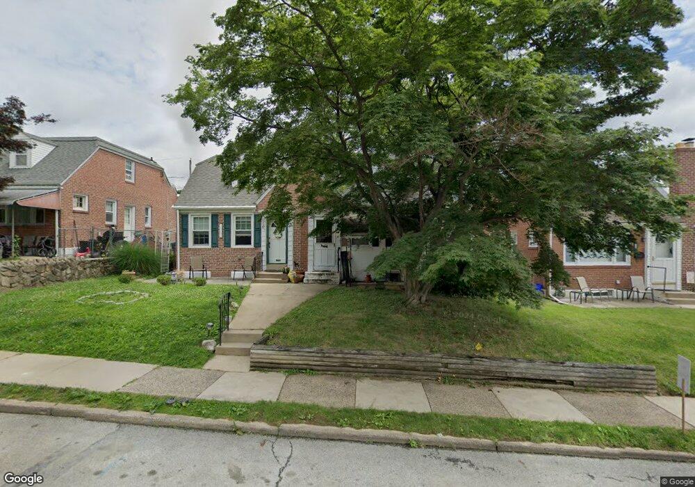
1205 Agnew Dr Drexel Hill, PA 19026
Estimated Value: $240,000 - $276,000
3
Beds
2
Baths
1,089
Sq Ft
$240/Sq Ft
Est. Value
About This Home
This home is located at 1205 Agnew Dr, Drexel Hill, PA 19026 and is currently estimated at $260,943, approximately $239 per square foot. 1205 Agnew Dr is a home located in Delaware County with nearby schools including Hillcrest El School, Drexel Hill Middle School, and Upper Darby High School.
Ownership History
Date
Name
Owned For
Owner Type
Purchase Details
Closed on
Jun 17, 2024
Sold by
Lawson Matthew Andrew
Bought by
Lawson Matthew Andrew and Lawson Ayu
Current Estimated Value
Purchase Details
Closed on
Feb 9, 2010
Sold by
Deweese Marsha and Estate Of Gersha Kelly
Bought by
Lawson Matthew Andrew
Home Financials for this Owner
Home Financials are based on the most recent Mortgage that was taken out on this home.
Original Mortgage
$148,117
Interest Rate
5.11%
Mortgage Type
VA
Purchase Details
Closed on
Apr 8, 2009
Sold by
Testa Cynthia and Mcmenamin Cynthia
Bought by
Kelly Gersha and Deweese Marsha
Home Financials for this Owner
Home Financials are based on the most recent Mortgage that was taken out on this home.
Original Mortgage
$76,000
Interest Rate
4.93%
Mortgage Type
New Conventional
Create a Home Valuation Report for This Property
The Home Valuation Report is an in-depth analysis detailing your home's value as well as a comparison with similar homes in the area
Home Values in the Area
Average Home Value in this Area
Purchase History
| Date | Buyer | Sale Price | Title Company |
|---|---|---|---|
| Lawson Matthew Andrew | -- | None Listed On Document | |
| Lawson Matthew Andrew | -- | None Listed On Document | |
| Lawson Matthew Andrew | $145,000 | None Available | |
| Kelly Gersha | $121,000 | None Available |
Source: Public Records
Mortgage History
| Date | Status | Borrower | Loan Amount |
|---|---|---|---|
| Previous Owner | Lawson Matthew Andrew | $148,117 | |
| Previous Owner | Kelly Gersha | $76,000 |
Source: Public Records
Tax History Compared to Growth
Tax History
| Year | Tax Paid | Tax Assessment Tax Assessment Total Assessment is a certain percentage of the fair market value that is determined by local assessors to be the total taxable value of land and additions on the property. | Land | Improvement |
|---|---|---|---|---|
| 2025 | $5,281 | $124,880 | $27,460 | $97,420 |
| 2024 | $5,281 | $124,880 | $27,460 | $97,420 |
| 2023 | $5,232 | $124,880 | $27,460 | $97,420 |
| 2022 | $5,091 | $124,880 | $27,460 | $97,420 |
| 2021 | $6,864 | $124,880 | $27,460 | $97,420 |
| 2020 | $5,187 | $80,180 | $29,950 | $50,230 |
| 2019 | $5,095 | $80,180 | $29,950 | $50,230 |
| 2018 | $5,037 | $80,180 | $0 | $0 |
| 2017 | $4,906 | $80,180 | $0 | $0 |
| 2016 | $440 | $80,180 | $0 | $0 |
| 2015 | $440 | $80,180 | $0 | $0 |
| 2014 | $440 | $80,180 | $0 | $0 |
Source: Public Records
Map
Nearby Homes
- 1133 Agnew Dr
- 1214 Roosevelt Dr
- 1237 Bryan St
- 1228 Bryan St
- 1114 Roosevelt Dr
- 1228 Old Ln
- 1101 Wilson Dr
- 1025 Shadeland Ave
- 1004 Turner Ave
- 924 Fairfax Rd
- 104 Gilmore Rd
- 2354 Bond Ave
- 1217 Ormond Ave
- 872 Fairfax Rd
- 71 S Brighton Ave
- 8525 Monroe Ave
- 2548 Irvington Rd
- 827 Hampshire Rd
- 858 Fairfax Rd
- 2219 Ardmore Ave