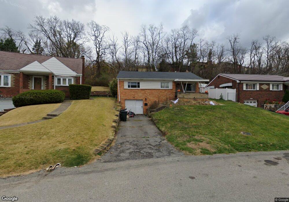
1205 Michael Dr Pittsburgh, PA 15227
Estimated Value: $126,000 - $186,000
3
Beds
2
Baths
1,028
Sq Ft
$163/Sq Ft
Est. Value
About This Home
This home is located at 1205 Michael Dr, Pittsburgh, PA 15227 and is currently estimated at $167,598, approximately $163 per square foot. 1205 Michael Dr is a home located in Allegheny County with nearby schools including J.E. Harrison Middle School and Baldwin Senior High School.
Ownership History
Date
Name
Owned For
Owner Type
Purchase Details
Closed on
Apr 10, 2024
Sold by
Vano Christina Lynne
Bought by
Simoni Ashton L
Current Estimated Value
Purchase Details
Closed on
Apr 4, 2024
Sold by
Vano Christina Lynne
Bought by
Simoni Ashton L
Purchase Details
Closed on
Nov 3, 2003
Sold by
Jenkins Erma
Bought by
Vano Jeffrey
Home Financials for this Owner
Home Financials are based on the most recent Mortgage that was taken out on this home.
Original Mortgage
$85,000
Interest Rate
6.05%
Mortgage Type
VA
Purchase Details
Closed on
Jun 22, 1998
Sold by
Jenkins Erma R and Lenz Kim J
Bought by
Jenkins Erma R
Purchase Details
Closed on
Jan 1, 1900
Create a Home Valuation Report for This Property
The Home Valuation Report is an in-depth analysis detailing your home's value as well as a comparison with similar homes in the area
Home Values in the Area
Average Home Value in this Area
Purchase History
| Date | Buyer | Sale Price | Title Company |
|---|---|---|---|
| Simoni Ashton L | $122,500 | -- | |
| Simoni Ashton L | $122,500 | -- | |
| Vano Christina Lynne | -- | -- | |
| Vano Jeffrey | $85,000 | -- | |
| Jenkins Erma R | -- | -- | |
| -- | -- | -- |
Source: Public Records
Mortgage History
| Date | Status | Borrower | Loan Amount |
|---|---|---|---|
| Previous Owner | Vano Jeffrey | $85,000 |
Source: Public Records
Tax History
| Year | Tax Paid | Tax Assessment Tax Assessment Total Assessment is a certain percentage of the fair market value that is determined by local assessors to be the total taxable value of land and additions on the property. | Land | Improvement |
|---|---|---|---|---|
| 2025 | $3,185 | $87,000 | $26,300 | $60,700 |
| 2024 | $3,185 | $87,000 | $26,300 | $60,700 |
| 2023 | $3,002 | $87,000 | $26,300 | $60,700 |
| 2022 | $2,970 | $87,000 | $26,300 | $60,700 |
| 2021 | $412 | $87,000 | $26,300 | $60,700 |
| 2020 | $2,894 | $87,000 | $26,300 | $60,700 |
| 2019 | $2,833 | $87,000 | $26,300 | $60,700 |
| 2017 | $2,088 | $87,000 | $26,300 | $60,700 |
Source: Public Records
Map
Nearby Homes
- 1157 Cloverfield Dr
- 1305 Michael Dr
- 1113 Towervue Dr
- 1507 Michael Dr Unit 113-D
- 746 Agnew Rd
- 226 Joseph St
- 245 Joseph St
- 0 Custer Unit 1727422
- 1027 Glass Run Rd
- 2831 Custer Ave
- 345 Brazil St
- 2729 Custer Ave
- 3053 Harmening Ave
- 226 Cedarcove St
- 216 Cedarcove St
- 313 Hamlet Ct
- 2900 Roland St
- 421 Kirk Ave
- 0 Becks Run Rd
- 2957 Churchview Ave
- 1209 Michael Dr
- 1201 Michael Dr
- 1213 Michael Dr
- 1045 Sanda Dr
- 1044 Towervue Dr
- 1217 Michael Dr
- 1050 Towervue Dr
- 1042 Towervue Dr
- 1214 Michael Dr
- 1041 Sanda Dr
- 1218 Michael Dr
- 1210 Michael Dr
- 1221 Michael Dr
- 1054 Towervue Dr
- 1035 Sanda Dr
- 1036 Towervue Dr
- 1034 Towervue Dr
- 1227 Michael Dr
- 1222 Michael Dr
- 1150 Michael Dr
Your Personal Tour Guide
Ask me questions while you tour the home.