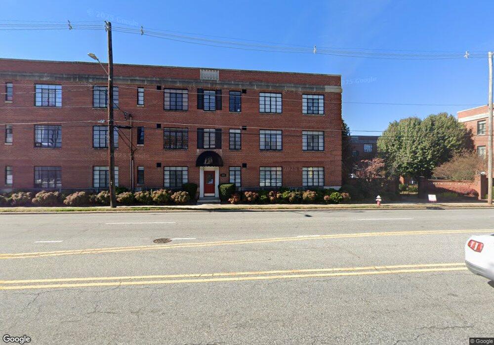
1205 N Main St Unit F High Point, NC 27262
Greater High Point NeighborhoodEstimated Value: $104,000 - $122,307
2
Beds
1
Bath
773
Sq Ft
$150/Sq Ft
Est. Value
About This Home
This home is located at 1205 N Main St Unit F, High Point, NC 27262 and is currently estimated at $115,827, approximately $149 per square foot. 1205 N Main St Unit F is a home located in Guilford County with nearby schools including Northwood Elementary School, Ferndale Middle School, and High Point Central High School.
Ownership History
Date
Name
Owned For
Owner Type
Purchase Details
Closed on
Jun 9, 2015
Bought by
Steve Silver Co
Current Estimated Value
Purchase Details
Closed on
Sep 25, 2003
Sold by
Thompson Kathy Dawn
Bought by
Reitzel J Brooks and Reitzel Lianne O
Home Financials for this Owner
Home Financials are based on the most recent Mortgage that was taken out on this home.
Original Mortgage
$52,000
Interest Rate
6.24%
Mortgage Type
Purchase Money Mortgage
Purchase Details
Closed on
Dec 14, 2000
Sold by
Alexander Elmore R and Alexander Pamela C
Bought by
Thompson Kathy Dawn
Home Financials for this Owner
Home Financials are based on the most recent Mortgage that was taken out on this home.
Original Mortgage
$42,750
Interest Rate
7.79%
Mortgage Type
Purchase Money Mortgage
Create a Home Valuation Report for This Property
The Home Valuation Report is an in-depth analysis detailing your home's value as well as a comparison with similar homes in the area
Home Values in the Area
Average Home Value in this Area
Purchase History
| Date | Buyer | Sale Price | Title Company |
|---|---|---|---|
| Steve Silver Co | $45,000 | -- | |
| Reitzel J Brooks | $65,000 | -- | |
| Thompson Kathy Dawn | $45,000 | -- |
Source: Public Records
Mortgage History
| Date | Status | Borrower | Loan Amount |
|---|---|---|---|
| Previous Owner | Reitzel J Brooks | $52,000 | |
| Previous Owner | Thompson Kathy Dawn | $42,750 |
Source: Public Records
Tax History Compared to Growth
Tax History
| Year | Tax Paid | Tax Assessment Tax Assessment Total Assessment is a certain percentage of the fair market value that is determined by local assessors to be the total taxable value of land and additions on the property. | Land | Improvement |
|---|---|---|---|---|
| 2025 | $994 | $72,100 | $16,000 | $56,100 |
| 2024 | $994 | $72,100 | $16,000 | $56,100 |
| 2023 | $994 | $72,100 | $16,000 | $56,100 |
| 2022 | $972 | $72,100 | $16,000 | $56,100 |
| 2021 | $689 | $50,000 | $11,000 | $39,000 |
| 2020 | $689 | $50,000 | $11,000 | $39,000 |
| 2019 | $689 | $50,000 | $0 | $0 |
| 2018 | $686 | $50,000 | $0 | $0 |
| 2017 | $686 | $50,000 | $0 | $0 |
| 2016 | $739 | $52,700 | $0 | $0 |
| 2015 | $743 | $52,700 | $0 | $0 |
| 2014 | $756 | $52,700 | $0 | $0 |
Source: Public Records
Map
Nearby Homes
- 1207 N Main St
- 1013 Johnson St
- 207 Hillcrest Dr
- 304 Louise Ave
- 300 Edgedale Dr
- 311 Rockspring Rd
- 1433 Larkin St
- 313 Rockspring Rd
- 315 Rockspring Rd
- 317 Rockspring Rd
- 321 Rockspring Rd
- 323 Rockspring Rd
- 325 Rockspring Rd
- 327 Rockspring Rd
- 331 Rockspring Rd
- 333 Rockspring Rd
- 335 Rockspring Rd
- 337 Rockspring Rd
- 1113 Clyde Place
- 1507 Larkin St
- 1205 N Main St Unit E
- 1205 N Main St Unit C
- 1205 N Main St Unit D
- 1205 N Main St Unit B
- 1203 N Main St Unit E
- 1203 N Main St Unit F
- 1203 N Main St Unit C
- 1203 N Main St Unit D
- 1203 N Main St Unit A
- 1203 N Main St Unit B
- 1203 N Main St
- 1209 N Main St Unit F
- 1209 N Main St Unit E
- 1209 N Main St Unit C
- 1209 N Main St Unit B
- 1209 N Main St Unit A
- 1211 N Main St Unit F
- 1211 N Main St Unit E
- 1211 N Main St Unit D
- 1211 N Main St Unit C