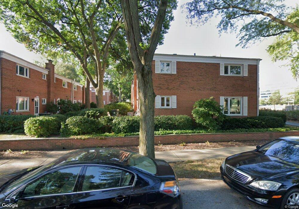
1205 Peterson Ave Park Ridge, IL 60068
O'Hare NeighborhoodEstimated Value: $313,000 - $363,000
3
Beds
2
Baths
1,296
Sq Ft
$256/Sq Ft
Est. Value
About This Home
This home is located at 1205 Peterson Ave, Park Ridge, IL 60068 and is currently estimated at $331,228, approximately $255 per square foot. 1205 Peterson Ave is a home located in Cook County with nearby schools including George Washington Elementary School, Lincoln Middle School, and Maine South High School.
Ownership History
Date
Name
Owned For
Owner Type
Purchase Details
Closed on
May 1, 2023
Sold by
Hodapp Sharon M
Bought by
Sharon M Hodapp Land Trust
Current Estimated Value
Purchase Details
Closed on
Jun 30, 1999
Sold by
Hodapp James D
Bought by
Hodapp Sharon
Home Financials for this Owner
Home Financials are based on the most recent Mortgage that was taken out on this home.
Original Mortgage
$126,000
Interest Rate
7.77%
Create a Home Valuation Report for This Property
The Home Valuation Report is an in-depth analysis detailing your home's value as well as a comparison with similar homes in the area
Home Values in the Area
Average Home Value in this Area
Purchase History
| Date | Buyer | Sale Price | Title Company |
|---|---|---|---|
| Sharon M Hodapp Land Trust | -- | None Listed On Document | |
| Hodapp Sharon | $165,000 | Law Title |
Source: Public Records
Mortgage History
| Date | Status | Borrower | Loan Amount |
|---|---|---|---|
| Previous Owner | Hodapp Sharon | $126,000 |
Source: Public Records
Tax History Compared to Growth
Tax History
| Year | Tax Paid | Tax Assessment Tax Assessment Total Assessment is a certain percentage of the fair market value that is determined by local assessors to be the total taxable value of land and additions on the property. | Land | Improvement |
|---|---|---|---|---|
| 2024 | $3,819 | $28,000 | $4,500 | $23,500 |
| 2023 | $3,780 | $28,000 | $4,500 | $23,500 |
| 2022 | $3,780 | $28,000 | $4,500 | $23,500 |
| 2021 | $4,305 | $21,920 | $2,722 | $19,198 |
| 2020 | $3,875 | $21,920 | $2,722 | $19,198 |
| 2019 | $3,816 | $24,520 | $2,722 | $21,798 |
| 2018 | $4,209 | $21,356 | $2,322 | $19,034 |
| 2017 | $4,206 | $21,356 | $2,322 | $19,034 |
| 2016 | $4,727 | $21,356 | $2,322 | $19,034 |
| 2015 | $4,709 | $19,645 | $2,001 | $17,644 |
| 2014 | $4,644 | $19,645 | $2,001 | $17,644 |
| 2013 | $4,367 | $19,645 | $2,001 | $17,644 |
Source: Public Records
Map
Nearby Homes
- 1715 S Greenwood Ave
- 1001 Peterson Ave
- 1610 S Greenwood Ave
- 1634 S Cumberland Ave
- 1805 Brophy Ave
- 1613 S Cumberland Ave
- 1812 S Fairview Ave
- 1705 S Prospect Ave
- 5555 N Cumberland Ave Unit 901
- 5555 N Cumberland Ave Unit 410
- 5555 N Cumberland Ave Unit 309
- 8727 W Bryn Mawr Ave Unit 501
- 8747 W Bryn Mawr Ave Unit 209
- 8747 W Bryn Mawr Ave Unit 207
- 8510 W Catalpa Ave Unit 1N
- 8510 W Catalpa Ave Unit 1S
- 8510 W Catalpa Ave Unit G
- 8510 W Catalpa Ave Unit 2S
- 1705 S Crescent Ave
- 1212 S Greenwood Ave
- 1205 Peterson Ave Unit E
- 1205 Peterson Ave
- 1205 Peterson Ave
- 1205 Peterson Ave
- 1205 Peterson Ave
- 1205 Peterson Ave Unit C
- 1155 Peterson Ave
- 1155 Peterson Ave
- 1155 Peterson Ave
- 1155 Peterson Ave
- 1155 Peterson Ave Unit C
- 1175 Peterson Ave
- 1175 Peterson Ave
- 1175 Peterson Ave
- 1175 Peterson Ave
- 1175 Peterson Ave
- 1175 Peterson Ave
- 1175 Peterson Ave Unit F
- 1175 Peterson Ave Unit C
- 1175 Peterson Ave Unit A