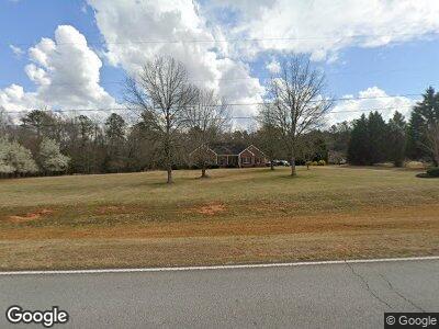
1205 S Bethany Rd McDonough, GA 30252
Estimated Value: $336,000 - $385,000
3
Beds
2
Baths
1,952
Sq Ft
$187/Sq Ft
Est. Value
About This Home
This home is located at 1205 S Bethany Rd, McDonough, GA 30252 and is currently estimated at $365,312, approximately $187 per square foot. 1205 S Bethany Rd is a home located in Henry County with nearby schools including Tussahaw Elementary School, Locust Grove Middle School, and Locust Grove High School.
Ownership History
Date
Name
Owned For
Owner Type
Purchase Details
Closed on
Sep 11, 2024
Sold by
Hembree Buddy C
Bought by
Hembree Sandra C
Current Estimated Value
Purchase Details
Closed on
Apr 29, 1996
Sold by
Adams Douglas Danny
Bought by
Hembree Buddy Sandra
Create a Home Valuation Report for This Property
The Home Valuation Report is an in-depth analysis detailing your home's value as well as a comparison with similar homes in the area
Home Values in the Area
Average Home Value in this Area
Purchase History
| Date | Buyer | Sale Price | Title Company |
|---|---|---|---|
| Hembree Sandra C | -- | -- | |
| Hembree Buddy Sandra | $23,000 | -- |
Source: Public Records
Mortgage History
| Date | Status | Borrower | Loan Amount |
|---|---|---|---|
| Previous Owner | Hembree Buddy C | $50,000 | |
| Previous Owner | Hembree Buddy C | $50,000 | |
| Previous Owner | Hembree Buddy C | $98,754 | |
| Previous Owner | Hembree Buddy C | $50,000 | |
| Closed | Hembree Buddy Sandra | $0 |
Source: Public Records
Tax History Compared to Growth
Tax History
| Year | Tax Paid | Tax Assessment Tax Assessment Total Assessment is a certain percentage of the fair market value that is determined by local assessors to be the total taxable value of land and additions on the property. | Land | Improvement |
|---|---|---|---|---|
| 2024 | $1,117 | $158,600 | $15,840 | $142,760 |
| 2023 | $789 | $150,120 | $15,240 | $134,880 |
| 2022 | $934 | $130,800 | $14,080 | $116,720 |
| 2021 | $934 | $109,400 | $12,080 | $97,320 |
| 2020 | $934 | $98,080 | $11,360 | $86,720 |
| 2019 | $934 | $93,320 | $10,800 | $82,520 |
| 2018 | $934 | $83,920 | $9,960 | $73,960 |
| 2016 | $934 | $78,520 | $8,800 | $69,720 |
| 2015 | -- | $75,680 | $10,040 | $65,640 |
| 2014 | $936 | $69,960 | $10,040 | $59,920 |
Source: Public Records
Map
Nearby Homes
- 201 Nina Cir
- 850 Coan Dr
- 950 Besse Way
- 563 Deadwood Trail
- 596 Deadwood Trail
- 556 Deadwood Trail
- 1576 King Mill Rd
- 560 Coan Dr
- 135 Kimbell Farm Dr
- 785 Seabolt Rd
- 229 Prescott St
- 206 Prescott St
- 308 Tussahaw Trail
- 705 Seabolt Rd
- 460 Rabbit Run
- 30 Apache Ct
- 678 Seabolt Rd
- 1555 S Bethany Rd
- 1202 Coan Dr
- 1569 King Mill Rd
- 1205 S Bethany Rd
- 1195 S Bethany Rd
- 1215 S Bethany Rd
- 188 Seabolt Dr
- 1235 S Bethany Rd
- 184 Seabolt Dr
- 180 Seabolt Dr
- 1251 S Bethany Rd
- 120 Seabolt Dr
- 1118 S Bethany Rd
- 200 Seabolt Dr
- 110 Seabolt Dr
- 1102 S Bethany Rd
- 1263 S Bethany Rd
- 1086 S Bethany Rd
- 0 Seabolt Dr Unit 8181925
- 0 Seabolt Dr Unit 9075127
- 0 Seabolt Dr Unit 3195757
- 0 Seabolt Dr Unit 7486314
- 0 Seabolt Dr Unit 8008088