
Seller's Agent in 2025
William Hunt
@properties/Christie's Intl RE
(219) 405-3860
6 in this area
82 Total Sales
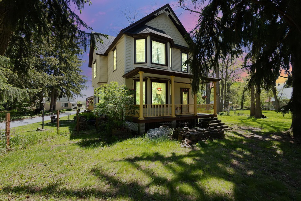
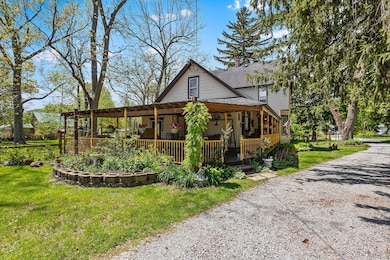
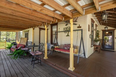
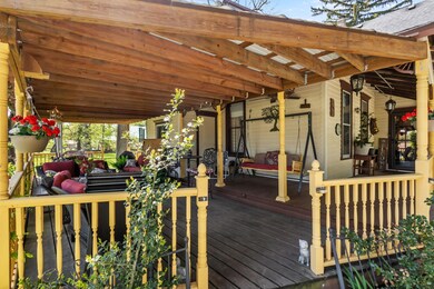
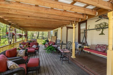
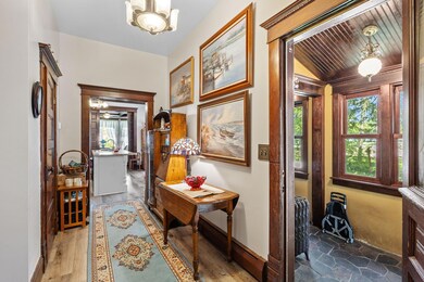
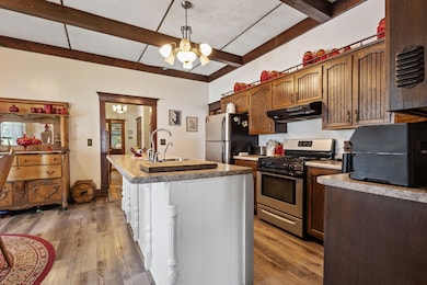
Charming Historic Home on 1.77 Acres in KoutsDiscover timeless character and modern comfort in this beautifully maintained early 1900s home, set on a spacious 1.77-acre lot on the south side of Kouts. Offering over 2,300 square feet, this 4-bedroom, 3-bath, features towering ceilings residence features a flexible floor plan with generous living and dining spaces, a main-floor bedroom with a large closet and bath, and a convenient mudroom. Classic architectural touches add charm throughout, while thoughtful updates provide everyday comfort.Outside, you'll find mature trees and shade loving landscaping, privacy, and a picturesque park setting--perfect for relaxing on the expansive porches or enjoying time outdoors. The two-story detached heated garage and workshop provide endless possibilities for hobbies, while the 40 x 30 ft pole barn provide expanded storage or extra parking. The 8 x 8ft chicken coop is ready for your flock. Located just blocks from Kouts schools, post office and downtown Kouts, this home blends space, charm, and a peaceful natural setting in a welcoming small-town community. This house is truly one of a kind!
Last Agent to Sell the Property
@properties/Christie's Intl RE License #RB17000035 Listed on: 05/12/2025
| Date | Type | Sale Price | Title Company |
|---|---|---|---|
| Warranty Deed | -- | Chicago Title | |
| Warranty Deed | -- | Professionals Title Services |
| Date | Status | Loan Amount | Loan Type |
|---|---|---|---|
| Open | $303,600 | New Conventional | |
| Previous Owner | $157,250 | New Conventional |
| Date | Event | Price | List to Sale | Price per Sq Ft |
|---|---|---|---|---|
| 08/29/2025 08/29/25 | Sold | $379,500 | 0.0% | $163 / Sq Ft |
| 06/01/2025 06/01/25 | Pending | -- | -- | -- |
| 05/12/2025 05/12/25 | For Sale | $379,500 | -- | $163 / Sq Ft |
| Year | Tax Paid | Tax Assessment Tax Assessment Total Assessment is a certain percentage of the fair market value that is determined by local assessors to be the total taxable value of land and additions on the property. | Land | Improvement |
|---|---|---|---|---|
| 2024 | $1,926 | $253,600 | $49,800 | $203,800 |
| 2023 | $1,786 | $248,600 | $47,800 | $200,800 |
| 2022 | $1,777 | $233,400 | $47,800 | $185,600 |
| 2021 | $1,848 | $214,600 | $47,800 | $166,800 |
| 2020 | $1,778 | $208,400 | $41,600 | $166,800 |
| 2019 | $1,669 | $191,200 | $41,600 | $149,600 |
| 2018 | $1,513 | $180,000 | $41,600 | $138,400 |
| 2017 | $1,498 | $180,000 | $41,600 | $138,400 |
| 2016 | $1,370 | $171,300 | $39,800 | $131,500 |
| 2014 | $1,429 | $174,100 | $38,800 | $135,300 |
| 2013 | -- | $152,400 | $40,400 | $112,000 |
Seller's Agent in 2025
William Hunt
@properties/Christie's Intl RE
(219) 405-3860
6 in this area
82 Total Sales
Buyer's Agent in 2025
Carol Roeske
HomeSmart Legacy
(773) 519-0269
1 in this area
20 Total Sales
Source: Northwest Indiana Association of REALTORS®
MLS Number: 820559
APN: 64-16-17-305-009.000-013
Disclaimer: Certain information contained herein is derived from information provided by parties other than Homes.com. All information provided is deemed reliable, but is not guaranteed to be accurate and should be independently verified.
![]() Copyright 2025 MuItiple Listing Service of the Northwest Indiana Realtors Association Multiple Listing Service (NIRA MLS). All rights reserved. IDX information is provided exclusively for personal, non-commercial use, and may not be used for any purpose other than to identify prospective properties consumers may be interested in purchasing. Information is deemed reliable but not guaranteed.
Copyright 2025 MuItiple Listing Service of the Northwest Indiana Realtors Association Multiple Listing Service (NIRA MLS). All rights reserved. IDX information is provided exclusively for personal, non-commercial use, and may not be used for any purpose other than to identify prospective properties consumers may be interested in purchasing. Information is deemed reliable but not guaranteed.