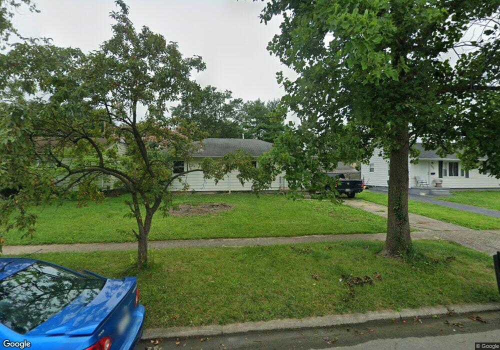
1205 Simpson Dr Columbus, OH 43227
Shady Lane NeighborhoodEstimated Value: $192,272 - $214,000
3
Beds
1
Bath
912
Sq Ft
$220/Sq Ft
Est. Value
About This Home
This home is located at 1205 Simpson Dr, Columbus, OH 43227 and is currently estimated at $200,818, approximately $220 per square foot. 1205 Simpson Dr is a home located in Franklin County with nearby schools including Shady Lane Elementary School, Sherwood Middle School, and Walnut Ridge High School.
Ownership History
Date
Name
Owned For
Owner Type
Purchase Details
Closed on
Jan 29, 2019
Sold by
Midfrist Bank
Bought by
Community Properties Of Central Ohio Llc
Current Estimated Value
Purchase Details
Closed on
Oct 31, 2018
Sold by
Kotlinski Paul T
Bought by
Midfirst Bank
Purchase Details
Closed on
Feb 28, 1998
Sold by
Shupe Sue K
Bought by
Kotlinski Paul T
Purchase Details
Closed on
Sep 1, 1983
Create a Home Valuation Report for This Property
The Home Valuation Report is an in-depth analysis detailing your home's value as well as a comparison with similar homes in the area
Home Values in the Area
Average Home Value in this Area
Purchase History
| Date | Buyer | Sale Price | Title Company |
|---|---|---|---|
| Community Properties Of Central Ohio Llc | $57,400 | Omega Title Agency Llc | |
| Midfirst Bank | $55,900 | Allodial Title Llc | |
| Kotlinski Paul T | $73,000 | Chicago Title | |
| -- | -- | -- |
Source: Public Records
Tax History Compared to Growth
Tax History
| Year | Tax Paid | Tax Assessment Tax Assessment Total Assessment is a certain percentage of the fair market value that is determined by local assessors to be the total taxable value of land and additions on the property. | Land | Improvement |
|---|---|---|---|---|
| 2024 | $2,493 | $54,390 | $16,520 | $37,870 |
| 2023 | $2,461 | $54,390 | $16,520 | $37,870 |
| 2022 | $1,442 | $27,130 | $6,200 | $20,930 |
| 2021 | $1,594 | $27,130 | $6,200 | $20,930 |
| 2020 | $1,627 | $26,960 | $6,200 | $20,760 |
| 2019 | $1,349 | $21,700 | $4,970 | $16,730 |
| 2018 | $1,280 | $21,700 | $4,970 | $16,730 |
| 2017 | $1,316 | $21,700 | $4,970 | $16,730 |
| 2016 | $1,285 | $19,400 | $4,870 | $14,530 |
| 2015 | $1,167 | $19,400 | $4,870 | $14,530 |
| 2014 | $1,169 | $19,400 | $4,870 | $14,530 |
| 2013 | $678 | $22,820 | $5,740 | $17,080 |
Source: Public Records
Map
Nearby Homes
- 1281 Maetzel Dr
- 4501 Amesbury Rd
- 1068 Ross Rd
- 4484 Grimsby Rd
- 1085 S Hamilton Rd
- 4467 Grimsby Rd
- 1130 Little Plum Ln
- 1291 Westphal Ave
- 4571 Aragon Ave
- 1563 Genoa Place
- 4677 E Livingston Ave
- 1571 Baxter Dr
- 1543 S Hamilton Rd
- 1607 Simpson Dr
- 1607 Shady Lane Rd
- 963 Erickson Ave
- 4181 Colby Ave
- 4991 Justin Rd
- 1618 S Hamilton Rd
- 4701 Janis Dr
- 1213 Simpson Dr
- 1199 Simpson Dr
- 1221 Simpson Dr
- 1189 Simpson Dr
- 1214 Huntly Dr
- 1222 Huntly Dr
- 1208 Huntly Dr
- 1230 Huntly Dr
- 1229 Simpson Dr
- 1206 Simpson Dr
- 1181 Simpson Dr
- 1198 Simpson Dr
- 1212 Simpson Dr
- 1236 Huntly Dr
- 1202 Huntly Dr
- 1190 Simpson Dr
- 1220 Simpson Dr
- 1237 Simpson Dr
- 1244 Huntly Dr
- 1175 Simpson Dr