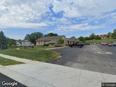
12059 Sheraton Ln Cincinnati, OH 45246
Estimated Value: $144,134
--
Bed
--
Bath
1,300
Sq Ft
$111/Sq Ft
Est. Value
About This Home
This home is located at 12059 Sheraton Ln, Cincinnati, OH 45246 and is currently estimated at $144,134, approximately $110 per square foot. 12059 Sheraton Ln is a home located in Hamilton County with nearby schools including Springdale Elementary School, Princeton Community Middle School, and Princeton High School.
Ownership History
Date
Name
Owned For
Owner Type
Purchase Details
Closed on
Nov 15, 2018
Sold by
Welsh Jeffrey A and Welsh Pamela S
Bought by
Online Design Inc
Current Estimated Value
Purchase Details
Closed on
Feb 9, 1999
Sold by
Sanders Lester W
Bought by
Welsh Jeffrey A
Home Financials for this Owner
Home Financials are based on the most recent Mortgage that was taken out on this home.
Original Mortgage
$93,500
Interest Rate
7.75%
Mortgage Type
Commercial
Create a Home Valuation Report for This Property
The Home Valuation Report is an in-depth analysis detailing your home's value as well as a comparison with similar homes in the area
Home Values in the Area
Average Home Value in this Area
Purchase History
| Date | Buyer | Sale Price | Title Company |
|---|---|---|---|
| Online Design Inc | $85,000 | None Available | |
| Welsh Jeffrey A | $110,000 | -- |
Source: Public Records
Mortgage History
| Date | Status | Borrower | Loan Amount |
|---|---|---|---|
| Previous Owner | Welsh Jeffrey A | $93,500 |
Source: Public Records
Tax History Compared to Growth
Tax History
| Year | Tax Paid | Tax Assessment Tax Assessment Total Assessment is a certain percentage of the fair market value that is determined by local assessors to be the total taxable value of land and additions on the property. | Land | Improvement |
|---|---|---|---|---|
| 2024 | $2,239 | $31,658 | $8,190 | $23,468 |
| 2023 | $2,197 | $31,658 | $8,190 | $23,468 |
| 2022 | $2,265 | $29,751 | $6,962 | $22,789 |
| 2021 | $2,249 | $29,751 | $6,962 | $22,789 |
| 2020 | $2,209 | $29,751 | $6,962 | $22,789 |
| 2019 | $2,558 | $32,375 | $8,190 | $24,185 |
| 2018 | $2,437 | $32,375 | $8,190 | $24,185 |
| 2017 | $3,401 | $46,865 | $8,190 | $38,675 |
| 2016 | $3,197 | $43,796 | $8,645 | $35,151 |
| 2015 | $3,202 | $43,796 | $8,645 | $35,151 |
| 2014 | $3,201 | $43,796 | $8,645 | $35,151 |
| 2013 | $3,258 | $46,102 | $9,100 | $37,002 |
Source: Public Records
Map
Nearby Homes
- 12070 Crossings Dr
- 12156 Peak Dr
- 11916 Lawnview Ave
- 2 Woodside Ct
- 21 Aspen Ct
- 11828 Woodvale Ct
- 11839 Mangrove Ln
- 156 Ruskin Dr
- 38 Providence Dr Unit 54
- 635 Cloverdale Ave
- 675 Cloverdale Ave
- 12 Clemson Ct
- 25 Fairgreen Cir
- 311 Bedford Glen Ln Unit 35
- 311 Bedford Glen Ln
- 12189 Kenn Rd
- 692 W Kemper Rd
- 9 Eland Ct
- 8589 Essex Orchard Station Dr
- 11435 Fitchburg Ln
- 12055 Sheraton Ln
- 12061 Sheraton Ln
- 12059 Sheraton Ln
- 12055 Sheraton Ln Unit 3
- 12057 Sheraton Ln
- 12051 Sheraton Ln
- 12073 Sheraton Ln
- 12071 Sheraton Ln Unit 4
- 12071 Sheraton Ln
- 12077 Sheraton Ln
- 12079 Sheraton Ln
- 12085 Sheraton Ln
- 12083 Sheraton Ln
- 12078 Crossings Dr Unit 94
- 12072 Crossings Dr
- 12068 Crossings Dr
- 401 Maple Circle Dr Unit 7
- 12074 Crossings Dr
- 12076 Crossings Dr Unit 95
- 405 Maple Circle Dr