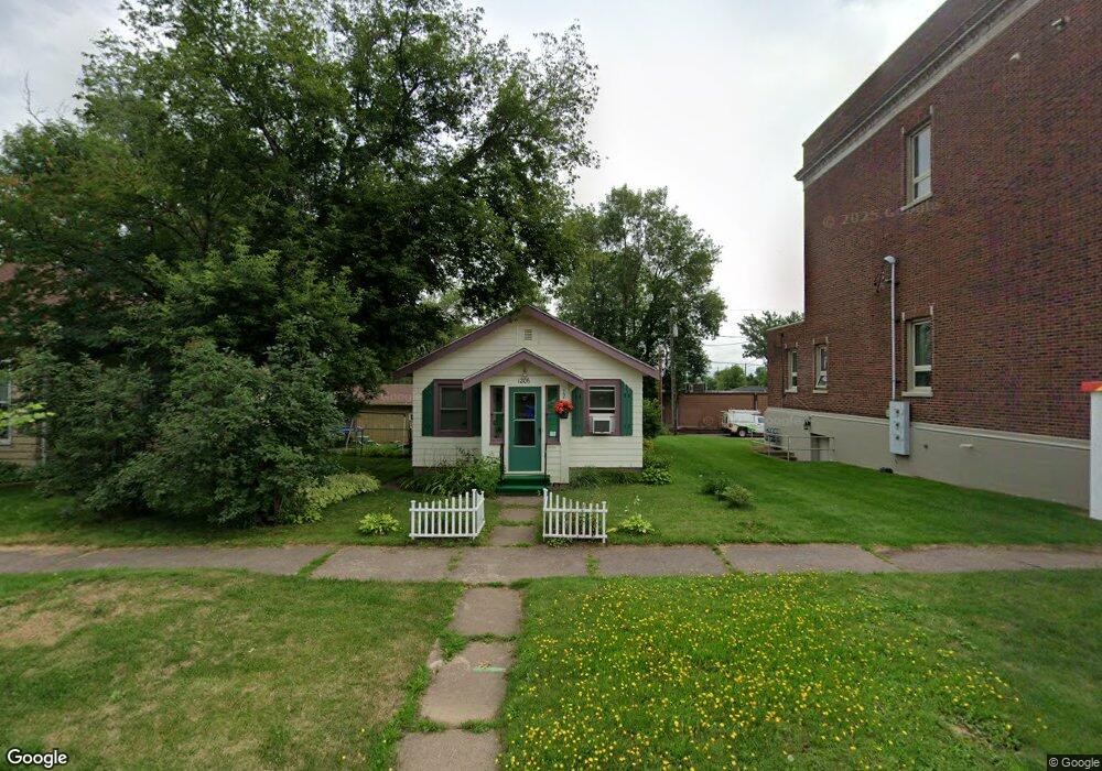
1206 101st Ave W Duluth, MN 55808
Gary-New Duluth NeighborhoodEstimated Value: $150,412 - $199,000
1
Bed
1
Bath
800
Sq Ft
$215/Sq Ft
Est. Value
About This Home
This home is located at 1206 101st Ave W, Duluth, MN 55808 and is currently estimated at $172,353, approximately $215 per square foot. 1206 101st Ave W is a home located in St. Louis County with nearby schools including Stowe Elementary School, Lincoln Park Middle School, and Denfeld High School.
Ownership History
Date
Name
Owned For
Owner Type
Purchase Details
Closed on
Oct 22, 2001
Sold by
Kucera Christopher T and Kucera Melanie
Bought by
Smith Barbara J
Current Estimated Value
Home Financials for this Owner
Home Financials are based on the most recent Mortgage that was taken out on this home.
Original Mortgage
$62,050
Interest Rate
7.26%
Create a Home Valuation Report for This Property
The Home Valuation Report is an in-depth analysis detailing your home's value as well as a comparison with similar homes in the area
Home Values in the Area
Average Home Value in this Area
Purchase History
| Date | Buyer | Sale Price | Title Company |
|---|---|---|---|
| Smith Barbara J | $64,000 | Consolidated Title |
Source: Public Records
Mortgage History
| Date | Status | Borrower | Loan Amount |
|---|---|---|---|
| Previous Owner | Smith Barbara J | $62,050 | |
| Closed | Smith Barbara J | $3,500 |
Source: Public Records
Tax History
| Year | Tax Paid | Tax Assessment Tax Assessment Total Assessment is a certain percentage of the fair market value that is determined by local assessors to be the total taxable value of land and additions on the property. | Land | Improvement |
|---|---|---|---|---|
| 2024 | $1,232 | $120,200 | $7,000 | $113,200 |
| 2023 | $1,232 | $117,600 | $6,900 | $110,700 |
| 2022 | $798 | $89,900 | $8,600 | $81,300 |
| 2021 | $770 | $73,300 | $7,000 | $66,300 |
| 2020 | $692 | $71,700 | $6,900 | $64,800 |
| 2019 | $730 | $62,500 | $6,000 | $56,500 |
| 2018 | $726 | $66,300 | $6,000 | $60,300 |
| 2017 | $730 | $71,900 | $7,400 | $64,500 |
| 2016 | $718 | $106,100 | $16,100 | $90,000 |
| 2015 | $725 | $43,100 | $4,500 | $38,600 |
| 2014 | $725 | $43,100 | $4,500 | $38,600 |
Source: Public Records
Map
Nearby Homes
- 1215 103rd Ave W
- 1xx E Gary St
- 1219 96th Ave W
- 1325 104th Ave W
- 13xx 99th Ave W
- 10 Glencrest Ct
- 23 Coban Dr
- 29 Burger Dr
- 119 96th Ave W
- XXX Commonwealth Ave
- 1063 86th Ave W
- 1010 85th Ave W
- TBD Arbor St
- 9501 Seaver Ave
- 9118 Gogebic St
- 125 Goldys Way
- 8408 Potters Place
- 8313 Eric Shaffer Way
- 121 Kayak View
- 8620 Maynard Place
- 1210 101st Ave W
- 1202 101st Ave W
- 1202 101st Ave W Unit Lower Unit
- 1202 101st Ave W Unit Upper Unit
- 1214 101st Ave W
- 1205 101st Ave W
- 1201 101st Ave W
- 14 W Mcgonagle St
- 1207 101st Ave W
- XXXX Lot 17 Commonwealth Ave
- XXX Lot 16 Commonwealth Ave
- 1215 101st Ave W
- 1132 101st Ave W
- 1200 Block Commonwealth Ave--
- 1129 101st Ave W
- 1130 101st Ave W
- 1219 101st Ave W
- 1210 102nd Ave W
- 115 W Mcgonagle St
- 1125 101st Ave W
Your Personal Tour Guide
Ask me questions while you tour the home.