Estimated Value: $280,000 - $294,000
2
Beds
3
Baths
1,398
Sq Ft
$204/Sq Ft
Est. Value
About This Home
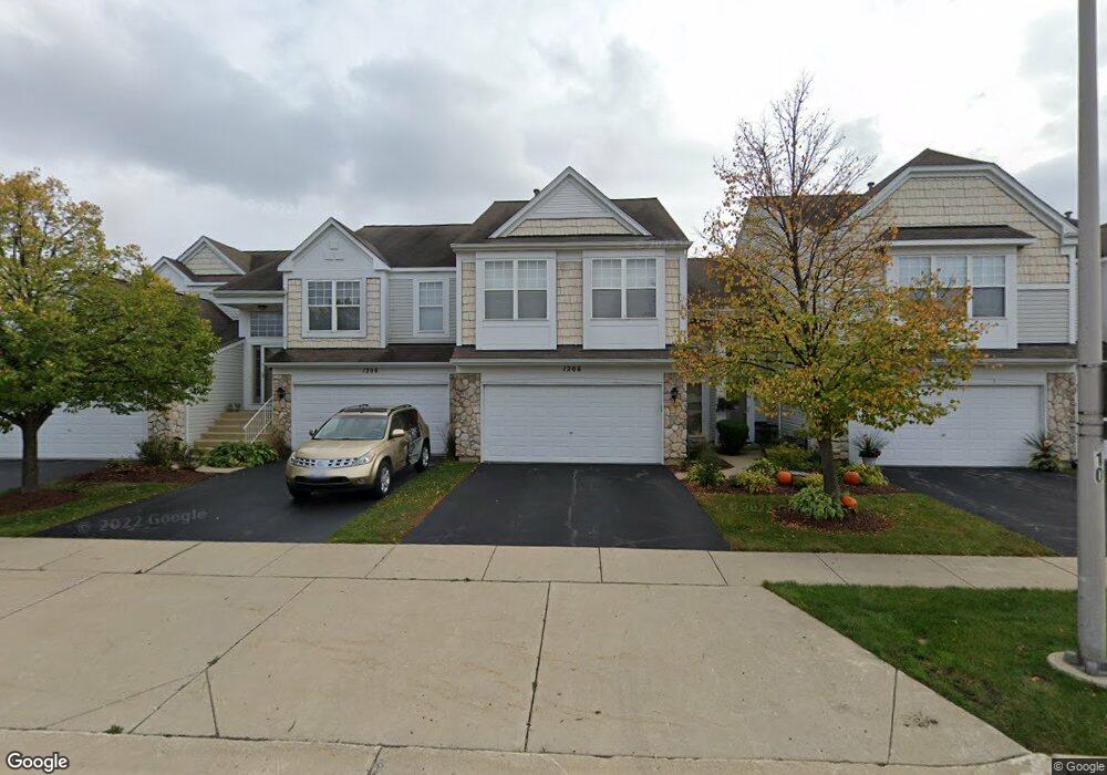
This home is located at 1206 Delta Dr Unit 113C, Elgin, IL 60123 and is currently estimated at $285,038, approximately $203 per square foot. 1206 Delta Dr Unit 113C is a home located in Kane County with nearby schools including Fox Meadow Elementary School, Kenyon Woods Middle School, and South Elgin High School.
Ownership History
Date
Name
Owned For
Owner Type
Purchase Details
Closed on
Aug 1, 2019
Sold by
Cross Horace B
Bought by
Cross Horace B and Cross Revocable Livin Horace B
Current Estimated Value
Purchase Details
Closed on
Sep 26, 2016
Sold by
Schwind Derrick E
Bought by
Cross Horace B
Home Financials for this Owner
Home Financials are based on the most recent Mortgage that was taken out on this home.
Original Mortgage
$106,400
Outstanding Balance
$85,408
Interest Rate
3.5%
Mortgage Type
New Conventional
Estimated Equity
$199,630
Purchase Details
Closed on
May 27, 2005
Sold by
Coletta Franco J and Fedorowicz Susan M
Bought by
Schwind Derrick E
Home Financials for this Owner
Home Financials are based on the most recent Mortgage that was taken out on this home.
Original Mortgage
$149,600
Interest Rate
5.5%
Mortgage Type
Purchase Money Mortgage
Purchase Details
Closed on
Jul 28, 2004
Sold by
Springborn Douglas A and Springborn Angela
Bought by
Coletta Franco J and Fedorowicz Susan M
Home Financials for this Owner
Home Financials are based on the most recent Mortgage that was taken out on this home.
Original Mortgage
$136,800
Interest Rate
6.4%
Mortgage Type
Purchase Money Mortgage
Purchase Details
Closed on
Oct 10, 2002
Sold by
Burnidge Melissa L
Bought by
Springborn Douglas A and Peterson Angela
Home Financials for this Owner
Home Financials are based on the most recent Mortgage that was taken out on this home.
Original Mortgage
$144,000
Interest Rate
6.08%
Purchase Details
Closed on
Jun 10, 2002
Sold by
Burnidge William F and Melissa L Burnidge Trust #2
Bought by
Burnidge Melissa L
Purchase Details
Closed on
Mar 5, 1999
Sold by
Pulte Home Corp
Bought by
Melissa L Burnidge Trust #2
Home Financials for this Owner
Home Financials are based on the most recent Mortgage that was taken out on this home.
Original Mortgage
$110,000
Interest Rate
6.55%
Create a Home Valuation Report for This Property
The Home Valuation Report is an in-depth analysis detailing your home's value as well as a comparison with similar homes in the area
Home Values in the Area
Average Home Value in this Area
Purchase History
| Date | Buyer | Sale Price | Title Company |
|---|---|---|---|
| Cross Horace B | -- | Gmt Title Agency | |
| Cross Horace B | $133,000 | Greater Metropolitan Title L | |
| Schwind Derrick E | $187,000 | Atg | |
| Coletta Franco J | $171,000 | Fox Title Company | |
| Springborn Douglas A | $160,000 | Chicago Title Insurance Co | |
| Burnidge Melissa L | -- | -- | |
| Melissa L Burnidge Trust #2 | $131,000 | First American Title Ins Co |
Source: Public Records
Mortgage History
| Date | Status | Borrower | Loan Amount |
|---|---|---|---|
| Open | Cross Horace B | $106,400 | |
| Previous Owner | Schwind Derrick E | $149,600 | |
| Previous Owner | Coletta Franco J | $136,800 | |
| Previous Owner | Springborn Douglas A | $144,000 | |
| Previous Owner | Melissa L Burnidge Trust #2 | $110,000 | |
| Closed | Coletta Franco J | $34,200 |
Source: Public Records
Tax History Compared to Growth
Tax History
| Year | Tax Paid | Tax Assessment Tax Assessment Total Assessment is a certain percentage of the fair market value that is determined by local assessors to be the total taxable value of land and additions on the property. | Land | Improvement |
|---|---|---|---|---|
| 2024 | $4,883 | $69,016 | $16,550 | $52,466 |
| 2023 | $4,633 | $62,351 | $14,952 | $47,399 |
| 2022 | $4,410 | $56,854 | $13,634 | $43,220 |
| 2021 | $4,207 | $53,155 | $12,747 | $40,408 |
| 2020 | $4,081 | $50,745 | $12,169 | $38,576 |
| 2019 | $3,954 | $48,338 | $11,592 | $36,746 |
| 2018 | $3,909 | $45,537 | $10,920 | $34,617 |
| 2017 | $3,811 | $43,048 | $10,323 | $32,725 |
| 2016 | $3,619 | $39,937 | $9,577 | $30,360 |
| 2015 | -- | $36,606 | $8,778 | $27,828 |
| 2014 | -- | $32,161 | $8,670 | $23,491 |
| 2013 | -- | $33,010 | $8,899 | $24,111 |
Source: Public Records
Map
Nearby Homes
- 1141 Delta Ct Unit 255E
- 1044 Reserve Dr
- 740 Fairview Ln
- 2464 Emily Ln
- 1410 Misthaven Ln
- 1458 Woodland Dr
- 761 Verde Vista Ct Unit 611F
- 2527 Emily Ln
- 2038 College Green Dr
- 2525 Rolling Ridge
- 25 Kingsport Ct
- 522 Lowell Dr Unit 2
- 512 Lowell Dr Unit 2
- 1524 S Pembroke Dr
- 1236 Sandhurst Ln Unit 4
- 671 Fieldcrest Dr
- 611 Woodbridge Dr
- 9N621 Flora Dr Unit 1
- 2452 Daybreak Ct Unit 2452
- 1063 Manchester Ct Unit 1
- 1200 Delta Dr Unit 116A
- 1208 Delta Dr Unit 112B
- 1210 Delta Dr Unit 111A
- 1204 Delta Dr Unit 114D
- 1202 Delta Dr Unit 115B
- 2350 Cove Ct
- 2358 Cove Ct Unit 122B
- 2354 Cove Ct Unit 124D
- 2356 Cove Ct Unit 123C
- 2360 Cove Ct Unit 121
- 1201 Delta Dr Unit 221E
- 1207 Delta Dr Unit 224B
- 1205 Delta Dr Unit 223D
- 1203 Delta Dr Unit 222D
- 1209 Delta Dr Unit 225A
- 1184 Delta Dr Unit 104D
- 1190 Delta Dr Unit 101A
- 1182 Delta Dr Unit 11822
- 1188 Delta Dr Unit 102B
- 1186 Delta Dr Unit 103C