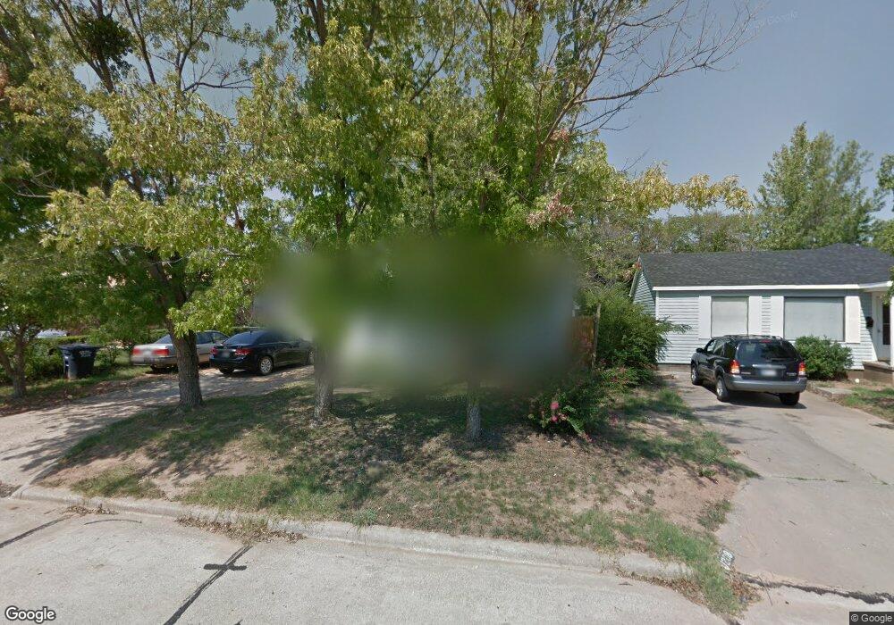
1206 E Carol Dr Shawnee, OK 74804
Estimated Value: $76,000 - $109,000
2
Beds
1
Bath
960
Sq Ft
$102/Sq Ft
Est. Value
About This Home
This home is located at 1206 E Carol Dr, Shawnee, OK 74804 and is currently estimated at $97,872, approximately $101 per square foot. 1206 E Carol Dr is a home located in Pottawatomie County with nearby schools including Sequoyah Elementary School, Shawnee Middle School, and Shawnee High School.
Ownership History
Date
Name
Owned For
Owner Type
Purchase Details
Closed on
Feb 8, 2012
Sold by
Mcmahan Jessica
Bought by
Brinton Jessica H and Brinton Shawn D
Current Estimated Value
Purchase Details
Closed on
Feb 24, 2010
Sold by
Arvest Trust Co Na
Bought by
Mcmahon Jessica
Home Financials for this Owner
Home Financials are based on the most recent Mortgage that was taken out on this home.
Original Mortgage
$38,316
Interest Rate
5.05%
Mortgage Type
New Conventional
Purchase Details
Closed on
Feb 2, 2006
Sold by
Drake Selma
Bought by
Arvest Trust Co Na and Selma Drake Living Trust
Create a Home Valuation Report for This Property
The Home Valuation Report is an in-depth analysis detailing your home's value as well as a comparison with similar homes in the area
Purchase History
| Date | Buyer | Sale Price | Title Company |
|---|---|---|---|
| Brinton Jessica H | -- | None Available | |
| Mcmahon Jessica | $34,500 | None Available | |
| Arvest Trust Co Na | -- | None Available |
Source: Public Records
Mortgage History
| Date | Status | Borrower | Loan Amount |
|---|---|---|---|
| Previous Owner | Mcmahon Jessica | $38,316 |
Source: Public Records
Tax History
| Year | Tax Paid | Tax Assessment Tax Assessment Total Assessment is a certain percentage of the fair market value that is determined by local assessors to be the total taxable value of land and additions on the property. | Land | Improvement |
|---|---|---|---|---|
| 2025 | $340 | $4,426 | $826 | $3,600 |
| 2024 | $331 | $4,298 | $826 | $3,472 |
| 2023 | $331 | $4,172 | $960 | $3,212 |
| 2022 | $325 | $4,172 | $960 | $3,212 |
| 2021 | $320 | $4,172 | $960 | $3,212 |
| 2020 | $328 | $4,243 | $960 | $3,283 |
| 2019 | $346 | $4,315 | $960 | $3,355 |
| 2018 | $352 | $4,435 | $960 | $3,475 |
| 2017 | $354 | $4,510 | $960 | $3,550 |
| 2016 | $360 | $4,524 | $953 | $3,571 |
| 2015 | $339 | $4,392 | $855 | $3,537 |
| 2014 | $326 | $4,264 | $820 | $3,444 |
Source: Public Records
Map
Nearby Homes
- 1207 E Carol Dr
- 1203 E Carol Dr
- 1225 E Carol Dr
- 1206 Monroe Dr
- 1223 E Rose Dr
- 1119 Quail Hollow Rd
- 1107 Quail Hollow Rd
- 31 E Oak Hill
- 1725 E Dougherty Dr
- 1406 E Bradley St
- 9 Dustin Cir
- 2 Turkey Knob St
- 5005 Chauncey Ln
- 1404 Charles Dr
- 17 Beckley St
- 1307 Laverne Ave
- 40 Northridge Rd
- 1301 Rickey Rd
- 23 Crown Point
- 1712 N Pennsylvania Ave
- 1204 E Carol Dr
- 1208 E Carol Dr
- 1202 E Carol Dr
- 1210 E Carol Dr
- 1212 E Carol Dr
- 1220 Carol Dr
- 1209 E Carol Dr
- 1211 E Carol Dr
- 1200 E Carol Dr
- 1213 E Carol Dr
- 1214 E Carol Dr
- 1211 Orchard Drives
- 1215 E Carol Dr
- 1701 N Center Ave
- 1201 E Carol Dr
- 1216 E Carol Dr
- 1217 E Carol Dr
- 1208 Rose Dr
- 1210 Rose Dr
- 1620 N Center Ave
Your Personal Tour Guide
Ask me questions while you tour the home.