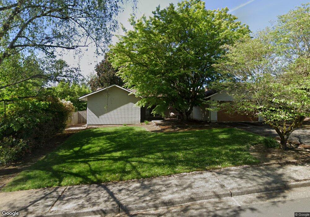
12060 SW Davies Rd Beaverton, OR 97008
Greenway NeighborhoodEstimated Value: $584,000 - $650,000
4
Beds
2
Baths
1,798
Sq Ft
$338/Sq Ft
Est. Value
About This Home
This home is located at 12060 SW Davies Rd, Beaverton, OR 97008 and is currently estimated at $607,379, approximately $337 per square foot. 12060 SW Davies Rd is a home located in Washington County with nearby schools including Greenway Elementary School, Conestoga Middle School, and Southridge High School.
Ownership History
Date
Name
Owned For
Owner Type
Purchase Details
Closed on
Aug 11, 2015
Sold by
Schieman Donald and Schieman Andrea
Bought by
Miner Wilma G and Miner Richard L
Current Estimated Value
Home Financials for this Owner
Home Financials are based on the most recent Mortgage that was taken out on this home.
Original Mortgage
$233,000
Outstanding Balance
$181,489
Interest Rate
3.91%
Mortgage Type
New Conventional
Estimated Equity
$425,890
Purchase Details
Closed on
Apr 5, 2013
Sold by
Nopper Susan
Bought by
Schieman Donald and Schieman Andrea
Home Financials for this Owner
Home Financials are based on the most recent Mortgage that was taken out on this home.
Original Mortgage
$254,308
Interest Rate
3.75%
Mortgage Type
FHA
Create a Home Valuation Report for This Property
The Home Valuation Report is an in-depth analysis detailing your home's value as well as a comparison with similar homes in the area
Home Values in the Area
Average Home Value in this Area
Purchase History
| Date | Buyer | Sale Price | Title Company |
|---|---|---|---|
| Miner Wilma G | $333,500 | First American | |
| Schieman Donald | $259,000 | Fidelity National Title Or |
Source: Public Records
Mortgage History
| Date | Status | Borrower | Loan Amount |
|---|---|---|---|
| Open | Miner Wilma G | $233,000 | |
| Previous Owner | Schieman Donald | $254,308 |
Source: Public Records
Tax History Compared to Growth
Tax History
| Year | Tax Paid | Tax Assessment Tax Assessment Total Assessment is a certain percentage of the fair market value that is determined by local assessors to be the total taxable value of land and additions on the property. | Land | Improvement |
|---|---|---|---|---|
| 2026 | $5,603 | $273,520 | -- | -- |
| 2025 | $5,603 | $265,560 | -- | -- |
| 2024 | $5,290 | $257,830 | -- | -- |
| 2023 | $5,290 | $250,330 | $0 | $0 |
| 2022 | $5,063 | $250,330 | $0 | $0 |
| 2021 | $4,886 | $235,970 | $0 | $0 |
| 2020 | $4,737 | $229,100 | $0 | $0 |
| 2019 | $4,588 | $222,430 | $0 | $0 |
| 2018 | $4,441 | $215,960 | $0 | $0 |
| 2017 | $4,275 | $209,670 | $0 | $0 |
| 2016 | $4,127 | $203,570 | $0 | $0 |
| 2015 | $3,973 | $197,650 | $0 | $0 |
| 2014 | $3,889 | $191,900 | $0 | $0 |
Source: Public Records
Map
Nearby Homes
- 8670 SW Indian Hill Ln
- 12119 SW Tesla Terrace
- 7875 SW Green Ln
- 7612 SW Cresmoor Dr
- 7505 SW Alpine Dr
- 12945 SW Hackamore Ct
- 9020 SW 130th Ave Unit 9020
- 11625 SW Settler Way
- 11990 SW Denney Rd
- 12145 SW Gingham Ln
- 13235 SW Barberry Dr
- 9750 SW Lookout Terrace
- 7110 SW Queen Ln
- 13465 SW Lancewood St
- 9625 SW 130th Ave
- 12720 SW Brockman St
- 12062 SW Conestoga Dr Unit 6
- 9964 SW Trapper Terrace Unit 259
- 13525 SW Fircrest Ct
- 10196 SW Trapper Terrace Unit 165
- 12080 SW Davies Rd
- 12040 SW Davies Rd
- 12155 SW Mckay Ct
- 12175 SW Mckay Ct
- 12100 SW Davies Rd
- 12075 SW Davies Rd
- 12135 SW Mckay Ct
- 12055 SW Davies Rd
- 12095 SW Davies Rd
- 12195 SW Mckay Ct
- 12115 SW Davies Rd
- 12120 SW Davies Rd
- 8400 SW Parkview Loop
- 12215 SW Mckay Ct
- 12120 SW Mckay Ct
- 8410 SW Parkview Loop
- 12135 SW Davies Rd
- 8530 SW Rebecca Ln
- 12140 SW Mckay Ct
- 8420 SW Parkview Loop