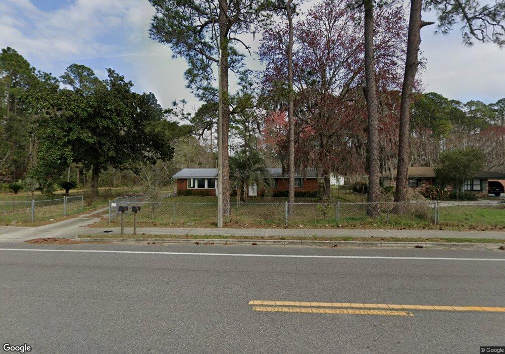
12061 Pulaski Rd Jacksonville, FL 32218
Oceanway NeighborhoodEstimated Value: $132,000 - $171,000
3
Beds
1
Bath
912
Sq Ft
$168/Sq Ft
Est. Value
About This Home
This home is located at 12061 Pulaski Rd, Jacksonville, FL 32218 and is currently estimated at $153,480, approximately $168 per square foot. 12061 Pulaski Rd is a home located in Duval County with nearby schools including Louis S. Sheffield Elementary School, Oceanway School, and First Coast High School.
Ownership History
Date
Name
Owned For
Owner Type
Purchase Details
Closed on
Jun 26, 2009
Sold by
Us Bank National Association
Bought by
Wofford Daniel
Current Estimated Value
Purchase Details
Closed on
Apr 3, 2009
Sold by
Merritt Donald W
Bought by
Us Bank National Association
Purchase Details
Closed on
Feb 19, 2004
Sold by
Kinchen Shirley Jean
Bought by
Merritt Donald W
Home Financials for this Owner
Home Financials are based on the most recent Mortgage that was taken out on this home.
Original Mortgage
$78,000
Interest Rate
5.87%
Mortgage Type
Unknown
Create a Home Valuation Report for This Property
The Home Valuation Report is an in-depth analysis detailing your home's value as well as a comparison with similar homes in the area
Home Values in the Area
Average Home Value in this Area
Purchase History
| Date | Buyer | Sale Price | Title Company |
|---|---|---|---|
| Wofford Daniel | $46,500 | Watson Title Insurance Agenc | |
| Us Bank National Association | $35,100 | None Available | |
| Merritt Donald W | $78,000 | First Coast Title Svcs Inc |
Source: Public Records
Mortgage History
| Date | Status | Borrower | Loan Amount |
|---|---|---|---|
| Previous Owner | Merritt Donald W | $78,000 |
Source: Public Records
Tax History Compared to Growth
Tax History
| Year | Tax Paid | Tax Assessment Tax Assessment Total Assessment is a certain percentage of the fair market value that is determined by local assessors to be the total taxable value of land and additions on the property. | Land | Improvement |
|---|---|---|---|---|
| 2025 | $2,162 | $112,473 | -- | -- |
| 2024 | $2,035 | $121,681 | $48,998 | $72,683 |
| 2023 | $2,035 | $116,942 | $47,598 | $69,344 |
| 2022 | $1,729 | $98,784 | $29,399 | $69,385 |
| 2021 | $1,567 | $78,646 | $23,099 | $55,547 |
| 2020 | $1,441 | $69,839 | $18,899 | $50,940 |
| 2019 | $1,494 | $71,793 | $20,999 | $50,794 |
| 2018 | $1,452 | $68,799 | $16,799 | $52,000 |
| 2017 | $1,391 | $67,825 | $16,799 | $51,026 |
| 2016 | $1,275 | $57,278 | $0 | $0 |
| 2015 | $1,195 | $52,050 | $0 | $0 |
| 2014 | $1,230 | $53,328 | $0 | $0 |
Source: Public Records
Map
Nearby Homes
- 11732 Lake Bend Cir
- 11738 Lake Bend Cir
- 11800 Lake Bend Cir
- 12283 Cardinal Creek Dr
- 11520 Dunforth Cove Dr
- 1365 Fre Gray Rd Rd
- 11567 Sycamore Cove Ln
- 11707 Wynell Rd
- 12441 Tiny Dr
- 12433 Tiny Dr
- 1107 Autumn Point Ct
- 12330 Deersong Dr N
- 12337 Cardinal Creek Dr
- 12345 Bristol Creek Dr
- 11614 Hickory Oak Dr
- 11607 Hickory Oak Dr
- 12572 Daylight Trail
- 1051 Morning Light Rd
- 12608 Daylight Trail
- 1068 Morning Light Rd
- 12051 Pulaski Rd
- 12041 Pulaski Rd
- 1182 Noah Rd
- 12054 Pulaski Rd
- 12033 Pulaski Rd
- 12071 Pulaski Rd
- 12110 Pulaski Rd
- 12038 Pulaski Rd
- 12023 Pulaski Rd
- 1144 Noah Rd
- 1155 Regis Rd
- 12114 Pulaski Rd
- 12030 Pulaski Rd
- 12015 Pulaski Rd
- 1135 Noah Rd
- 12020 Pulaski Rd
- 1130 Noah Rd
- 1135 Regis Rd
- 12005 Pulaski Rd
- 1125 Noah Rd