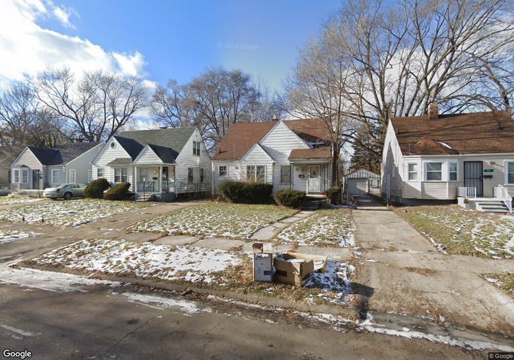
12067 Rossiter St Detroit, MI 48224
Moross-Morang NeighborhoodEstimated Value: $71,000 - $104,000
3
Beds
2
Baths
1,100
Sq Ft
$78/Sq Ft
Est. Value
About This Home
This home is located at 12067 Rossiter St, Detroit, MI 48224 and is currently estimated at $85,623, approximately $77 per square foot. 12067 Rossiter St is a home located in Wayne County with nearby schools including Carleton Elementary School, Edward 'Duke' Ellington Conservatory of Music and Art, and Charles L. Spain Elementary-Middle School.
Ownership History
Date
Name
Owned For
Owner Type
Purchase Details
Closed on
May 1, 2008
Sold by
Jarmon Marla L
Bought by
Hsbc Bank Usa Na and Ace Securities Corp Home Equity Loan Tru
Current Estimated Value
Purchase Details
Closed on
Aug 23, 2006
Sold by
Beeker Clifford O and Beeker Bonnie V
Bought by
Jarmon Maria L
Create a Home Valuation Report for This Property
The Home Valuation Report is an in-depth analysis detailing your home's value as well as a comparison with similar homes in the area
Home Values in the Area
Average Home Value in this Area
Purchase History
| Date | Buyer | Sale Price | Title Company |
|---|---|---|---|
| Hsbc Bank Usa Na | $58,962 | None Available | |
| Jarmon Maria L | $68,800 | Metropolitan Title Company |
Source: Public Records
Tax History Compared to Growth
Tax History
| Year | Tax Paid | Tax Assessment Tax Assessment Total Assessment is a certain percentage of the fair market value that is determined by local assessors to be the total taxable value of land and additions on the property. | Land | Improvement |
|---|---|---|---|---|
| 2025 | $941 | $33,200 | $0 | $0 |
| 2024 | $941 | $29,200 | $0 | $0 |
| 2023 | $912 | $24,200 | $0 | $0 |
| 2022 | $872 | $19,200 | $0 | $0 |
| 2021 | $969 | $15,600 | $0 | $0 |
| 2020 | $959 | $14,600 | $0 | $0 |
| 2019 | $946 | $11,500 | $0 | $0 |
| 2018 | $816 | $9,800 | $0 | $0 |
| 2017 | $190 | $10,000 | $0 | $0 |
| 2016 | $1,330 | $18,100 | $0 | $0 |
| 2015 | $1,810 | $18,100 | $0 | $0 |
| 2013 | $2,015 | $20,153 | $0 | $0 |
| 2010 | -- | $29,547 | $1,238 | $28,309 |
Source: Public Records
Map
Nearby Homes
- 12096 Rossiter St
- 12260 Wayburn St
- 19242 Moross Rd
- 19302 Moross Rd
- 12025 Lakepointe St
- 12125 Wayburn St
- 12450 Lansdowne St
- 19346 Moross Rd
- 19124 Moross Rd
- 11912 Lakepointe St
- 11959 Roxbury St
- 12066 Wayburn St
- 19050 Moross Rd
- 19196 Mccormick St
- 11851 Lakepointe St
- 11908 Roxbury St
- 19415 Moross Rd
- 11832 Roxbury St
- 11910 Rossiter St
- 19331 Mccormick St
- 12075 Rossiter St
- 12081 Rossiter St
- 12051 Rossiter St
- 12089 Rossiter St
- 12164 Wayburn St Unit Bldg-Unit
- 12164 Wayburn St
- 12158 Wayburn St
- 12172 Wayburn St
- 19209 LINV Wayburn St
- 12041 Rossiter St
- 12150 Wayburn St
- 12180 Wayburn St
- 12097 Rossiter St
- 12190 Wayburn St
- 12140 Wayburn St
- 12033 Rossiter St
- 12064 Rossiter St
- 12056 Rossiter St
- 12072 Rossiter St
- 12025 Rossiter St