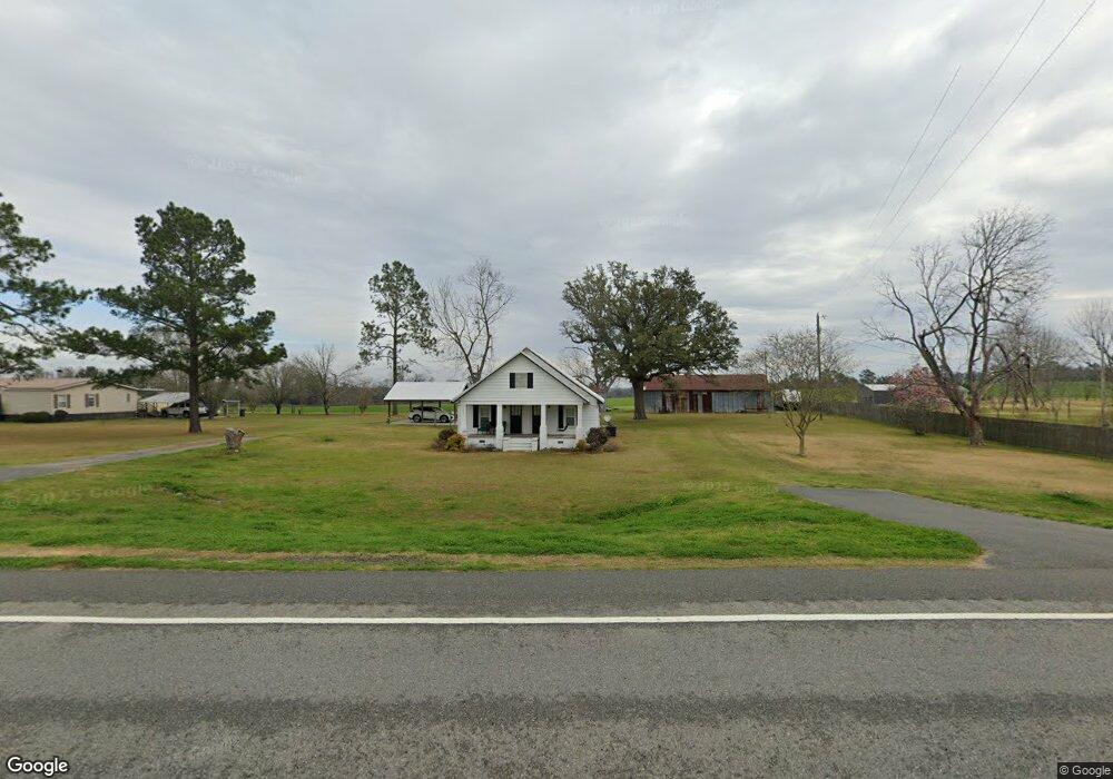
12069 Valdosta Hwy Quitman, GA 31643
Estimated Value: $179,000 - $219,552
--
Bed
1
Bath
1,320
Sq Ft
$150/Sq Ft
Est. Value
About This Home
This home is located at 12069 Valdosta Hwy, Quitman, GA 31643 and is currently estimated at $198,138, approximately $150 per square foot. 12069 Valdosta Hwy is a home located in Brooks County with nearby schools including North Brooks Elementary School.
Ownership History
Date
Name
Owned For
Owner Type
Purchase Details
Closed on
Feb 4, 2022
Sold by
Ortega Rose
Bought by
Barnes Stanley T and Barnes Judy L
Current Estimated Value
Purchase Details
Closed on
Jan 12, 2022
Sold by
Barnes Stanley T
Bought by
Ortega Rose and Ortega Jesse
Purchase Details
Closed on
Jul 5, 2017
Sold by
Barnes Stanley
Bought by
Barnes Stanley and Barnes Judy L
Purchase Details
Closed on
Jun 28, 2017
Sold by
Raleigh
Bought by
Barnes Stanley T and Barnes Judy L
Purchase Details
Closed on
Feb 12, 1987
Sold by
Barnes Jewell
Bought by
Barnes Stanley
Create a Home Valuation Report for This Property
The Home Valuation Report is an in-depth analysis detailing your home's value as well as a comparison with similar homes in the area
Home Values in the Area
Average Home Value in this Area
Purchase History
| Date | Buyer | Sale Price | Title Company |
|---|---|---|---|
| Barnes Stanley T | -- | -- | |
| Ortega Rose | $140,000 | -- | |
| Barnes Stanley | -- | -- | |
| Barnes Stanley T | -- | -- | |
| Barnes Stanley | -- | -- |
Source: Public Records
Tax History Compared to Growth
Tax History
| Year | Tax Paid | Tax Assessment Tax Assessment Total Assessment is a certain percentage of the fair market value that is determined by local assessors to be the total taxable value of land and additions on the property. | Land | Improvement |
|---|---|---|---|---|
| 2024 | $1,278 | $60,600 | $24,680 | $35,920 |
| 2023 | $773 | $56,760 | $22,360 | $34,400 |
| 2022 | $1,773 | $58,498 | $21,720 | $36,778 |
| 2021 | $1,581 | $54,786 | $22,600 | $32,186 |
| 2020 | $1,507 | $54,264 | $22,600 | $31,664 |
| 2019 | $1,491 | $52,417 | $21,720 | $30,697 |
| 2018 | $1,570 | $53,754 | $22,160 | $31,594 |
| 2017 | $908 | $18,900 | $0 | $18,900 |
| 2016 | $894 | $41,012 | $0 | $0 |
| 2015 | -- | $37,524 | $0 | $0 |
| 2014 | -- | $25,300 | $4,800 | $20,500 |
| 2013 | -- | $25,660 | $5,160 | $20,500 |
Source: Public Records
Map
Nearby Homes
- 4386 Studstill Rd
- 51 Green Lake Cir
- 17 Green Lake Cir
- 6211 Hardee Dr
- 85 Hitch St
- 11439 Adel Hwy
- 168 Azalea St
- Tract 2 Hall Webb Rd
- 6821 Miller Bridge Rd
- 16000 Valdosta Hwy
- 295 Sunflower
- 471 Jamar Trail
- 1440 Peach Rd
- 288 Jamar Trail
- 270 Jamar Trail
- 248 Jamar Trail
- 61 Trail of Hawk Rd
- 6818 Troupeville Rd
- 8262 Troupeville Rd
- 212 Hilltop Cir
- 12051 Valdosta Hwy
- 12235 Valdosta Hwy
- 11765 Valdosta Hwy
- 11761 Valdosta Hwy
- 12449 Valdosta Hwy
- 12741 Valdosta Hwy
- 921 Sims Rd
- 944 Sims Rd
- 917 Sims Rd
- 703 Sims Rd
- 668 Sims Rd
- 200 Cameron Cir
- 180 Cameron Cir
- 203 Vickie St
- 142 Cameron Cir
- 672 Sims Rd
- 132 Cameron Cir
- 161 Vicki St
- 141 Cameron Cir
- 118 Cameron Cir