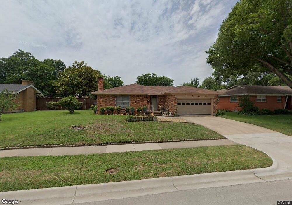
1207 Bellemead Dr Denton, TX 76201
Rayzor Ranch NeighborhoodEstimated Value: $321,065 - $354,000
3
Beds
2
Baths
1,996
Sq Ft
$171/Sq Ft
Est. Value
About This Home
This home is located at 1207 Bellemead Dr, Denton, TX 76201 and is currently estimated at $340,766, approximately $170 per square foot. 1207 Bellemead Dr is a home located in Denton County with nearby schools including Newton Rayzor Elementary School, Calhoun Middle School, and Denton High School.
Ownership History
Date
Name
Owned For
Owner Type
Purchase Details
Closed on
Aug 18, 1998
Sold by
Punsalan Felipe Q and Punsalan Erlinda R
Bought by
Batac Mario Sigua and Batac Juanita Punsalang
Current Estimated Value
Home Financials for this Owner
Home Financials are based on the most recent Mortgage that was taken out on this home.
Original Mortgage
$71,655
Outstanding Balance
$14,975
Interest Rate
6.94%
Mortgage Type
FHA
Estimated Equity
$325,791
Create a Home Valuation Report for This Property
The Home Valuation Report is an in-depth analysis detailing your home's value as well as a comparison with similar homes in the area
Home Values in the Area
Average Home Value in this Area
Purchase History
| Date | Buyer | Sale Price | Title Company |
|---|---|---|---|
| Batac Mario Sigua | -- | -- |
Source: Public Records
Mortgage History
| Date | Status | Borrower | Loan Amount |
|---|---|---|---|
| Open | Batac Mario Sigua | $71,655 |
Source: Public Records
Tax History Compared to Growth
Tax History
| Year | Tax Paid | Tax Assessment Tax Assessment Total Assessment is a certain percentage of the fair market value that is determined by local assessors to be the total taxable value of land and additions on the property. | Land | Improvement |
|---|---|---|---|---|
| 2025 | $798 | $256,446 | $107,800 | $188,917 |
| 2024 | $4,500 | $233,133 | $0 | $0 |
| 2023 | $798 | $211,939 | $107,800 | $185,112 |
| 2022 | $4,090 | $192,672 | $53,440 | $156,446 |
| 2021 | $3,894 | $175,156 | $33,400 | $141,756 |
| 2020 | $4,022 | $175,975 | $33,400 | $142,575 |
| 2019 | $4,036 | $169,143 | $33,400 | $145,267 |
| 2018 | $3,714 | $153,766 | $33,400 | $124,579 |
| 2017 | $3,455 | $139,787 | $33,400 | $111,097 |
| 2016 | $3,141 | $127,079 | $20,040 | $111,516 |
| 2015 | $2,086 | $115,526 | $20,040 | $95,486 |
| 2013 | -- | $114,673 | $26,460 | $88,213 |
Source: Public Records
Map
Nearby Homes
- 1200 Thomas St
- 1027 Stanley St
- 1014 Hillcrest St
- 910 Stanley St Unit 3
- 910 Stanley St Unit 5
- 910 Stanley St Unit 1
- 910 Stanley St Unit 2
- 910 Stanley St Unit 6
- 1813 Crescent St
- 1716 Cordell St
- 419 Marietta St
- 2230 Alamo Place
- 1319 Tulane Dr
- 1509 Egan St
- 2044 W Oak St
- 2109 Malone St
- 2225 Southway
- 1007 Westway St
- 1004 Westway St
- 2516 Bowling Green St
- 1211 Bellemead Dr
- 1201 Bellemead Dr
- 1215 Bellemead Dr
- 1128 Thomas St
- 1124 Thomas St
- 1206 Thomas St
- 1206 Bellemead Dr
- 1120 Thomas St
- 1223 Bellemead Dr
- 1119 Bellemead Dr
- 1200 Bellemead Dr
- 1210 Bellemead Dr
- 1214 Bellemead Dr
- 1212 Thomas St
- 1114 Thomas St
- 1225 Bellemead Dr
- 1218 Bellemead Dr
- 1122 Bellemead Dr
- 1218 Thomas St
- 1105 Bellemead Dr