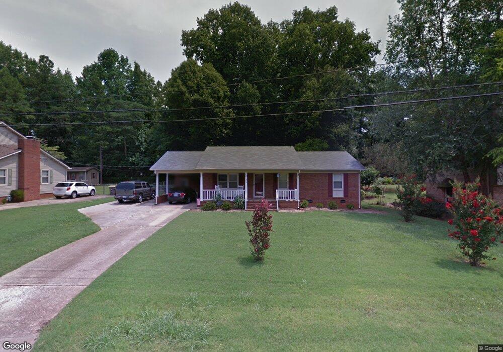
1207 Berkshire Dr Kannapolis, NC 28081
Estimated Value: $266,000 - $294,000
3
Beds
2
Baths
1,443
Sq Ft
$195/Sq Ft
Est. Value
About This Home
This home is located at 1207 Berkshire Dr, Kannapolis, NC 28081 and is currently estimated at $280,711, approximately $194 per square foot. 1207 Berkshire Dr is a home located in Cabarrus County with nearby schools including Shady Brook Elementary School, Kannapolis Middle, and A.L. Brown High School.
Ownership History
Date
Name
Owned For
Owner Type
Purchase Details
Closed on
Jun 11, 2025
Sold by
Finke-Delfs Melody and Delfs Kenneth Joseph
Bought by
Delfs Family Revocable Trust and Delfs
Current Estimated Value
Purchase Details
Closed on
Dec 15, 2021
Sold by
Cook Thomas E and Cook Milagros B
Bought by
Delfs Melody
Purchase Details
Closed on
Nov 21, 2007
Sold by
Cook Joi Lynn Sluder
Bought by
Cook Thomas E
Purchase Details
Closed on
Dec 1, 1996
Bought by
Cook Thomas E
Purchase Details
Closed on
Jan 1, 1994
Purchase Details
Closed on
Jul 1, 1988
Purchase Details
Closed on
Jun 1, 1986
Create a Home Valuation Report for This Property
The Home Valuation Report is an in-depth analysis detailing your home's value as well as a comparison with similar homes in the area
Home Values in the Area
Average Home Value in this Area
Purchase History
| Date | Buyer | Sale Price | Title Company |
|---|---|---|---|
| Delfs Family Revocable Trust | -- | None Listed On Document | |
| Delfs Family Revocable Trust | -- | None Listed On Document | |
| Delfs Melody | $234,000 | None Available | |
| Cook Thomas E | -- | None Available | |
| Cook Thomas E | $95,000 | -- | |
| -- | $79,500 | -- | |
| -- | $7,000 | -- | |
| -- | $61,000 | -- |
Source: Public Records
Tax History Compared to Growth
Tax History
| Year | Tax Paid | Tax Assessment Tax Assessment Total Assessment is a certain percentage of the fair market value that is determined by local assessors to be the total taxable value of land and additions on the property. | Land | Improvement |
|---|---|---|---|---|
| 2025 | $2,975 | $262,030 | $63,000 | $199,030 |
| 2024 | $2,975 | $262,030 | $63,000 | $199,030 |
| 2023 | $2,013 | $146,920 | $34,000 | $112,920 |
| 2022 | $2,013 | $146,920 | $34,000 | $112,920 |
| 2021 | $2,013 | $146,920 | $34,000 | $112,920 |
| 2020 | $2,013 | $146,920 | $34,000 | $112,920 |
| 2019 | $1,668 | $121,780 | $25,000 | $96,780 |
| 2018 | $1,644 | $121,780 | $25,000 | $96,780 |
| 2017 | $1,620 | $121,780 | $25,000 | $96,780 |
| 2016 | $1,620 | $122,830 | $32,000 | $90,830 |
| 2015 | $1,548 | $122,830 | $32,000 | $90,830 |
| 2014 | $1,548 | $122,830 | $32,000 | $90,830 |
Source: Public Records
Map
Nearby Homes
- 1208 Berkshire Dr
- 1209 Derbyshire Rd
- 1200 Berkshire Dr
- 1110 Rogers Lake Rd
- 1620 Longbow Dr
- 915 Sprucewood St
- 1408 Nottingham Rd
- 1010 Sprucewood St
- 1003 Robinhood Ln
- 00 Sapp Rd
- 1441 Sherwood Dr
- 1418 Oakwood Ave
- 809 Walker St
- 804 Evergreen Ave
- 1410 Oakwood Ave
- 1229 Brecken Ct
- 3833 Crossbane St
- 1828 Independence Square
- 1408 Wildwood Dr
- 703 Brookcrest Dr
- 1205 Berkshire Dr
- 1209 Berkshire Dr
- 0 Independence Square
- 000 Independence Square Unit 6
- 1203 Berkshire Dr
- 1211 Berkshire Dr
- 1206 Berkshire Dr
- 1204 Berkshire Dr
- 1202 Berkshire Dr
- 1210 Berkshire Dr
- 1213 Berkshire Dr
- 1201 Berkshire Dr
- 1207 Derbyshire Rd
- 1212 Berkshire Dr
- 1204 Rogers Lake Rd
- 1205 Derbyshire Rd
- 1300 Rogers Lake Rd
- 1301 Derbyshire Rd
- 1214 Derbyshire Rd
- 1303 Derbyshire Rd