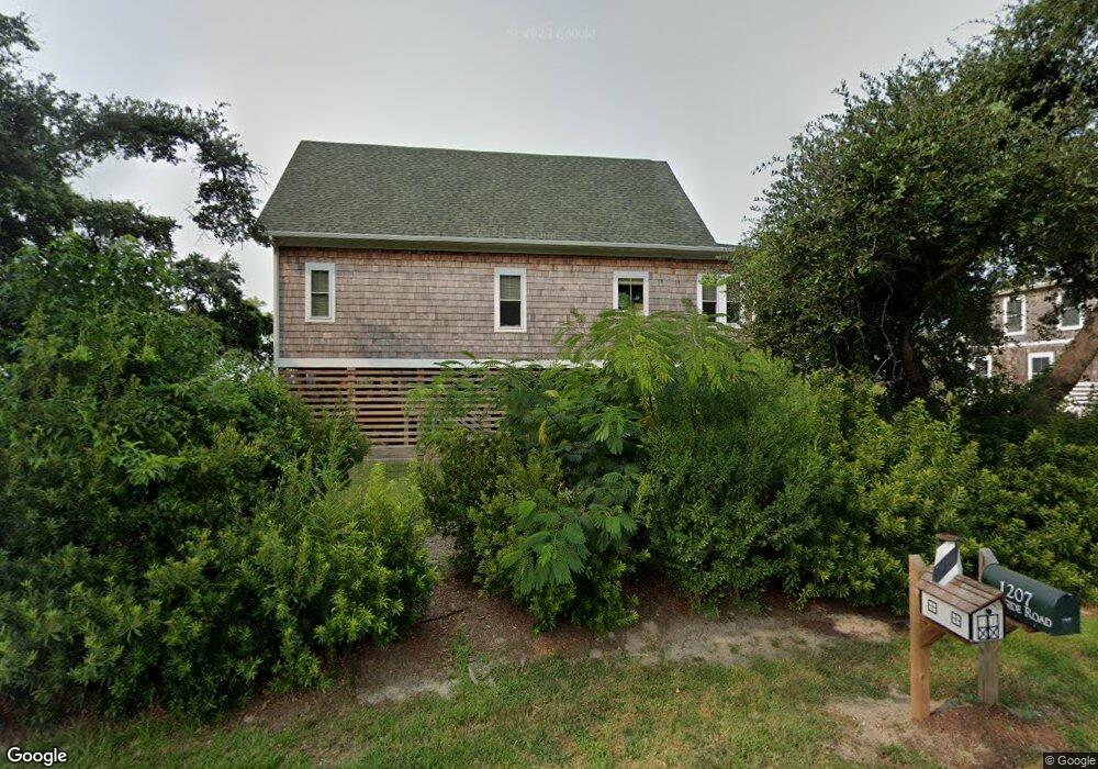
1207 Burnside Rd Manteo, NC 27954
Estimated Value: $547,203 - $640,000
3
Beds
3
Baths
1,658
Sq Ft
$364/Sq Ft
Est. Value
About This Home
This home is located at 1207 Burnside Rd, Manteo, NC 27954 and is currently estimated at $603,551, approximately $364 per square foot. 1207 Burnside Rd is a home with nearby schools including Manteo Elementary School, Manteo Middle School, and Manteo High School.
Ownership History
Date
Name
Owned For
Owner Type
Purchase Details
Closed on
Mar 17, 2020
Sold by
Harrell Robert F and Harrell Deloris U
Bought by
Harrell Tess Jordanna
Current Estimated Value
Home Financials for this Owner
Home Financials are based on the most recent Mortgage that was taken out on this home.
Original Mortgage
$234,000
Interest Rate
3.4%
Mortgage Type
Construction
Create a Home Valuation Report for This Property
The Home Valuation Report is an in-depth analysis detailing your home's value as well as a comparison with similar homes in the area
Home Values in the Area
Average Home Value in this Area
Purchase History
| Date | Buyer | Sale Price | Title Company |
|---|---|---|---|
| Harrell Tess Jordanna | -- | None Available | |
| Ambra Jr Francis T D | $6,000 | None Available |
Source: Public Records
Mortgage History
| Date | Status | Borrower | Loan Amount |
|---|---|---|---|
| Closed | Harrell Tess Jordanna | $234,000 |
Source: Public Records
Tax History Compared to Growth
Tax History
| Year | Tax Paid | Tax Assessment Tax Assessment Total Assessment is a certain percentage of the fair market value that is determined by local assessors to be the total taxable value of land and additions on the property. | Land | Improvement |
|---|---|---|---|---|
| 2024 | $2,142 | $387,600 | $39,100 | $348,500 |
| 2023 | $2,121 | $387,600 | $39,100 | $348,500 |
| 2022 | $2,082 | $387,600 | $39,100 | $348,500 |
| 2021 | $2,043 | $387,600 | $39,100 | $348,500 |
| 2020 | $47 | $8,900 | $8,900 | $0 |
| 2019 | $52 | $8,400 | $8,400 | $0 |
| 2018 | $52 | $8,400 | $8,400 | $0 |
| 2017 | $52 | $8,400 | $8,400 | $0 |
| 2016 | $48 | $8,400 | $8,400 | $0 |
| 2014 | $48 | $8,400 | $8,400 | $0 |
Source: Public Records
Map
Nearby Homes
- 1285 Burnside Rd Unit Lot 1
- 1285 Burnside Rd Unit Lot 2
- 1285 Burnside Rd Unit Lot 3
- 104 Coleman Rd
- 1095 Burnside Rd Unit Lot B3
- 1006 Burnside Rd
- 717 Fernando St Unit Lot 3
- 803 Lindsey Ln Unit Lot 40
- 804 Lindsey Ln
- 137 Sherwood Dr Unit Lot 58
- 137 Sherwood Dr
- 938 Burnside Rd Unit Lot NA
- 942 Burnside Rd Unit Lot NA
- 0 N Highway 64 264 Unit Lot 1R 129719
- 0 N Highway 64 264 Unit Lot 3R 129718
- 715 Arvilla Ln Unit Lot 4
- 501 Dora Dr Unit Lot 26
- 517 Unit 2 Ananias Dare St Unit 2
- 517 Unit 1 Ananias Dare St Unit 1
- 517 Ananias Dare St Unit 4
- 1211 Burnside Rd
- 1199 Burnside Rd
- 1210 Burnside Rd Unit 4
- 1210 Burnside Rd
- 1214 Burnside Rd
- 1219 Burnside Rd
- 1216 Burnside Rd Unit K533
- 1216 Burnside Rd
- 1190 Burnside Rd
- 1226 Burnside Rd Unit 6
- 1226 Burnside Rd
- 1229 Burnside Rd
- 1230 Burnside Rd
- 1239 Burnside Rd
- 1182 Burnside Rd
- 1234 Burnside Rd
- 1180 Burnside Rd
- 1178 Burnside Rd
- 1177 Burnside Rd
- 1171 Burnside Rd
