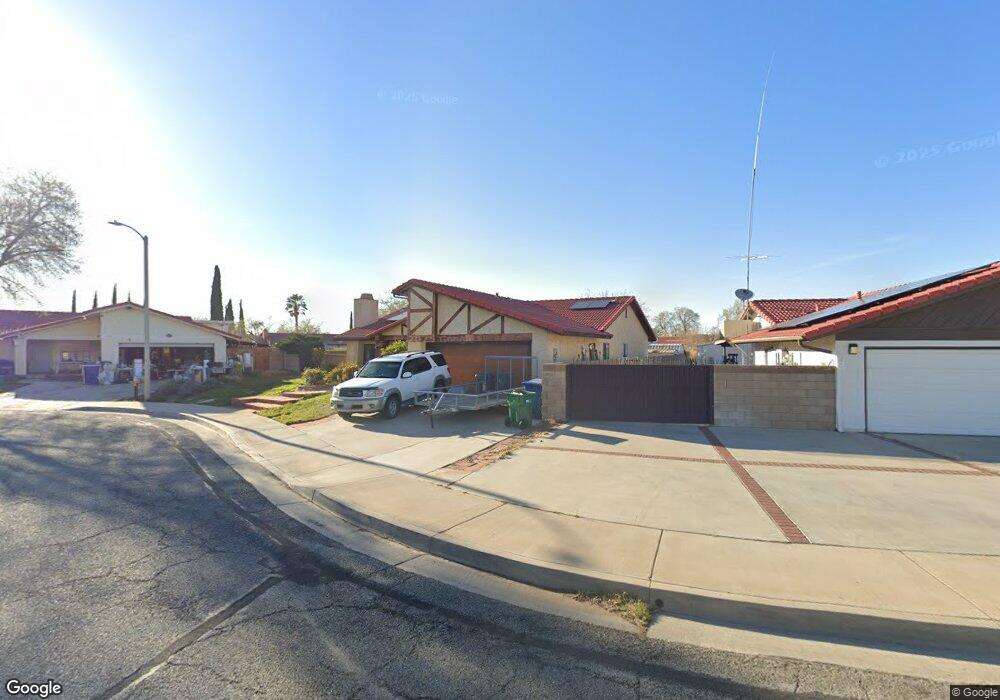
1207 Pasteur Dr Lancaster, CA 93535
East Lancaster NeighborhoodEstimated Value: $489,000 - $522,000
4
Beds
2
Baths
2,080
Sq Ft
$241/Sq Ft
Est. Value
About This Home
This home is located at 1207 Pasteur Dr, Lancaster, CA 93535 and is currently estimated at $501,873, approximately $241 per square foot. 1207 Pasteur Dr is a home located in Los Angeles County with nearby schools including Lincoln Elementary School, New Vista Middle School, and Eastside High School.
Ownership History
Date
Name
Owned For
Owner Type
Purchase Details
Closed on
Sep 28, 1994
Sold by
Jones Louis Edgar and Jones Lois A
Bought by
Miguel Thomas and Dernbach Carolyn
Current Estimated Value
Home Financials for this Owner
Home Financials are based on the most recent Mortgage that was taken out on this home.
Original Mortgage
$97,600
Interest Rate
8.78%
Create a Home Valuation Report for This Property
The Home Valuation Report is an in-depth analysis detailing your home's value as well as a comparison with similar homes in the area
Home Values in the Area
Average Home Value in this Area
Purchase History
| Date | Buyer | Sale Price | Title Company |
|---|---|---|---|
| Miguel Thomas | $122,000 | First American Title Company |
Source: Public Records
Mortgage History
| Date | Status | Borrower | Loan Amount |
|---|---|---|---|
| Closed | Miguel Thomas | $97,600 |
Source: Public Records
Tax History
| Year | Tax Paid | Tax Assessment Tax Assessment Total Assessment is a certain percentage of the fair market value that is determined by local assessors to be the total taxable value of land and additions on the property. | Land | Improvement |
|---|---|---|---|---|
| 2025 | $3,650 | $204,887 | $47,012 | $157,875 |
| 2024 | $3,650 | $200,871 | $46,091 | $154,780 |
| 2023 | $3,575 | $196,934 | $45,188 | $151,746 |
| 2022 | $3,480 | $193,073 | $44,302 | $148,771 |
| 2021 | $3,084 | $189,288 | $43,434 | $145,854 |
| 2019 | $2,997 | $183,676 | $42,147 | $141,529 |
| 2018 | $2,945 | $180,075 | $41,321 | $138,754 |
| 2016 | $2,783 | $173,084 | $39,717 | $133,367 |
| 2015 | $2,748 | $170,485 | $39,121 | $131,364 |
| 2014 | $2,736 | $167,146 | $38,355 | $128,791 |
Source: Public Records
Map
Nearby Homes
- 43629 Rembrandt St
- 43743 Alain Ct
- 43601 Rembrandt St
- 1251 Herzel Ave
- 1144 E Avenue j10
- 1311 Herzel Ave
- 1144 E Avenue J 10
- 87 E Avenue J 12
- 117 E Avenue J 12
- 43815 Silver Bow Rd
- 1519 Michelle Ave
- 1518 E Avenue j12
- 1518 E Avenue J-12
- 1118 E Avenue K
- 43903 11th St E
- 1217 Camran Ave
- 1311 Camran Ave
- 43927 Fallon Dr
- 0 10th St E Unit SR25172836
- 0 10th St E Unit PW25091742
- 1215 Pasteur Dr
- 1201 Pasteur Dr
- 43726 Rembrandt St
- 1226 E Avenue j12
- 1214 E Avenue j12
- 43732 Rembrandt St
- 43720 Rembrandt St
- 1219 Pasteur Dr
- 439000 Rembrandt St
- 43738 Rembrandt St
- 1228 E Avenue j12
- 43714 Rembrandt St
- 1227 Pasteur Dr
- 43744 Rembrandt St
- 1212 Pasteur Dr
- 1208 Pasteur Dr
- 43708 Rembrandt St
- 1200 Pasteur Dr
- 1234 E Avenue j12
- 1206 Pasteur Dr
Your Personal Tour Guide
Ask me questions while you tour the home.