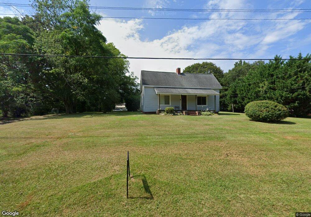
1208 Confederate Ave Lancaster, SC 29720
Estimated Value: $193,613 - $269,000
--
Bed
2
Baths
1,493
Sq Ft
$156/Sq Ft
Est. Value
About This Home
This home is located at 1208 Confederate Ave, Lancaster, SC 29720 and is currently estimated at $233,153, approximately $156 per square foot. 1208 Confederate Ave is a home located in Lancaster County with nearby schools including Erwin Elementary School, South Middle School, and Lancaster High School.
Ownership History
Date
Name
Owned For
Owner Type
Purchase Details
Closed on
Aug 25, 2006
Sold by
Threatt Christina R
Bought by
Threatt Jerry N
Current Estimated Value
Home Financials for this Owner
Home Financials are based on the most recent Mortgage that was taken out on this home.
Original Mortgage
$67,570
Outstanding Balance
$39,642
Interest Rate
6.25%
Mortgage Type
Adjustable Rate Mortgage/ARM
Estimated Equity
$193,511
Create a Home Valuation Report for This Property
The Home Valuation Report is an in-depth analysis detailing your home's value as well as a comparison with similar homes in the area
Home Values in the Area
Average Home Value in this Area
Purchase History
| Date | Buyer | Sale Price | Title Company |
|---|---|---|---|
| Threatt Jerry N | -- | None Available |
Source: Public Records
Mortgage History
| Date | Status | Borrower | Loan Amount |
|---|---|---|---|
| Open | Threatt Jerry N | $67,570 |
Source: Public Records
Tax History Compared to Growth
Tax History
| Year | Tax Paid | Tax Assessment Tax Assessment Total Assessment is a certain percentage of the fair market value that is determined by local assessors to be the total taxable value of land and additions on the property. | Land | Improvement |
|---|---|---|---|---|
| 2024 | $588 | $3,832 | $504 | $3,328 |
| 2023 | $585 | $3,832 | $504 | $3,328 |
| 2022 | $583 | $3,832 | $504 | $3,328 |
| 2021 | $571 | $3,832 | $504 | $3,328 |
| 2020 | $555 | $3,616 | $504 | $3,112 |
| 2019 | $1,224 | $3,616 | $504 | $3,112 |
| 2018 | $1,178 | $3,616 | $504 | $3,112 |
| 2017 | $542 | $0 | $0 | $0 |
| 2016 | $529 | $0 | $0 | $0 |
| 2015 | $439 | $0 | $0 | $0 |
| 2014 | $439 | $0 | $0 | $0 |
| 2013 | $439 | $0 | $0 | $0 |
Source: Public Records
Map
Nearby Homes
- 1324 Mason St
- 1250 Hampton Grace Ave
- 1397 Grace Ave
- 1428 Boxwood Ave
- 1447 Carmel Rd
- 1631 Oakdale Dr
- 1658 Oakdale Dr
- 1530 Danlee Dr
- 1795 Grace Ave
- 951 Confederate Ave
- 1797 Drywood Cir
- 1007 Old Thompson Ave
- 1746 Grace Ave Unit 1
- 1801 Grace Ave
- 1500 Victoria St Unit 4
- 1509 Victoria St Unit 13
- 1503 Victoria St
- 1501 Victoria St Unit 11
- 1817 Grace Ave
- 5.45 acres Memorial Park Rd
- 1198 Confederate Ave
- 1156 Confederate Ave
- 1211 Confederate Ave
- 1197 Confederate Ave
- 1561 Carmel Rd
- 1437 Erwin St
- 1170 Confederate Ave
- 1444 Erwin St
- 1553 Carmel Rd
- 1445 Erwin St
- 1334 Mason St
- 1177 Hampton Grace Ave
- 1545 Carmel Rd
- 1422 State Road S-29-372
- 1451 Erwin St
- 1163 Confederate Ave
- 1428 Pink Dogwood Ave
- 1350 Mason St
- 1664 Pinewood Ave
- 1537 Carmel Rd