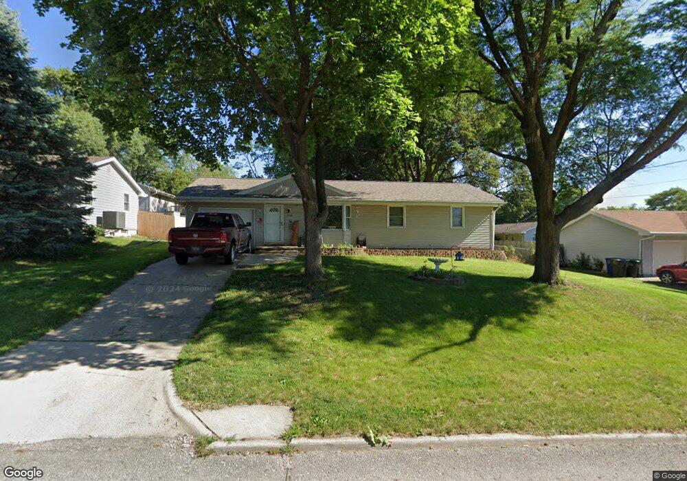
1208 E Philip St Des Moines, IA 50315
South Central DSM NeighborhoodEstimated Value: $197,492 - $216,000
3
Beds
1
Bath
1,024
Sq Ft
$204/Sq Ft
Est. Value
About This Home
This home is located at 1208 E Philip St, Des Moines, IA 50315 and is currently estimated at $208,623, approximately $203 per square foot. 1208 E Philip St is a home located in Polk County with nearby schools including Lovejoy Elementary School, Weeks Middle School, and Lincoln High School.
Ownership History
Date
Name
Owned For
Owner Type
Purchase Details
Closed on
Apr 8, 2011
Sold by
The Secretary Of Housing & Urban Develop
Bought by
Summit Development & Construction
Current Estimated Value
Purchase Details
Closed on
Aug 16, 2010
Sold by
Wells Fargo Bank Na
Bought by
Secretary Of Housing & Urban Development
Purchase Details
Closed on
Jul 23, 2010
Sold by
Brummet Joseph and Brummet Teri
Bought by
Wells Fargo Bank Na
Purchase Details
Closed on
Aug 24, 2007
Sold by
Fultz Nicole and Fultz Jeremy
Bought by
Brummet Joseph and Brummet Terri
Home Financials for this Owner
Home Financials are based on the most recent Mortgage that was taken out on this home.
Original Mortgage
$127,006
Interest Rate
6.77%
Mortgage Type
Purchase Money Mortgage
Create a Home Valuation Report for This Property
The Home Valuation Report is an in-depth analysis detailing your home's value as well as a comparison with similar homes in the area
Home Values in the Area
Average Home Value in this Area
Purchase History
| Date | Buyer | Sale Price | Title Company |
|---|---|---|---|
| Summit Development & Construction | -- | None Available | |
| Secretary Of Housing & Urban Development | -- | None Available | |
| Wells Fargo Bank Na | $154,637 | None Available | |
| Brummet Joseph | $128,500 | None Available |
Source: Public Records
Mortgage History
| Date | Status | Borrower | Loan Amount |
|---|---|---|---|
| Previous Owner | Brummet Joseph | $127,006 |
Source: Public Records
Tax History Compared to Growth
Tax History
| Year | Tax Paid | Tax Assessment Tax Assessment Total Assessment is a certain percentage of the fair market value that is determined by local assessors to be the total taxable value of land and additions on the property. | Land | Improvement |
|---|---|---|---|---|
| 2025 | $3,424 | $184,800 | $38,300 | $146,500 |
| 2024 | $3,424 | $174,100 | $35,500 | $138,600 |
| 2023 | $3,486 | $174,100 | $35,500 | $138,600 |
| 2022 | $3,460 | $147,900 | $31,000 | $116,900 |
| 2021 | $3,264 | $147,900 | $31,000 | $116,900 |
| 2020 | $3,390 | $130,800 | $27,400 | $103,400 |
| 2019 | $2,984 | $130,800 | $27,400 | $103,400 |
| 2018 | $2,952 | $111,000 | $22,700 | $88,300 |
| 2017 | $2,966 | $111,000 | $22,700 | $88,300 |
| 2016 | $2,890 | $109,700 | $21,000 | $88,700 |
| 2015 | $2,890 | $109,700 | $21,000 | $88,700 |
| 2014 | $2,918 | $109,800 | $20,700 | $89,100 |
Source: Public Records
Map
Nearby Homes
- 1201 E Philip St
- 705 E Watrous Ave
- 401 E Mckinley Ave
- 904 E Hackley Ave
- 448 Scandia Ave
- 712 E Hackley Ave
- 3909 SE 5th St
- 801 E Hackley Ave
- 3616 SE 11th St
- 5205 SE 9th St
- 409 Wilmers Ave
- 4316 SE 4th St
- 1617 Evergreen Ave
- 1600 Evergreen Ave
- 3624 SE 18th St
- 311 E Emma Ave
- 209 E Philip St
- 1902 E Marion St
- 126 E Maxwelton Dr
- 108 E Philip St
- 1200 E Philip St
- 1214 E Philip St
- 4301 SE 12th St
- 4300 SE 13th St
- 1209 E Philip St
- 1215 E Philip St
- 4217 SE 12th St
- 4216 SE 13th St
- 1221 E Philip St
- 1118 E Philip St
- 4306 SE 12th St
- 4211 SE 12th St
- 4300 SE 12th St
- 1119 E Philip St
- 4307 SE 13th St
- 1111 E Philip St
- 1104 E Philip St
- 4309 SE 11th St
- 1211 E Leach Ave
- 4210 SE 12th St