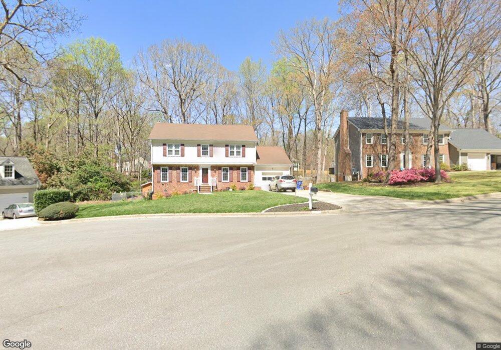
1208 Maury Ct Raleigh, NC 27615
Estimated Value: $630,000 - $709,000
4
Beds
3
Baths
2,266
Sq Ft
$294/Sq Ft
Est. Value
About This Home
This home is located at 1208 Maury Ct, Raleigh, NC 27615 and is currently estimated at $666,236, approximately $294 per square foot. 1208 Maury Ct is a home located in Wake County with nearby schools including Lead Mine Elementary School, Carroll Middle, and Sanderson High School.
Ownership History
Date
Name
Owned For
Owner Type
Purchase Details
Closed on
Jul 23, 2015
Sold by
Puskar Carolyn L
Bought by
Buck James C and Buck Adrienne M
Current Estimated Value
Home Financials for this Owner
Home Financials are based on the most recent Mortgage that was taken out on this home.
Original Mortgage
$279,000
Outstanding Balance
$219,431
Interest Rate
4.11%
Mortgage Type
New Conventional
Estimated Equity
$446,805
Purchase Details
Closed on
Jan 15, 1988
Bought by
Puskar Carolyn L
Create a Home Valuation Report for This Property
The Home Valuation Report is an in-depth analysis detailing your home's value as well as a comparison with similar homes in the area
Home Values in the Area
Average Home Value in this Area
Purchase History
| Date | Buyer | Sale Price | Title Company |
|---|---|---|---|
| Buck James C | $310,000 | Attorney | |
| Puskar Carolyn L | $156,500 | -- |
Source: Public Records
Mortgage History
| Date | Status | Borrower | Loan Amount |
|---|---|---|---|
| Open | Buck James C | $279,000 |
Source: Public Records
Tax History Compared to Growth
Tax History
| Year | Tax Paid | Tax Assessment Tax Assessment Total Assessment is a certain percentage of the fair market value that is determined by local assessors to be the total taxable value of land and additions on the property. | Land | Improvement |
|---|---|---|---|---|
| 2025 | $4,624 | $527,960 | $205,000 | $322,960 |
| 2024 | $4,605 | $527,960 | $205,000 | $322,960 |
| 2023 | $3,725 | $339,948 | $140,000 | $199,948 |
| 2022 | $3,462 | $339,948 | $140,000 | $199,948 |
| 2021 | $3,328 | $339,948 | $140,000 | $199,948 |
| 2020 | $3,267 | $339,948 | $140,000 | $199,948 |
| 2019 | $3,619 | $310,528 | $142,000 | $168,528 |
| 2018 | $3,413 | $310,528 | $142,000 | $168,528 |
| 2017 | $3,250 | $310,528 | $142,000 | $168,528 |
| 2016 | $3,184 | $310,528 | $142,000 | $168,528 |
| 2015 | -- | $342,826 | $142,000 | $200,826 |
| 2014 | -- | $342,826 | $142,000 | $200,826 |
Source: Public Records
Map
Nearby Homes
- 7820 Harbor Dr
- 8521 Harbor Dr
- 1032 Vestavia Woods Dr
- 7922 Footman Way
- 8420 Caldbeck Dr
- 1516 Bridgeport Dr
- 8305 Greywinds Dr
- 7771 Falcon Rest Cir Unit 7771
- 8337 Greywinds Dr
- 7704 Falcon Rest Cir
- 8121 Greys Landing Way
- 8308 Grey Abbey Place
- 1308 Hillbrow Ln Unit 203
- 8825 Leeshire Ln
- 8015 Brown Bark Place
- 2428 Havershire Dr
- 8904 Mildenhall Ct
- 721 Tan Tara Square
- 3008 Eden Harbor Ct
- 8021 Thrush Ridge Ln