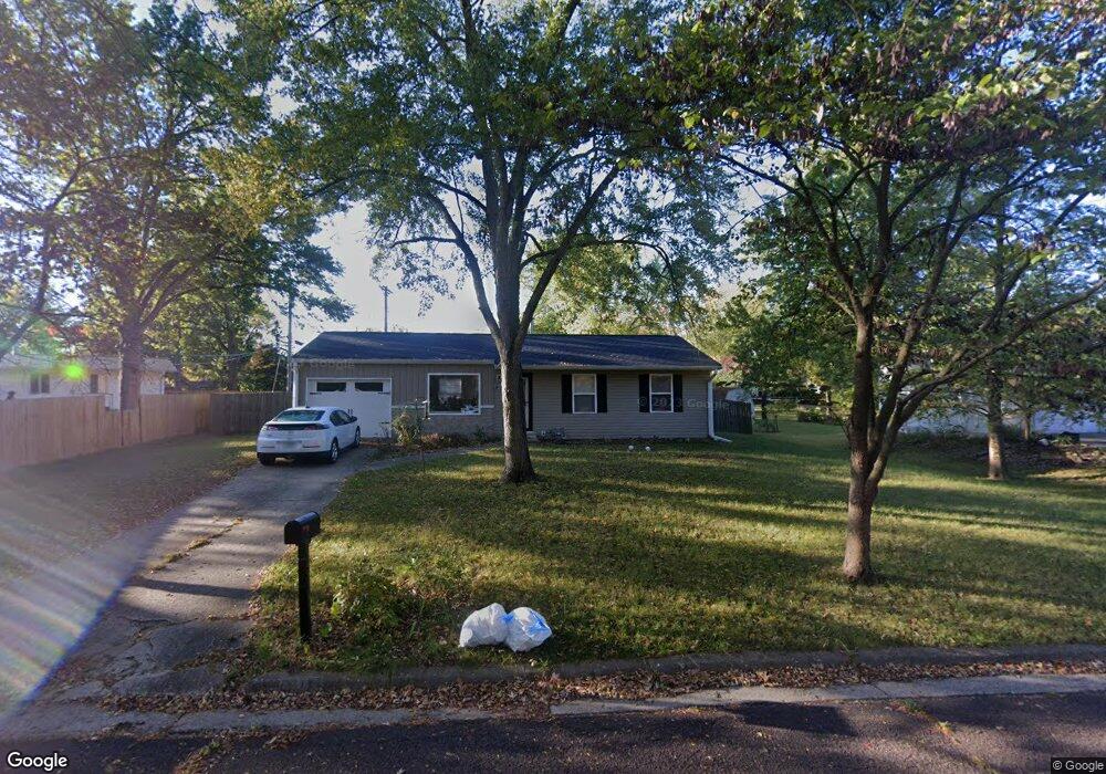
1208 Saint Michael Dr Columbia, MO 65203
Westwinds Park NeighborhoodEstimated Value: $200,000 - $236,000
3
Beds
1
Bath
925
Sq Ft
$230/Sq Ft
Est. Value
About This Home
This home is located at 1208 Saint Michael Dr, Columbia, MO 65203 and is currently estimated at $212,667, approximately $229 per square foot. 1208 Saint Michael Dr is a home located in Boone County with nearby schools including Russell Boulevard Elementary School, West Middle School, and David H. Hickman High School.
Ownership History
Date
Name
Owned For
Owner Type
Purchase Details
Closed on
Jun 5, 2014
Sold by
Seitz Donald E and Seitz Julia K
Bought by
Zties Family Llc
Current Estimated Value
Home Financials for this Owner
Home Financials are based on the most recent Mortgage that was taken out on this home.
Original Mortgage
$347,372
Outstanding Balance
$264,913
Interest Rate
4.27%
Mortgage Type
Future Advance Clause Open End Mortgage
Estimated Equity
-$52,246
Purchase Details
Closed on
Apr 30, 2013
Sold by
Sutter Robert J and Sutter Robert
Bought by
Seitz Donald E
Create a Home Valuation Report for This Property
The Home Valuation Report is an in-depth analysis detailing your home's value as well as a comparison with similar homes in the area
Home Values in the Area
Average Home Value in this Area
Purchase History
| Date | Buyer | Sale Price | Title Company |
|---|---|---|---|
| Zties Family Llc | -- | Boone Central Title Co | |
| Seitz Donald E | -- | Boone Central Title Company |
Source: Public Records
Mortgage History
| Date | Status | Borrower | Loan Amount |
|---|---|---|---|
| Open | Zties Family Llc | $347,372 |
Source: Public Records
Tax History Compared to Growth
Tax History
| Year | Tax Paid | Tax Assessment Tax Assessment Total Assessment is a certain percentage of the fair market value that is determined by local assessors to be the total taxable value of land and additions on the property. | Land | Improvement |
|---|---|---|---|---|
| 2025 | $1,196 | $20,292 | $2,679 | $17,613 |
| 2024 | $1,196 | $17,727 | $2,679 | $15,048 |
| 2023 | $1,186 | $17,727 | $2,679 | $15,048 |
| 2022 | $1,097 | $16,416 | $2,679 | $13,737 |
| 2021 | $1,099 | $16,416 | $2,679 | $13,737 |
| 2020 | $1,044 | $14,650 | $2,679 | $11,971 |
| 2019 | $1,044 | $14,650 | $2,679 | $11,971 |
| 2018 | $974 | $0 | $0 | $0 |
| 2017 | $987 | $13,566 | $2,679 | $10,887 |
| 2016 | $987 | $13,566 | $2,679 | $10,887 |
| 2015 | $911 | $13,566 | $2,679 | $10,887 |
| 2014 | $916 | $13,566 | $2,679 | $10,887 |
Source: Public Records
Map
Nearby Homes
- 1102 Westwinds Dr
- 906 West Blvd S
- 1424 Bradford Dr
- 1402 W Rollins Rd
- 912 W Rollins Rd
- 1108 W Stewart Rd
- 1109 Lakeshore Dr
- 1008 Lakeshore Dr
- 1414 Shannon Place
- 839 Marylee Ct
- 404 S Greenwood Ave
- 504 S Glenwood Ave
- 1010 Yale
- 1402 Coachlamp Ct
- 1307 Garden Ct
- 1201 Fieldcrest
- 1105 Vegas Dr
- 711 Thilly Ave
- 2306 Woodridge Rd
- 2008 S Deerborn Cir
- 1210 Saint Michael Dr
- 1211 Saint Christopher St
- 1301 Saint Andrew St
- 1303 Saint Andrew St
- 1216 Frances Dr
- 1306 Saint Michael Dr
- 1207 Saint Christopher St
- 1214 Frances Dr
- 1306 St Michael Dr
- 1307 Saint Andrew St
- 1220 Frances Dr
- 1210 Frances Dr
- 1308 Saint Michael Dr
- 1212 Saint Christopher St
- 1311 Saint Andrew St
- 1208 Saint Christopher St
- 1305 Saint Christopher St
- 1204 Saint Christopher St
- 1021 Crestland Ave
- 1302 Saint Christopher St