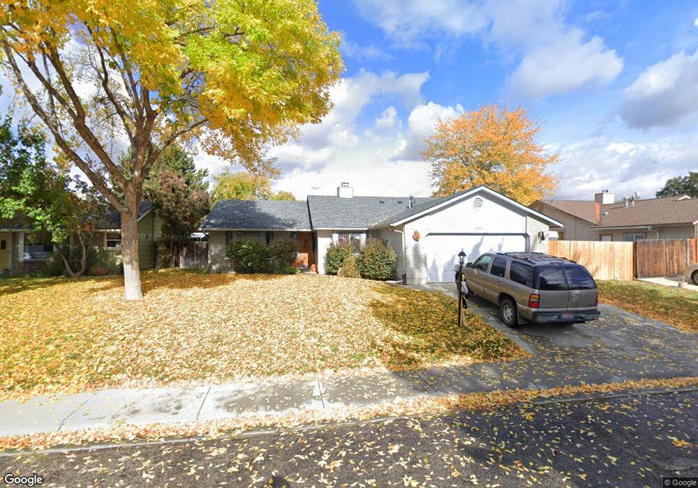
12084 W Gunsmoke Dr Boise, ID 83713
West Boise NeighborhoodEstimated Value: $425,000 - $444,501
3
Beds
2
Baths
1,718
Sq Ft
$254/Sq Ft
Est. Value
About This Home
This home is located at 12084 W Gunsmoke Dr, Boise, ID 83713 and is currently estimated at $435,875, approximately $253 per square foot. 12084 W Gunsmoke Dr is a home located in Ada County with nearby schools including Frontier Elementary School, Lowell Scott Middle School, and Centennial High School.
Ownership History
Date
Name
Owned For
Owner Type
Purchase Details
Closed on
Dec 20, 2018
Sold by
Rad Andy A and Rad Julie M
Bought by
Stafford Cassie L
Current Estimated Value
Home Financials for this Owner
Home Financials are based on the most recent Mortgage that was taken out on this home.
Original Mortgage
$196,629
Outstanding Balance
$173,580
Interest Rate
4.9%
Mortgage Type
New Conventional
Estimated Equity
$262,295
Purchase Details
Closed on
Jun 26, 1997
Sold by
Evans Robert A
Bought by
Rad Andy A and Rad Julie M
Create a Home Valuation Report for This Property
The Home Valuation Report is an in-depth analysis detailing your home's value as well as a comparison with similar homes in the area
Home Values in the Area
Average Home Value in this Area
Purchase History
| Date | Buyer | Sale Price | Title Company |
|---|---|---|---|
| Stafford Cassie L | -- | Pioneer Title Co Of Ada | |
| Rad Andy A | -- | Idaho Escrow Inc |
Source: Public Records
Mortgage History
| Date | Status | Borrower | Loan Amount |
|---|---|---|---|
| Open | Stafford Cassie L | $196,629 |
Source: Public Records
Tax History Compared to Growth
Tax History
| Year | Tax Paid | Tax Assessment Tax Assessment Total Assessment is a certain percentage of the fair market value that is determined by local assessors to be the total taxable value of land and additions on the property. | Land | Improvement |
|---|---|---|---|---|
| 2025 | $1,573 | $384,300 | -- | -- |
| 2024 | $1,486 | $362,900 | -- | -- |
| 2023 | $1,486 | $338,500 | $0 | $0 |
| 2022 | $1,905 | $407,200 | $0 | $0 |
| 2021 | $1,611 | $308,800 | $0 | $0 |
| 2020 | $1,382 | $238,600 | $0 | $0 |
| 2019 | $1,586 | $223,800 | $0 | $0 |
| 2018 | $2,750 | $193,600 | $0 | $0 |
| 2017 | $2,620 | $173,500 | $0 | $0 |
| 2016 | $2,544 | $164,400 | $0 | $0 |
| 2015 | $2,481 | $153,300 | $0 | $0 |
| 2012 | -- | $124,200 | $0 | $0 |
Source: Public Records
Map
Nearby Homes
- 11900 W Ramrod Dr
- Plan 2301 at Mooseland
- Plan 2800 at Mooseland
- 12116 W Musket Dr
- 12528 W Lewis And Clark Dr
- 10992 W Musket Dr
- 12153 W Ginger Creek Dr
- 12169 W Ginger Creek Dr
- 12137 W Ginger Creek Dr
- 12159 W Ginger Creek Dr
- 2870 N Cloverdale Rd
- 11266 W Race Ct
- 3981 N Creswell Ln
- 3142 N Sharon Ave
- 3994 N Creswell Ln
- 3993 N Creswell Ln
- 11934 W Ardyce St
- 12030 W Abram St
- 4101 N Creswell Way
- 12838 W Fiddleleaf Dr
- 12060 W Gunsmoke Dr
- 12108 W Gunsmoke Dr
- 12065 W Flintlock Dr
- 12087 W Flintlock Dr
- 12043 W Flintlock Dr
- 12109 W Flintlock Dr
- 12036 W Gunsmoke Dr
- 12085 W Gunsmoke Dr
- 12134 W Gunsmoke Dr
- 12061 W Gunsmoke Dr
- 12021 W Flintlock Dr
- 12109 W Gunsmoke Dr
- 12037 W Gunsmoke Dr
- 12012 W Gunsmoke Dr
- 12084 W Flintlock Dr
- 12062 W Flintlock Dr
- 12133 W Gunsmoke Dr
- 11999 W Flintlock Dr
- 12013 W Gunsmoke Dr
- 12106 W Flintlock Dr