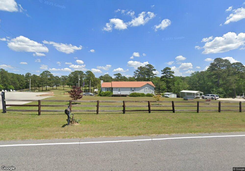
1209 Airport Rd Hamlet, NC 28345
Estimated Value: $209,000 - $256,000
--
Bed
--
Bath
1,659
Sq Ft
$139/Sq Ft
Est. Value
About This Home
This home is located at 1209 Airport Rd, Hamlet, NC 28345 and is currently estimated at $231,333, approximately $139 per square foot. 1209 Airport Rd is a home with nearby schools including Fairview Heights Elementary School, Hamlet Middle School, and Ashley Chapel Educational Center.
Ownership History
Date
Name
Owned For
Owner Type
Purchase Details
Closed on
Jan 20, 2006
Sold by
Singletary Robert Keith
Bought by
Singletary Ashley S
Current Estimated Value
Home Financials for this Owner
Home Financials are based on the most recent Mortgage that was taken out on this home.
Original Mortgage
$83,000
Interest Rate
6.29%
Mortgage Type
Future Advance Clause Open End Mortgage
Create a Home Valuation Report for This Property
The Home Valuation Report is an in-depth analysis detailing your home's value as well as a comparison with similar homes in the area
Home Values in the Area
Average Home Value in this Area
Purchase History
| Date | Buyer | Sale Price | Title Company |
|---|---|---|---|
| Singletary Ashley S | -- | -- |
Source: Public Records
Mortgage History
| Date | Status | Borrower | Loan Amount |
|---|---|---|---|
| Closed | Singletary Ashley S | $83,000 |
Source: Public Records
Tax History Compared to Growth
Tax History
| Year | Tax Paid | Tax Assessment Tax Assessment Total Assessment is a certain percentage of the fair market value that is determined by local assessors to be the total taxable value of land and additions on the property. | Land | Improvement |
|---|---|---|---|---|
| 2025 | $1,363 | $148,292 | $13,196 | $135,096 |
| 2024 | $1,392 | $148,292 | $13,196 | $135,096 |
| 2023 | $1,203 | $111,860 | $6,829 | $105,031 |
| 2022 | $1,203 | $111,860 | $6,829 | $105,031 |
| 2021 | $1,199 | $111,860 | $6,829 | $105,031 |
| 2020 | $1,195 | $111,860 | $6,829 | $105,031 |
| 2019 | $1,145 | $111,860 | $6,829 | $105,031 |
| 2018 | $1,145 | $111,860 | $6,829 | $105,031 |
| 2016 | $1,097 | $111,860 | $6,829 | $105,031 |
| 2014 | -- | $108,588 | $6,956 | $101,632 |
Source: Public Records
Map
Nearby Homes
- 1169 Airport Rd
- 592 Freeman Mill Rd
- 1481 Airport Rd
- 7 Cheraw
- 107 Switch Rd
- 904 Austin St
- 0 Maple Ave
- 817 Austin St
- 117 Sargent Dr
- 303 Dogwood Ln
- 212 Richmond Ave
- 00 Ellen Dr
- 0 McDonald Ave
- 228 Freeman Mill Rd
- 409 Myrtle Ave
- 1100 McDonald Ave
- 607 Henderson St
- 515 McDonald Ave
- 104 Edens St
- 130 Mcarthur St
- 1195 Airport Rd
- 1213 Airport Rd
- 1218 Airport Rd
- 1183 Airport Rd
- 1229 Airport Rd
- 1217 Airport Rd
- 1237 Airport Rd
- 160 Dusty Trail
- 557 Cheraw Hwy
- 1245 Airport Rd
- 808 Cheraw Rd
- 1157 Airport Rd
- 802 Cheraw Rd
- 1255 Airport Rd
- 798 Cheraw Rd
- 1263 Airport Rd
- 176 Dusty Trail
- 914 S Nc Highway 177
- 790 Cheraw Rd
- 788 Cheraw Rd