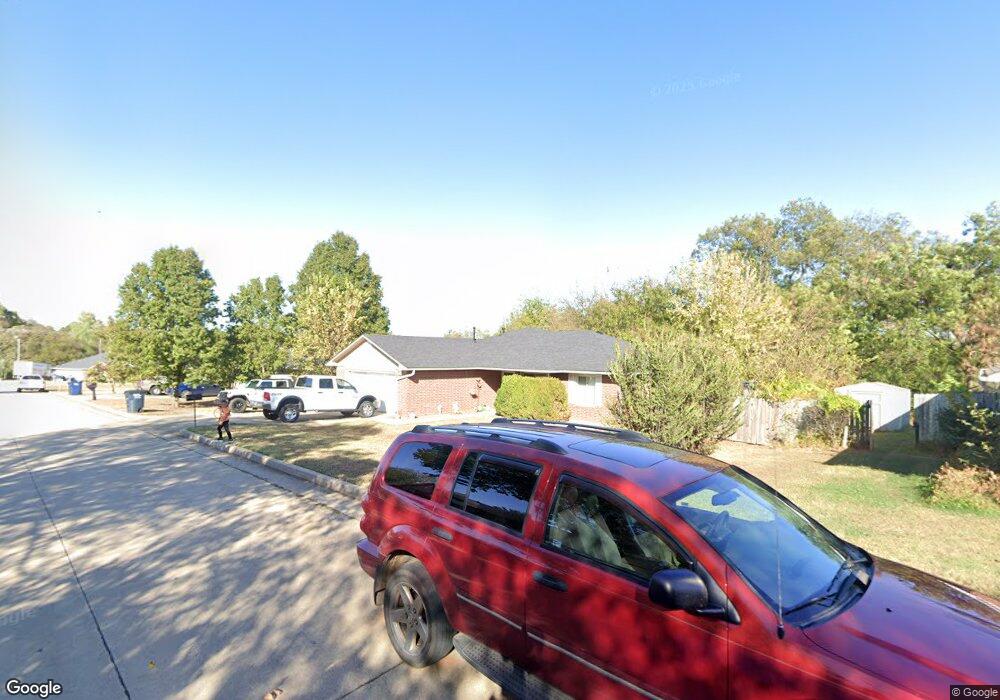
1209 Austin Dr Shawnee, OK 74801
Estimated Value: $158,329 - $216,000
3
Beds
2
Baths
1,476
Sq Ft
$124/Sq Ft
Est. Value
About This Home
This home is located at 1209 Austin Dr, Shawnee, OK 74801 and is currently estimated at $183,332, approximately $124 per square foot. 1209 Austin Dr is a home with nearby schools including Sequoyah Elementary School, Shawnee Middle School, and Shawnee High School.
Ownership History
Date
Name
Owned For
Owner Type
Purchase Details
Closed on
May 17, 2022
Sold by
Housing Authority Of The Absentee Shawne
Bought by
Miller Mike S
Current Estimated Value
Purchase Details
Closed on
Jul 23, 2015
Sold by
Housing Authority Of The Absentee Shawne
Bought by
Lindsay Lila
Purchase Details
Closed on
Apr 3, 2002
Sold by
Westchester Dev Company
Bought by
Housing Authority Absente
Purchase Details
Closed on
Jun 19, 2000
Sold by
First National Bank Trust
Bought by
Westchester Dev Company
Purchase Details
Closed on
Jul 3, 1997
Sold by
Austin William
Bought by
Central Ok Housing Dev
Create a Home Valuation Report for This Property
The Home Valuation Report is an in-depth analysis detailing your home's value as well as a comparison with similar homes in the area
Purchase History
| Date | Buyer | Sale Price | Title Company |
|---|---|---|---|
| Miller Mike S | -- | None Listed On Document | |
| Lindsay Lila | -- | None Available | |
| Housing Authority Absente | $99,500 | -- | |
| Westchester Dev Company | $24,000 | -- | |
| Central Ok Housing Dev | $190,000 | -- |
Source: Public Records
Tax History
| Year | Tax Paid | Tax Assessment Tax Assessment Total Assessment is a certain percentage of the fair market value that is determined by local assessors to be the total taxable value of land and additions on the property. | Land | Improvement |
|---|---|---|---|---|
| 2025 | $961 | $10,638 | $600 | $10,038 |
| 2024 | $943 | $10,328 | $600 | $9,728 |
| 2023 | $943 | $10,027 | $600 | $9,427 |
| 2022 | $926 | $10,027 | $600 | $9,427 |
| 2021 | $910 | $10,027 | $600 | $9,427 |
| 2020 | $937 | $10,269 | $600 | $9,669 |
| 2019 | $980 | $10,390 | $600 | $9,790 |
| 2018 | $986 | $10,631 | $600 | $10,031 |
| 2017 | $984 | $10,753 | $600 | $10,153 |
| 2016 | $1,007 | $10,873 | $600 | $10,273 |
| 2015 | -- | $0 | $0 | $0 |
| 2014 | -- | $0 | $0 | $0 |
Source: Public Records
Map
Nearby Homes
- 32 Comanche Dr
- 1306 E Wallace St
- 31 Seneca Dr
- 24 Seneca Dr
- 648 N Cleveland Ave
- 911 N Pesotum Ave
- 1327 E Fay St
- 1223 E Wallace St
- 0 E Fay St
- 1322 E Margaret St
- 1314 E Margaret St
- 1337 E Margaret St
- 703 N Roosevelt Ave
- 1214 E Edwards St
- 17 Sequoyah Blvd
- 1201 E Margaret St
- 1307 Laverne Ave
- 17 Mojave Dr
- 1202 Mark St
- 535 N Patchin Ave
- 1211 N Austin Dr
- 1213 Austin Dr
- 1205 Austin Dr
- 1208 Austin Dr
- 1210 Austin Dr
- 1207 N Austin Dr
- 1215 Austin Dr
- 1203 N Pesotum Ave
- 1209 N Pesotum Ave
- 1211 N Pesotum Ave
- 1212 Austin Dr
- 1217 Austin Dr
- 1213 N Pesotum Ave
- 1402 E Wayne St
- 1215 N Pesotum Ave
- 1216 N Pesotum Ave
- 1219 Austin Dr
- 1528 E Remington St
- 1316 E Wallace St
- 1218 N Pesotum Ave
Your Personal Tour Guide
Ask me questions while you tour the home.