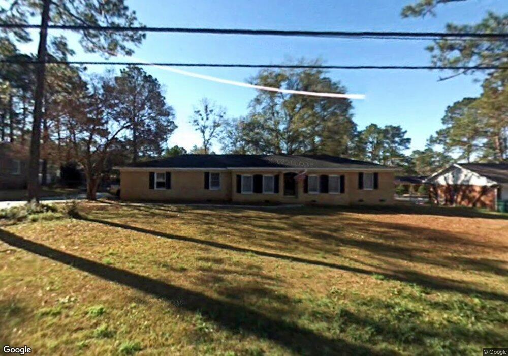
1209 Gornto Rd Valdosta, GA 31602
Estimated Value: $207,824 - $246,000
--
Bed
2
Baths
1,853
Sq Ft
$123/Sq Ft
Est. Value
About This Home
This home is located at 1209 Gornto Rd, Valdosta, GA 31602 and is currently estimated at $228,206, approximately $123 per square foot. 1209 Gornto Rd is a home located in Lowndes County with nearby schools including S.L. Mason Elementary School, Valdosta Middle School, and Valdosta High School.
Ownership History
Date
Name
Owned For
Owner Type
Purchase Details
Closed on
Apr 10, 2002
Sold by
Savikis Jerome R and Savikis Glen
Bought by
Brunot Felix E and Brunot Kathleen P
Current Estimated Value
Purchase Details
Closed on
Jan 16, 1992
Bought by
Savikis Jerome R and Savikis Glen
Purchase Details
Closed on
Apr 7, 1979
Bought by
Booth William T and Booth Linda
Purchase Details
Closed on
Sep 14, 1976
Bought by
Moore John E Jr Etal
Purchase Details
Closed on
Jun 18, 1976
Bought by
Moore John E
Create a Home Valuation Report for This Property
The Home Valuation Report is an in-depth analysis detailing your home's value as well as a comparison with similar homes in the area
Home Values in the Area
Average Home Value in this Area
Purchase History
| Date | Buyer | Sale Price | Title Company |
|---|---|---|---|
| Brunot Felix E | $86,000 | -- | |
| Savikis Jerome R | $66,800 | -- | |
| Booth William T | $13,000 | -- | |
| Moore John E Jr Etal | -- | -- | |
| Moore John E | $36,500 | -- |
Source: Public Records
Tax History Compared to Growth
Tax History
| Year | Tax Paid | Tax Assessment Tax Assessment Total Assessment is a certain percentage of the fair market value that is determined by local assessors to be the total taxable value of land and additions on the property. | Land | Improvement |
|---|---|---|---|---|
| 2024 | $1,714 | $67,370 | $13,560 | $53,810 |
| 2023 | $1,714 | $67,370 | $13,560 | $53,810 |
| 2022 | $1,362 | $46,289 | $13,560 | $32,729 |
| 2021 | $1,401 | $46,289 | $13,560 | $32,729 |
| 2020 | $1,431 | $46,289 | $13,560 | $32,729 |
| 2019 | $1,430 | $46,289 | $13,560 | $32,729 |
| 2018 | $1,449 | $46,289 | $13,560 | $32,729 |
| 2017 | $1,459 | $46,289 | $13,560 | $32,729 |
| 2016 | $1,457 | $46,289 | $13,560 | $32,729 |
| 2015 | -- | $46,289 | $13,560 | $32,729 |
| 2014 | $1,360 | $46,289 | $13,560 | $32,729 |
Source: Public Records
Map
Nearby Homes
- 1211 Gornto Rd
- 1212 Dellwood Dr
- 1108 Kimberly Dr
- 1104 Linda Dr
- 2502B Jerry Jones Dr Unit 1
- 5 Dellwood Cir
- 2432 Meadowbrook Dr
- 2436 Meadowbrook Dr
- 908 Maplewood Dr
- 2424 Westwood Dr
- 2208 Dogwood Dr
- 2214 Park Ln
- 903 Gornto Rd
- 2325 White Oak Dr
- 2400 Winding Way
- 2207 S Sherwood Dr
- 1114 Lake Dr
- 1 Fox Hollow Cir
- 1112 Lake Dr
- 68 Pineridge Dr
- 1207 Gornto Rd
- 1210 Kimberly Dr
- 1208 Kimberly Dr
- 1206 Kimberly Dr
- 1212 Kimberly Dr
- 1205 Gornto Rd
- 1213 Gornto Rd
- 1202 Gornto Rd
- 1200 Gornto Rd
- 1204 Gornto Rd
- 1204 Kimberly Dr
- 1214 Kimberly Dr
- 1203 Gornto Rd
- 1206 Gornto Rd
- 1215 Gornto Rd
- 1209 Kimberly Dr
- 1110 Gornto Rd
- 1207 Kimberly Dr
- 1211 Kimberly Dr
- 1202 Kimberly Dr