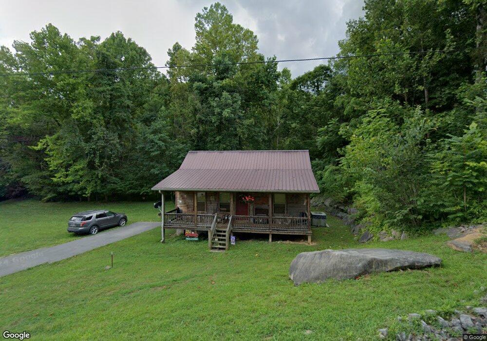
1209 King Mountain Rd Jamestown, TN 38556
Estimated Value: $134,187 - $262,000
--
Bed
--
Bath
768
Sq Ft
$256/Sq Ft
Est. Value
About This Home
This home is located at 1209 King Mountain Rd, Jamestown, TN 38556 and is currently estimated at $196,547, approximately $255 per square foot. 1209 King Mountain Rd is a home.
Ownership History
Date
Name
Owned For
Owner Type
Purchase Details
Closed on
May 17, 2017
Sold by
Cravens Jackie
Bought by
Cravens Rodney Dale
Current Estimated Value
Home Financials for this Owner
Home Financials are based on the most recent Mortgage that was taken out on this home.
Original Mortgage
$71,250
Outstanding Balance
$61,262
Interest Rate
5.5%
Mortgage Type
Adjustable Rate Mortgage/ARM
Estimated Equity
$135,285
Purchase Details
Closed on
Sep 30, 2005
Sold by
Not Provided
Bought by
Cravens Jackie
Create a Home Valuation Report for This Property
The Home Valuation Report is an in-depth analysis detailing your home's value as well as a comparison with similar homes in the area
Home Values in the Area
Average Home Value in this Area
Purchase History
| Date | Buyer | Sale Price | Title Company |
|---|---|---|---|
| Cravens Rodney Dale | $75,000 | -- | |
| Cravens Jackie | $1,000 | -- |
Source: Public Records
Mortgage History
| Date | Status | Borrower | Loan Amount |
|---|---|---|---|
| Open | Cravens Rodney Dale | $71,250 |
Source: Public Records
Tax History Compared to Growth
Tax History
| Year | Tax Paid | Tax Assessment Tax Assessment Total Assessment is a certain percentage of the fair market value that is determined by local assessors to be the total taxable value of land and additions on the property. | Land | Improvement |
|---|---|---|---|---|
| 2025 | $377 | $27,925 | $0 | $0 |
| 2024 | $377 | $27,925 | $1,625 | $26,300 |
| 2023 | $377 | $27,925 | $1,625 | $26,300 |
| 2022 | $326 | $17,050 | $1,375 | $15,675 |
| 2021 | $326 | $17,050 | $1,375 | $15,675 |
| 2020 | $326 | $17,050 | $1,375 | $15,675 |
| 2019 | $326 | $17,050 | $1,375 | $15,675 |
| 2018 | $326 | $17,050 | $1,375 | $15,675 |
| 2017 | $326 | $16,450 | $1,175 | $15,275 |
| 2016 | $326 | $16,450 | $1,175 | $15,275 |
| 2015 | $326 | $16,452 | $0 | $0 |
| 2014 | $326 | $16,452 | $0 | $0 |
Source: Public Records
Map
Nearby Homes
- 37 Lot 37 Milky Way
- 0 Lot 55 Milky Way
- 2021 Milky Way
- 0 Milky Way Rd Unit RTC2996177
- 5735 E East Port Rd
- 0 Bolestown Loop
- 0 Bolestown Loop
- 00 Bolestown Loop
- 0 Boatland Rd
- 221 Cedar Grove Ln
- 0 Jamestown Hwy Unit 11586513
- 464 Wilder Hwy (76 Ac)
- 0 Cliff Edge Rd
- Lot Cliff Edge Rd
- 0 Wilson Ridge Rd
- 464 Wilder Hwy 76 Ac
- 464 Wilder Hwy 25 Ac
- 464 Wilder Hwy Unit 76 Ac
- 464 Wilder Hwy Unit 25 Ac
- 1100 Eastport Dock Rd
- 1219 King Mountain Rd
- 910 Tollie Ln
- 912 Tollie Ln
- 915 Tollie Ln
- 921 Tollie Ln
- 0 Tollie Ln
- 507 Benton Ln
- 1252 King Mountain Rd
- 959 Tollie Ln
- 1 Tollie Ln
- --- King Mountain Rd
- 77 Ac. King Mountain Rd
- E/O King Mountain Rd
- 0 King Mountain Rd Unit 190776
- 0 King Mountain Rd
- 1265 King Mountain Rd
- 1265 King Mountain Rd
- 597 Benton Ln
- 990 Tollie Ln
- 620 Benton Ln