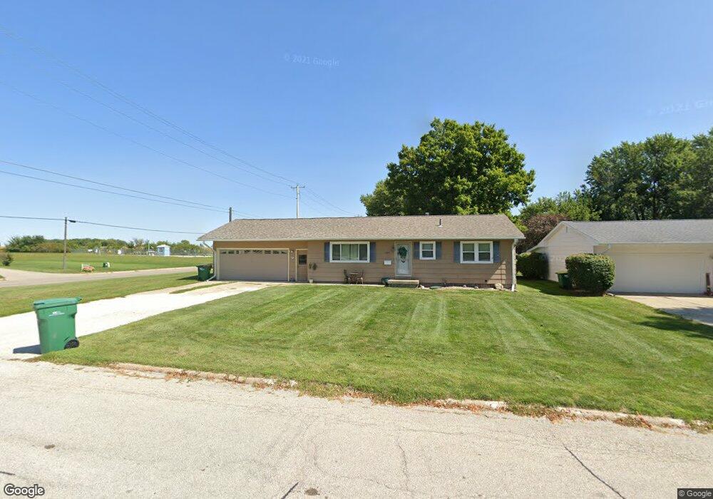
1209 N Mulberry St Creston, IA 50801
Estimated Value: $180,336 - $217,000
3
Beds
2
Baths
1,120
Sq Ft
$171/Sq Ft
Est. Value
About This Home
This home is located at 1209 N Mulberry St, Creston, IA 50801 and is currently estimated at $191,834, approximately $171 per square foot. 1209 N Mulberry St is a home with nearby schools including Creston Early Childhood Center, Creston Elementary School, and Creston Middle School.
Ownership History
Date
Name
Owned For
Owner Type
Purchase Details
Closed on
Jun 25, 2007
Sold by
Estate Of Mary Margaret Palser
Bought by
Wynn Jeffrey S and Brammer Amy Jo
Current Estimated Value
Home Financials for this Owner
Home Financials are based on the most recent Mortgage that was taken out on this home.
Original Mortgage
$84,000
Outstanding Balance
$51,594
Interest Rate
6.26%
Mortgage Type
New Conventional
Estimated Equity
$140,240
Create a Home Valuation Report for This Property
The Home Valuation Report is an in-depth analysis detailing your home's value as well as a comparison with similar homes in the area
Home Values in the Area
Average Home Value in this Area
Purchase History
| Date | Buyer | Sale Price | Title Company |
|---|---|---|---|
| Wynn Jeffrey S | $84,000 | None Available |
Source: Public Records
Mortgage History
| Date | Status | Borrower | Loan Amount |
|---|---|---|---|
| Open | Wynn Jeffrey S | $84,000 |
Source: Public Records
Tax History Compared to Growth
Tax History
| Year | Tax Paid | Tax Assessment Tax Assessment Total Assessment is a certain percentage of the fair market value that is determined by local assessors to be the total taxable value of land and additions on the property. | Land | Improvement |
|---|---|---|---|---|
| 2025 | $2,734 | $159,320 | $20,460 | $138,860 |
| 2024 | $2,734 | $145,250 | $20,460 | $124,790 |
| 2023 | $3,328 | $162,360 | $19,460 | $142,900 |
| 2022 | $3,300 | $137,760 | $19,460 | $118,300 |
| 2021 | $3,383 | $128,750 | $18,190 | $110,560 |
| 2020 | $3,278 | $128,450 | $17,050 | $111,400 |
| 2019 | $3,251 | $128,450 | $0 | $0 |
| 2018 | $3,111 | $128,450 | $0 | $0 |
| 2017 | $2,888 | $128,450 | $0 | $0 |
| 2016 | $2,876 | $128,450 | $0 | $0 |
| 2015 | $2,876 | $117,840 | $0 | $0 |
| 2014 | $2,692 | $117,840 | $0 | $0 |
Source: Public Records
Map
Nearby Homes
- 1208 N Vine St
- 1216 N Birch St
- 907 N Walnut St
- 805 Carpenter St
- 1100 N Pine St
- 1204 N Maple St
- 1007 N Maple St
- 1002 N Elm St
- 302 W Seneca St
- 404 W Townline St
- 609 N Maple St
- 605 N Maple St
- 1102 N Division St
- 510 N Maple St
- 409 N Pine St
- 410 N Pine St
- 307 N Birch St
- 304 N Birch St
- 1303 E Howard St
- 220 N Walnut St
- 1207 N Mulberry St
- 1205 N Mulberry St
- 1204 N Chestnut St
- 1208 N Chestnut St
- 1206 N Chestnut St
- 1203 N Mulberry St
- 701 E Townline St
- 1202 N Chestnut St
- 1201 N Mulberry St
- 605 E Townline St
- 1307 N Mulberry St
- 1200 N Chestnut St
- 1207 N Chestnut St
- 1205 N Chestnut St
- 601 E Townline St
- 1203 N Chestnut St
- 1027 N Mulberry St
- 1201 N Chestnut St
- 1214 N Poplar St
- 1303 N Mulberry St