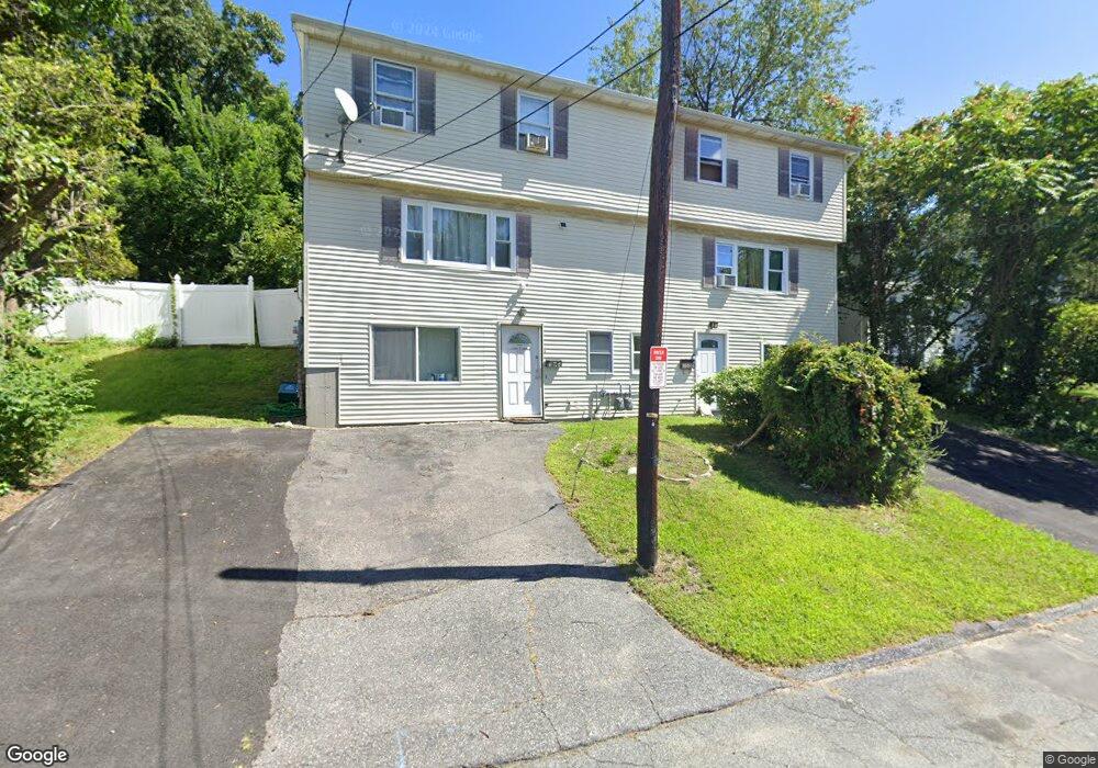
120A Brooks St Worcester, MA 01606
Greendale NeighborhoodEstimated Value: $376,000 - $451,000
3
Beds
2
Baths
1,176
Sq Ft
$345/Sq Ft
Est. Value
About This Home
This home is located at 120A Brooks St, Worcester, MA 01606 and is currently estimated at $405,573, approximately $344 per square foot. 120A Brooks St is a home located in Worcester County with nearby schools including Norrback Avenue Elementary School, Jacob Hiatt Magnet School, and Chandler Magnet.
Ownership History
Date
Name
Owned For
Owner Type
Purchase Details
Closed on
Jan 7, 2005
Sold by
Anum Ebenezer and Addy Eunice A
Bought by
Addy Eunice A
Current Estimated Value
Purchase Details
Closed on
Mar 1, 2000
Sold by
Patil Avinash Balwant
Bought by
Anum Ebenezer and Addy Eunice A
Home Financials for this Owner
Home Financials are based on the most recent Mortgage that was taken out on this home.
Original Mortgage
$80,100
Interest Rate
8.21%
Mortgage Type
Purchase Money Mortgage
Create a Home Valuation Report for This Property
The Home Valuation Report is an in-depth analysis detailing your home's value as well as a comparison with similar homes in the area
Home Values in the Area
Average Home Value in this Area
Purchase History
| Date | Buyer | Sale Price | Title Company |
|---|---|---|---|
| Addy Eunice A | -- | -- | |
| Anum Ebenezer | $89,000 | -- |
Source: Public Records
Mortgage History
| Date | Status | Borrower | Loan Amount |
|---|---|---|---|
| Open | Anum Ebenezer | $8,000 | |
| Previous Owner | Anum Ebenezer | $80,100 |
Source: Public Records
Tax History Compared to Growth
Tax History
| Year | Tax Paid | Tax Assessment Tax Assessment Total Assessment is a certain percentage of the fair market value that is determined by local assessors to be the total taxable value of land and additions on the property. | Land | Improvement |
|---|---|---|---|---|
| 2025 | $4,307 | $326,500 | $104,500 | $222,000 |
| 2024 | $4,124 | $299,900 | $104,500 | $195,400 |
| 2023 | $3,896 | $271,700 | $90,900 | $180,800 |
| 2022 | $3,488 | $229,300 | $72,700 | $156,600 |
| 2021 | $3,243 | $199,200 | $58,200 | $141,000 |
| 2020 | $3,240 | $190,600 | $58,200 | $132,400 |
| 2019 | $3,114 | $173,000 | $52,300 | $120,700 |
| 2018 | $3,133 | $165,700 | $52,300 | $113,400 |
| 2017 | $2,987 | $155,400 | $52,300 | $103,100 |
| 2016 | $2,892 | $140,300 | $39,400 | $100,900 |
| 2015 | -- | $140,300 | $39,400 | $100,900 |
| 2014 | $2,741 | $140,300 | $39,400 | $100,900 |
Source: Public Records
Map
Nearby Homes
- 120A Brooks St Unit A
- 124B Brooks St
- 124A Brooks St
- 120B Brooks St
- 124 Brooks St
- 124 Brooks St Unit B
- 116 Brooks St Unit B
- 116 Brooks St
- 126B Brooks St
- 126A Brooks St
- 116B Brooks St
- 116A Brooks St
- 51A Mount Ave
- 126 Brooks St Unit B
- 49A Mount Ave
- 49 Mount Ave
- 51B Mount Ave
- 114 Brooks St
- 114B Brooks St
- 114A Brooks St