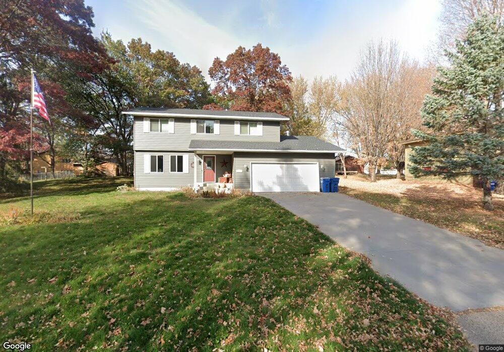
121 10th St N Sauk Rapids, MN 56379
Estimated Value: $293,000 - $330,000
4
Beds
3
Baths
1,800
Sq Ft
$173/Sq Ft
Est. Value
About This Home
This home is located at 121 10th St N, Sauk Rapids, MN 56379 and is currently estimated at $312,171, approximately $173 per square foot. 121 10th St N is a home located in Benton County with nearby schools including Pleasant View Elementary School, Sauk Rapids-Rice Middle School, and Sauk Rapids-Rice Senior High School.
Create a Home Valuation Report for This Property
The Home Valuation Report is an in-depth analysis detailing your home's value as well as a comparison with similar homes in the area
Home Values in the Area
Average Home Value in this Area
Tax History Compared to Growth
Tax History
| Year | Tax Paid | Tax Assessment Tax Assessment Total Assessment is a certain percentage of the fair market value that is determined by local assessors to be the total taxable value of land and additions on the property. | Land | Improvement |
|---|---|---|---|---|
| 2025 | $3,412 | $296,500 | $30,900 | $265,600 |
| 2024 | $3,516 | $282,900 | $30,900 | $252,000 |
| 2023 | $3,358 | $297,400 | $30,900 | $266,500 |
| 2022 | $3,132 | $262,000 | $28,100 | $233,900 |
| 2021 | $2,856 | $225,600 | $28,100 | $197,500 |
| 2018 | $2,098 | $162,900 | $23,956 | $138,944 |
| 2017 | $2,098 | $128,700 | $22,831 | $105,869 |
| 2016 | $2,058 | $147,200 | $27,000 | $120,200 |
| 2015 | $2,080 | $114,100 | $22,195 | $91,905 |
| 2014 | -- | $100,800 | $21,498 | $79,302 |
| 2013 | -- | $102,400 | $21,583 | $80,817 |
Source: Public Records
Map
Nearby Homes
- 702 N Benton Dr
- 709 N Benton Dr
- 314 Pleasant Ridge Dr
- 1018 N Benton Dr
- 224 9th St N
- 390 18th Street Ct NW
- 18th 18th
- 870 18th St NW
- 820 18th St NW
- 32608 River Vista Ln
- 1914 N Benton Dr
- 32467 County Road 1
- 615 3rd Ave N
- 1804 Oak Pond Dr
- 752 12th St N
- 1806 Oak Pond Dr
- 1209 Oak Pond Dr
- 1809 Eastern Star Loop
- 932 Oak Pond Ct
- 93 10th St S
- 129 10th St N
- 111 10th St N
- 120 11th St N
- 110 11th St N
- 128 11th St N
- 103 10th St N
- 124 10th St N
- 1087 2nd Ave N
- 120 10th St N
- 102 11th St N
- 102 102 N 11th-Street-
- 104 10th St N
- 1092 2nd Ave N
- 1098 1098 2nd-Avenue-n
- 1098 2nd Ave N
- 1098 4 1/2 Ave N
- 1081 2nd Ave N
- 1092 4 1/2 Ave N
- 206 11th St N
- 1103 4 1/2 Ave N