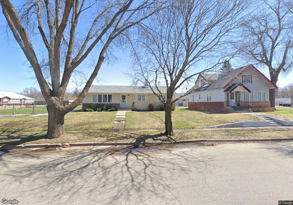
121 3rd Ave N Brownton, MN 55312
Estimated Value: $200,000 - $261,000
3
Beds
2
Baths
1,196
Sq Ft
$192/Sq Ft
Est. Value
About This Home
This home is located at 121 3rd Ave N, Brownton, MN 55312 and is currently estimated at $229,084, approximately $191 per square foot. 121 3rd Ave N is a home located in McLeod County with nearby schools including Lincoln Elementary School, Lakeside Elementary School, and Glencoe-Silver Lake Jr. High School.
Ownership History
Date
Name
Owned For
Owner Type
Purchase Details
Closed on
Aug 10, 2018
Sold by
Binnebose Jacob L and Binnebose Kristina
Bought by
Seymour Megan and Anderson Logan
Current Estimated Value
Home Financials for this Owner
Home Financials are based on the most recent Mortgage that was taken out on this home.
Original Mortgage
$123,200
Outstanding Balance
$106,994
Interest Rate
4.5%
Mortgage Type
New Conventional
Estimated Equity
$122,090
Create a Home Valuation Report for This Property
The Home Valuation Report is an in-depth analysis detailing your home's value as well as a comparison with similar homes in the area
Purchase History
| Date | Buyer | Sale Price | Title Company |
|---|---|---|---|
| Seymour Megan | $154,000 | None Available |
Source: Public Records
Mortgage History
| Date | Status | Borrower | Loan Amount |
|---|---|---|---|
| Open | Seymour Megan | $123,200 |
Source: Public Records
Tax History
| Year | Tax Paid | Tax Assessment Tax Assessment Total Assessment is a certain percentage of the fair market value that is determined by local assessors to be the total taxable value of land and additions on the property. | Land | Improvement |
|---|---|---|---|---|
| 2024 | $3,442 | $187,800 | $24,900 | $162,900 |
| 2023 | $3,442 | $194,200 | $24,900 | $169,300 |
| 2022 | $2,882 | $165,900 | $21,700 | $144,200 |
| 2021 | $2,932 | $137,200 | $18,900 | $118,300 |
| 2020 | $2,628 | $137,200 | $18,900 | $118,300 |
| 2019 | $1,890 | $116,000 | $17,100 | $98,900 |
| 2018 | $1,874 | $0 | $0 | $0 |
| 2017 | $1,494 | $0 | $0 | $0 |
| 2016 | $1,504 | $0 | $0 | $0 |
| 2015 | $1,366 | $0 | $0 | $0 |
| 2014 | -- | $0 | $0 | $0 |
Source: Public Records
Map
Nearby Homes
- xxx Lot 3 Division St W
- 237 5th St N
- 0 Plum Ave Unit NOC6335195
- Lot 2 U S Highway 212
- XXX US Hwy 212
- xxx Lot 2 Us Hwy 212
- 16452 90th St
- 0 57th St
- 12221 Page Ave
- 7900 Lace Ave
- 7900 Lace Ave N
- 12893 County Road 7
- Lot 2 Tagus Ave
- 630 Mowbray St
- 1199 E 2nd St
- 22447 150th St
- XXX 455th Ave
- XXX Airport Rd
- 511 Southfork Cir SE
- 1400 Sherwood St SE
- 114 3rd Ave N
- 110 3rd Ave N
- 113 3rd St S
- 113 3rd Ave S
- 108 4th Ave S
- 129 4th Ave N
- 212 Division St E
- 139 4th Ave N
- 111 4th Ave N
- 227 Division St W
- 227 Division St W
- 0 2nd St N Unit 4969786
- 0 0 N 3rd Ave
- 417 2nd Ave N
- 215 215 Division St E
- 119 3rd Ave S
- 107 4th Ave N
- 116 4th Ave S
- 215 Division St W
- 108 2nd Ave N
Your Personal Tour Guide
Ask me questions while you tour the home.