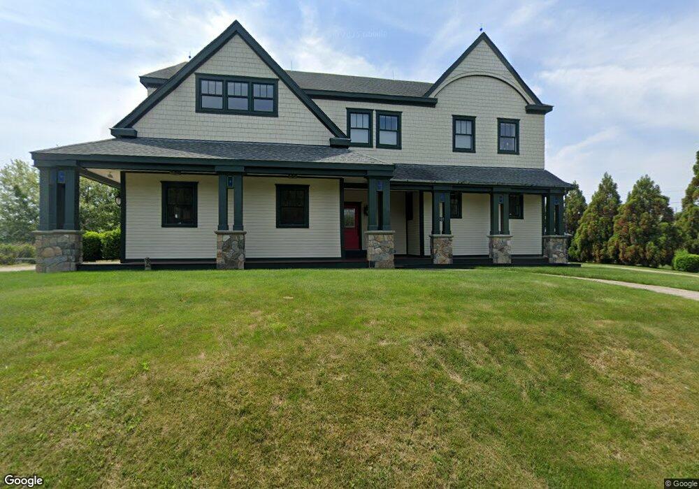
121 Atlantic Ave Wakefield, RI 02879
Estimated Value: $1,154,000 - $1,780,362
3
Beds
4
Baths
4,116
Sq Ft
$363/Sq Ft
Est. Value
About This Home
This home is located at 121 Atlantic Ave, Wakefield, RI 02879 and is currently estimated at $1,494,591, approximately $363 per square foot. 121 Atlantic Ave is a home with nearby schools including South Kingstown High School.
Ownership History
Date
Name
Owned For
Owner Type
Purchase Details
Closed on
Sep 17, 2020
Sold by
Russell R & M E Auclair Lt and Auclair
Bought by
Community Drive Llc
Current Estimated Value
Purchase Details
Closed on
Dec 13, 2013
Sold by
25 Narragansett Blvd L
Bought by
Auclair Russell R and Auclair Mary E
Create a Home Valuation Report for This Property
The Home Valuation Report is an in-depth analysis detailing your home's value as well as a comparison with similar homes in the area
Home Values in the Area
Average Home Value in this Area
Purchase History
| Date | Buyer | Sale Price | Title Company |
|---|---|---|---|
| Community Drive Llc | -- | None Available | |
| Community Drive Llc | -- | None Available | |
| 121 Atlantic Llc | -- | None Available | |
| Auclair Russell R | -- | -- |
Source: Public Records
Tax History
| Year | Tax Paid | Tax Assessment Tax Assessment Total Assessment is a certain percentage of the fair market value that is determined by local assessors to be the total taxable value of land and additions on the property. | Land | Improvement |
|---|---|---|---|---|
| 2025 | $11,899 | $1,331,000 | $376,800 | $954,200 |
| 2024 | $12,281 | $1,111,400 | $316,000 | $795,400 |
| 2023 | $12,281 | $1,111,400 | $316,000 | $795,400 |
| 2022 | $12,170 | $1,111,400 | $316,000 | $795,400 |
| 2021 | $12,311 | $852,000 | $257,700 | $594,300 |
| 2020 | $12,311 | $852,000 | $257,700 | $594,300 |
| 2019 | $12,311 | $852,000 | $257,700 | $594,300 |
| 2018 | $11,570 | $737,900 | $206,100 | $531,800 |
| 2017 | $11,297 | $737,900 | $206,100 | $531,800 |
| 2016 | $11,135 | $737,900 | $206,100 | $531,800 |
| 2015 | $10,911 | $703,000 | $197,600 | $505,400 |
| 2014 | $9,556 | $617,300 | $197,600 | $419,700 |
Source: Public Records
Map
Nearby Homes
- 210 Washington St
- 836 Matunuck Beach Rd
- 975 Matunuck Beach Rd
- 14 E Pointe Ct Unit 14
- 550 Cards Pond Rd
- 6 MacAlder St
- 1138 Succotash Rd
- 1140 Succotash Rd
- 1185 Succotash Rd
- 2321 Post Rd
- 7 Conch Rd
- 11 Wendy Ln
- 17 Goose Island Rd
- 2 Green Hill Ave
- 209 Carpenter Dr
- 0 Barnacle Rd
- 37 Coast Guard Ave
- 29 Coast Guard Ave
- 0 Hemlock Ave
- 480 Sand Plains Trail Unit D68
- 120 Atlantic Ave
- 131 Atlantic Ave
- 140 Community Dr
- 148 Community Dr
- 104 Atlantic Ave
- 103 Atlantic Ave
- 112 Community Dr
- 127 Park Ave
- 142 Atlantic Ave
- 119 Park Ave
- 135 Park Ave
- 149 Community Dr
- 151 Atlantic Ave
- 150 Atlantic Ave
- 158 Community Dr
- 104 Community Dr
- 107 Park Ave
- 113 Community Dr
- 113 Community Dr Unit 1
- 100 Community Dr
Your Personal Tour Guide
Ask me questions while you tour the home.