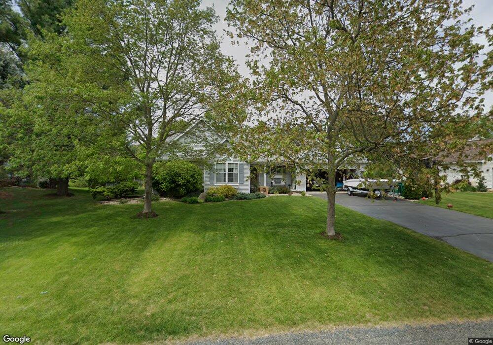
121 Gull Pointe Dr Battle Creek, MI 49037
Estimated Value: $303,000 - $438,000
3
Beds
2
Baths
1,674
Sq Ft
$224/Sq Ft
Est. Value
About This Home
This home is located at 121 Gull Pointe Dr, Battle Creek, MI 49037 and is currently estimated at $375,517, approximately $224 per square foot. 121 Gull Pointe Dr is a home located in Calhoun County with nearby schools including Thomas M. Ryan Intermediate School, Gull Lake Middle School, and Gull Lake High School.
Ownership History
Date
Name
Owned For
Owner Type
Purchase Details
Closed on
Sep 8, 2015
Sold by
Cook James R and Cook Rana Paige
Bought by
Meskinaoui Samir
Current Estimated Value
Home Financials for this Owner
Home Financials are based on the most recent Mortgage that was taken out on this home.
Original Mortgage
$211,375
Interest Rate
3.93%
Mortgage Type
New Conventional
Purchase Details
Closed on
May 20, 2014
Sold by
Cook James R and Cook Rana Paige
Bought by
The Cook Family Trust
Purchase Details
Closed on
Dec 18, 2000
Sold by
Mayhak Michael G and Mayhak Kimber L
Bought by
Cook James R and Cook Rana P
Create a Home Valuation Report for This Property
The Home Valuation Report is an in-depth analysis detailing your home's value as well as a comparison with similar homes in the area
Home Values in the Area
Average Home Value in this Area
Purchase History
| Date | Buyer | Sale Price | Title Company |
|---|---|---|---|
| Meskinaoui Samir | -- | Attorney | |
| The Cook Family Trust | -- | None Available | |
| Cook James R | $161,500 | -- |
Source: Public Records
Mortgage History
| Date | Status | Borrower | Loan Amount |
|---|---|---|---|
| Previous Owner | Meskinaoui Samir | $211,375 |
Source: Public Records
Tax History Compared to Growth
Tax History
| Year | Tax Paid | Tax Assessment Tax Assessment Total Assessment is a certain percentage of the fair market value that is determined by local assessors to be the total taxable value of land and additions on the property. | Land | Improvement |
|---|---|---|---|---|
| 2025 | $4,966 | $176,500 | $0 | $0 |
| 2024 | $1,519 | $176,600 | $0 | $0 |
| 2023 | $4,437 | $163,300 | $0 | $0 |
| 2022 | $1,378 | $135,500 | $0 | $0 |
| 2021 | $4,314 | $126,000 | $0 | $0 |
| 2020 | $4,440 | $128,500 | $0 | $0 |
| 2019 | $2,584 | $119,700 | $0 | $0 |
| 2018 | $3,685 | $109,800 | $11,200 | $98,600 |
| 2017 | $3,685 | $112,700 | $0 | $0 |
| 2016 | $3,685 | $107,400 | $0 | $0 |
| 2015 | -- | $87,000 | $0 | $0 |
| 2014 | -- | $95,050 | $0 | $0 |
Source: Public Records
Map
Nearby Homes
- 153 Colonial Dr
- 115 Suwanee St
- 0 Outlot A Suwanee St
- 16783 E Augusta Dr
- 132 Oriole Dr
- 104 Quail St
- 21026 Dana Dr
- 3600 Michigan Ave W
- 3192 Michigan Ave W
- 8368 N 46th St
- 230 Roxbury Ln
- 196 N Gardner Ave
- 15250 Alister MacKenzie Ave
- 2901 Michigan Ave W
- 235 Oak St
- 113 Blueberry Ln
- 111 Virginia Ave
- 135 N Lindow Dr
- 22100 N Uldriks Dr
- 646 Marie Ave
- 127 Gull Pointe Dr
- 115 Gull Pointe Dr
- 113 Gull Pointe Dr
- 133 Gull Pointe Dr
- 107 Gull Pointe Dr
- 146 Colonial Dr
- 110 Gull Pointe Dr
- 128 Gull Pointe Dr
- 10 Colonial Dr
- 0 Colonial Dr
- 14 Colonial Dr
- 11 Colonial Dr
- 136 Gull Pointe Dr
- 129 Colonial Dr
- 101 Gull Point Dr
- 146 Colonial Dr
- 123 Colonial Dr
- 139 Gull Pointe Dr
- 135 Colonial Dr
- 101 Gull Pointe Dr