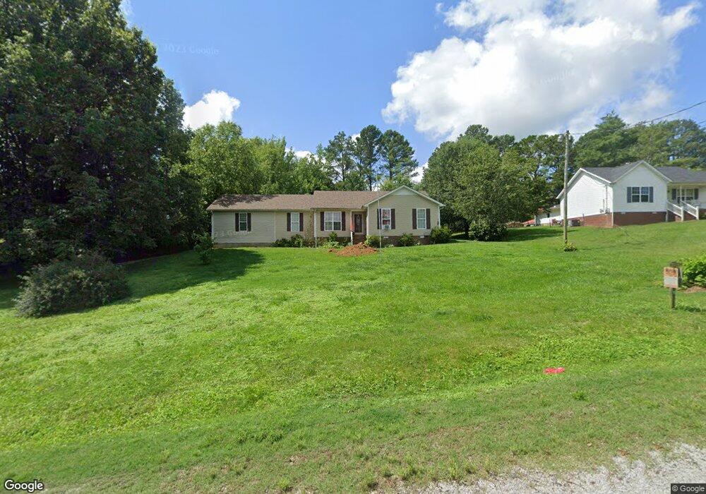
121 Hawthorne Rd Pulaski, TN 38478
Estimated Value: $219,986 - $292,000
Studio
2
Baths
1,237
Sq Ft
$209/Sq Ft
Est. Value
About This Home
This home is located at 121 Hawthorne Rd, Pulaski, TN 38478 and is currently estimated at $258,997, approximately $209 per square foot. 121 Hawthorne Rd is a home located in Giles County with nearby schools including Pulaski Elementary School, Southside Elementary School, and Bridgeforth Middle School.
Ownership History
Date
Name
Owned For
Owner Type
Purchase Details
Closed on
Jul 12, 2007
Sold by
Weichert Relocation Resour
Bought by
Shelton Candy
Current Estimated Value
Purchase Details
Closed on
May 1, 2007
Sold by
Stoneburner Timothy B
Bought by
Weichert Relocation Recources
Purchase Details
Closed on
Jan 3, 2006
Sold by
Us Bank Na
Bought by
Stoneburner Timothy B
Home Financials for this Owner
Home Financials are based on the most recent Mortgage that was taken out on this home.
Original Mortgage
$60,720
Interest Rate
6.18%
Purchase Details
Closed on
Aug 3, 2005
Bought by
Us Bank Na 4801 Frederica
Purchase Details
Closed on
Jul 27, 1998
Sold by
Wilson Bass
Bought by
Breeding Kenny F and Breeding Betty
Create a Home Valuation Report for This Property
The Home Valuation Report is an in-depth analysis detailing your home's value as well as a comparison with similar homes in the area
Purchase History
We collect this data history from publicly available records. To have your information removed, we recommend requesting removal directly through your county’s website.
| Date | Buyer | Sale Price | Title Company |
|---|---|---|---|
| Shelton Candy | $92,500 | -- | |
| Weichert Relocation Recources | $92,500 | -- | |
| Stoneburner Timothy B | $75,900 | -- | |
| Us Bank Na 4801 Frederica | $77,700 | -- | |
| Breeding Kenny F | $78,250 | -- | |
| Laursen Earl & Dolorita Tr | -- | -- |
Source: Public Records
Mortgage History
We collect this data history from publicly available records. To have your information removed, we recommend requesting removal directly through your county’s website.
| Date | Status | Borrower | Loan Amount |
|---|---|---|---|
| Previous Owner | Laursen Earl & Dolorita Tr | $60,720 | |
| Previous Owner | Laursen Earl & Dolorita Tr | $15,180 |
Source: Public Records
Tax History
| Year | Tax Paid | Tax Assessment Tax Assessment Total Assessment is a certain percentage of the fair market value that is determined by local assessors to be the total taxable value of land and additions on the property. | Land | Improvement |
|---|---|---|---|---|
| 2025 | $988 | $42,875 | $6,350 | $36,525 |
| 2024 | $852 | $42,875 | $6,350 | $36,525 |
| 2023 | $852 | $42,875 | $6,350 | $36,525 |
| 2022 | $852 | $42,875 | $6,350 | $36,525 |
| 2021 | $608 | $21,525 | $2,625 | $18,900 |
| 2020 | $608 | $21,525 | $2,625 | $18,900 |
| 2019 | $608 | $21,525 | $2,625 | $18,900 |
| 2018 | $608 | $21,525 | $2,625 | $18,900 |
| 2017 | $608 | $21,525 | $2,625 | $18,900 |
| 2016 | $655 | $22,050 | $2,625 | $19,425 |
| 2015 | $611 | $22,050 | $2,625 | $19,425 |
| 2014 | $611 | $22,060 | $0 | $0 |
Source: Public Records
Map
Nearby Homes
- 149 Hawthorne Rd
- 3345 Pigeon Roost Rd
- 153 Poling Dr
- 155 Poling Dr
- 142 Poling Dr
- 159 Poling Dr
- 0 Lewisburg Hwy Unit RTC3130421
- 1 Haywood Creek Rd
- 2 Haywood Creek Rd
- 790 Blooming Grove Rd
- 4768 Lewisburg Hwy
- 0 Shady Ln Unit RTC2914418
- 204 Alex Dr
- 194 Al Roman Rd
- 5251 Lewisburg Hwy
- 5 Rambling Ridge Rd
- 155 Rambling Ridge
- 25 View Point Valley
- 19 View Point Valley
- 20 View Point Valley
- 169 Hawthorne Rd
- 116 Hawthorne Rd
- 146 Hawthorne Rd
- 168 Hawthorne Rd
- 173 Hawthorne Rd
- 650 Maxwell Hill Rd
- 174 Hawthorne Rd
- 182 Hawthorne Rd
- 0 Maxwell Hill Rd
- 1 Maxwell Hill Rd
- 8 Maxwell Hill Rd
- 221 Meadow Lark Dr
- 600 Maxwell Hill Rd
- 219 Meadow Lark Dr
- 217 Meadow Lark Dr
- 0 Meadow Lark Dr
- 555 Maxwell Hill Rd
- 570 Maxwell Hill Rd
- 487 Maxwell Hill Rd
- 195 Coy Rd
Your Personal Tour Guide
Ask me questions while you tour the home.