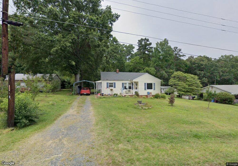
121 Holt Rd Albemarle, NC 28001
Estimated Value: $166,806 - $227,000
2
Beds
1
Bath
1,050
Sq Ft
$182/Sq Ft
Est. Value
About This Home
This home is located at 121 Holt Rd, Albemarle, NC 28001 and is currently estimated at $191,202, approximately $182 per square foot. 121 Holt Rd is a home located in Stanly County with nearby schools including Badin Elementary School, North Stanly Middle School, and North Stanly High School.
Ownership History
Date
Name
Owned For
Owner Type
Purchase Details
Closed on
Mar 18, 2016
Sold by
Fannie Mae
Bought by
Polk Patricia
Current Estimated Value
Purchase Details
Closed on
Dec 17, 2015
Sold by
Uwharrie Bank
Bought by
Federal National Mortgage Association and Fannie Mae
Purchase Details
Closed on
Nov 25, 2015
Sold by
Hubbard Brian K
Bought by
Uwharrie Bank
Purchase Details
Closed on
Nov 15, 2005
Sold by
Nance Chucky L and Nance Jennifer R
Bought by
Hubbard Brian K
Home Financials for this Owner
Home Financials are based on the most recent Mortgage that was taken out on this home.
Original Mortgage
$65,000
Interest Rate
5.84%
Mortgage Type
Purchase Money Mortgage
Purchase Details
Closed on
Aug 5, 2005
Sold by
Couick Michael E and Blizzard Teresa V
Bought by
Nance Chucky L
Create a Home Valuation Report for This Property
The Home Valuation Report is an in-depth analysis detailing your home's value as well as a comparison with similar homes in the area
Home Values in the Area
Average Home Value in this Area
Purchase History
| Date | Buyer | Sale Price | Title Company |
|---|---|---|---|
| Polk Patricia | -- | Attorney | |
| Federal National Mortgage Association | -- | Attorney | |
| Uwharrie Bank | $66,331 | Attorney | |
| Hubbard Brian K | $65,000 | None Available | |
| Nance Chucky L | $44,000 | None Available |
Source: Public Records
Mortgage History
| Date | Status | Borrower | Loan Amount |
|---|---|---|---|
| Previous Owner | Hubbard Brian K | $65,000 |
Source: Public Records
Tax History Compared to Growth
Tax History
| Year | Tax Paid | Tax Assessment Tax Assessment Total Assessment is a certain percentage of the fair market value that is determined by local assessors to be the total taxable value of land and additions on the property. | Land | Improvement |
|---|---|---|---|---|
| 2025 | $1,014 | $90,519 | $19,440 | $71,079 |
| 2024 | $769 | $63,016 | $11,664 | $51,352 |
| 2023 | $384 | $63,016 | $11,664 | $51,352 |
| 2022 | $384 | $63,016 | $11,664 | $51,352 |
| 2021 | $384 | $63,016 | $11,664 | $51,352 |
| 2020 | $341 | $52,530 | $10,368 | $42,162 |
| 2019 | $344 | $52,530 | $10,368 | $42,162 |
| 2018 | $688 | $52,530 | $10,368 | $42,162 |
| 2017 | $662 | $52,530 | $10,368 | $42,162 |
| 2016 | $648 | $51,427 | $9,720 | $41,707 |
| 2015 | $655 | $51,427 | $9,720 | $41,707 |
| 2014 | $670 | $51,427 | $9,720 | $41,707 |
Source: Public Records
Map
Nearby Homes
- 2812 Highway 52
- 36433 Azalea Cir
- 2810 Greenwood Park Cir
- 2808 Murdock Ln
- 2011 Mountain Creek Rd
- 38430 Airport Rd
- 2411 Brookmeade Dr
- 36984 B&C Carter Rd
- 38899 Dalton Ln
- Lot 486 Skyline Dr
- 514 Crestview Dr
- 700 Valleyview Dr Unit 1
- 38037 Mountain Creek Rd
- 37108 Melton Rd
- 36048 Palestine Rd
- 1811 Continental Dr
- 217 Circle Dr
- 35209 Beth Rd
- 37254 Barnhardt Rd
- 38692 Smoke Ridge Rd
- 125 Holt Rd
- 115 Holt Rd
- 000 Us Highway 52 Hwy
- 129 Holt Rd
- 116 Holt Rd
- 126 Holt Rd
- 111 Holt Rd
- 133 Holt Rd
- 128 Holt Rd
- 2832 Us Highway 52 N
- 00 Us Hwy 52 Hwy N
- 2902 Us Highway 52 N
- 134 Holt Rd
- 205 Holt Rd
- 36814 Auto Dr
- 200 Holt Rd
- 36757 Auto Dr
- 37609 Us Highway 52 N
- 40103 Us Highway 52 N
- 2831 Us Highway 52 N