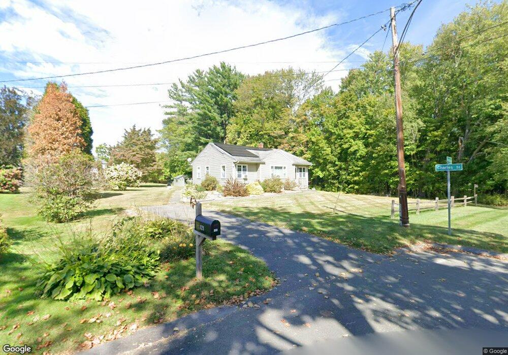
121 Maple St Easthampton, MA 01027
Estimated Value: $368,000 - $420,000
3
Beds
2
Baths
1,148
Sq Ft
$340/Sq Ft
Est. Value
About This Home
This home is located at 121 Maple St, Easthampton, MA 01027 and is currently estimated at $390,070, approximately $339 per square foot. 121 Maple St is a home located in Hampshire County with nearby schools including Easthampton High School, Hilltown Cooperative Charter Public School, and Tri-County Schools.
Ownership History
Date
Name
Owned For
Owner Type
Purchase Details
Closed on
Jul 27, 2007
Sold by
Butler Koren P and Butler-Kurth Tracie E
Bought by
Hubert Holly A and Holes Jennifer M
Current Estimated Value
Home Financials for this Owner
Home Financials are based on the most recent Mortgage that was taken out on this home.
Original Mortgage
$234,000
Outstanding Balance
$149,063
Interest Rate
6.78%
Mortgage Type
Purchase Money Mortgage
Estimated Equity
$241,007
Purchase Details
Closed on
May 26, 2000
Sold by
Symonds Robin W
Bought by
Butler Koren P and Kurth Tracie
Home Financials for this Owner
Home Financials are based on the most recent Mortgage that was taken out on this home.
Original Mortgage
$127,300
Interest Rate
8.1%
Mortgage Type
Purchase Money Mortgage
Purchase Details
Closed on
Jul 29, 1997
Sold by
Gryszan Emil V
Bought by
Symonds Robin W
Home Financials for this Owner
Home Financials are based on the most recent Mortgage that was taken out on this home.
Original Mortgage
$80,850
Interest Rate
7.7%
Mortgage Type
Purchase Money Mortgage
Create a Home Valuation Report for This Property
The Home Valuation Report is an in-depth analysis detailing your home's value as well as a comparison with similar homes in the area
Home Values in the Area
Average Home Value in this Area
Purchase History
| Date | Buyer | Sale Price | Title Company |
|---|---|---|---|
| Hubert Holly A | $234,000 | -- | |
| Butler Koren P | $134,000 | -- | |
| Symonds Robin W | $110,000 | -- |
Source: Public Records
Mortgage History
| Date | Status | Borrower | Loan Amount |
|---|---|---|---|
| Open | Hubert Holly A | $234,000 | |
| Previous Owner | Symonds Robin W | $20,000 | |
| Previous Owner | Symonds Robin W | $127,700 | |
| Previous Owner | Symonds Robin W | $127,300 | |
| Previous Owner | Symonds Robin W | $80,850 |
Source: Public Records
Tax History
| Year | Tax Paid | Tax Assessment Tax Assessment Total Assessment is a certain percentage of the fair market value that is determined by local assessors to be the total taxable value of land and additions on the property. | Land | Improvement |
|---|---|---|---|---|
| 2025 | $4,562 | $333,700 | $119,200 | $214,500 |
| 2024 | $4,406 | $324,900 | $116,000 | $208,900 |
| 2023 | $3,103 | $211,800 | $91,800 | $120,000 |
| 2022 | $3,501 | $211,800 | $91,800 | $120,000 |
| 2021 | $4,129 | $235,400 | $91,800 | $143,600 |
| 2020 | $3,762 | $211,800 | $91,800 | $120,000 |
| 2019 | $3,162 | $204,500 | $91,800 | $112,700 |
| 2018 | $3,034 | $189,600 | $86,600 | $103,000 |
| 2017 | $2,960 | $182,600 | $83,300 | $99,300 |
| 2016 | $3,049 | $195,600 | $83,300 | $112,300 |
| 2015 | $2,963 | $195,600 | $83,300 | $112,300 |
Source: Public Records
Map
Nearby Homes
- 2 Oak St
- 40 Clark St
- 33 Knipfer Ave
- 4 Gaugh St
- 29 Parsons St Unit 1
- 12 Glen Cove Place Unit B
- 18-20 Oakdale Place
- 10 Glen Cove Place Unit A
- 19 Nicols Way Unit 19
- 7 Union Ct
- 211 East St Unit 11
- 11 Dragon Cir
- 6 Wilton Rd
- 41 South St Unit 11
- 6 S St & Abutting Lots
- 336 Main St
- 36 & 36R Holly Cir
- 385 Main St
- 2 W Park Dr
- M143 &152 Glendale St
- 117 Maple St
- 118 Maple St
- 17 Charles St Unit 19
- 114 Maple St Unit D
- 114 Maple St Unit C
- 114 Maple St Unit B
- 114 Maple St Unit A
- 11 Charles St Unit 13
- 8 Charles St
- 113 Maple St
- 112 Maple St
- 100 Briggs St
- 96 Briggs St
- 57 Charles St
- 21 Admiral St
- 110 Maple St
- 90 Briggs St
- 23 Admiral St
- 101 Briggs St
- 71 Clark St
Your Personal Tour Guide
Ask me questions while you tour the home.