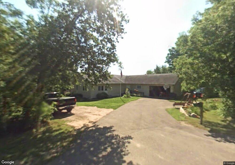
121 Maplewood Dr Randall, MN 56475
Estimated Value: $333,221 - $2,040,000
5
Beds
2
Baths
2,219
Sq Ft
$351/Sq Ft
Est. Value
About This Home
This home is located at 121 Maplewood Dr, Randall, MN 56475 and is currently estimated at $779,555, approximately $351 per square foot. 121 Maplewood Dr is a home with nearby schools including Little Falls Senior High School.
Ownership History
Date
Name
Owned For
Owner Type
Purchase Details
Closed on
Sep 8, 2023
Sold by
Homestead Group Llc A Minnesota Limite
Bought by
Price Brian and Price Shirley
Current Estimated Value
Purchase Details
Closed on
Mar 31, 2022
Sold by
Kc Holdings Llp
Bought by
Homestead Group Llc
Home Financials for this Owner
Home Financials are based on the most recent Mortgage that was taken out on this home.
Original Mortgage
$146,250
Interest Rate
3.76%
Mortgage Type
New Conventional
Purchase Details
Closed on
Feb 9, 2012
Sold by
Nelson/Kupers Llp
Bought by
Kc Holdings Llp
Home Financials for this Owner
Home Financials are based on the most recent Mortgage that was taken out on this home.
Original Mortgage
$70,000
Interest Rate
3.91%
Mortgage Type
Purchase Money Mortgage
Create a Home Valuation Report for This Property
The Home Valuation Report is an in-depth analysis detailing your home's value as well as a comparison with similar homes in the area
Home Values in the Area
Average Home Value in this Area
Purchase History
| Date | Buyer | Sale Price | Title Company |
|---|---|---|---|
| Price Brian | $15,000 | -- | |
| Homestead Group Llc | $2,040,000 | None Listed On Document | |
| Kc Holdings Llp | $985,000 | None Available |
Source: Public Records
Mortgage History
| Date | Status | Borrower | Loan Amount |
|---|---|---|---|
| Previous Owner | Homestead Group Llc | $146,250 | |
| Previous Owner | Kc Holdings Llp | $70,000 |
Source: Public Records
Tax History Compared to Growth
Tax History
| Year | Tax Paid | Tax Assessment Tax Assessment Total Assessment is a certain percentage of the fair market value that is determined by local assessors to be the total taxable value of land and additions on the property. | Land | Improvement |
|---|---|---|---|---|
| 2025 | $3,190 | $288,600 | $44,300 | $244,300 |
| 2024 | $3,226 | $288,600 | $44,300 | $244,300 |
| 2023 | $3,226 | $298,200 | $36,900 | $261,300 |
| 2022 | $2,866 | $252,500 | $36,900 | $215,600 |
| 2021 | $2,898 | $208,500 | $31,900 | $176,600 |
| 2020 | $3,026 | $595,700 | $95,700 | $500,000 |
| 2019 | $2,990 | $200,200 | $31,900 | $168,300 |
| 2018 | $2,832 | $190,900 | $31,900 | $159,000 |
| 2017 | $2,726 | $174,300 | $31,900 | $142,400 |
| 2016 | $2,456 | $0 | $0 | $0 |
| 2014 | $2,084 | $0 | $0 | $0 |
| 2013 | $2,084 | $0 | $0 | $0 |
Source: Public Records
Map
Nearby Homes
- xxx Lost Lake Trail
- 109 1st St
- Tbd Dove Rd
- 524 Superior Ave
- TBD Little Elk Dr
- TBD Lake Camile Dr
- TBD E 6th St
- Lot 8 Blk 1 Ridgewood Dr
- Lot 2 Blk 2 Ridgewood Dr
- Lot 3 Blk 2 Ridgewood Dr
- Lot 5 Blk 2 Ridgewood Dr
- Lot 7 Blk 1 Ridgewood Dr
- Lot 4 Blk 2 Ridgewood Dr
- Lot 6 Blk 2 Ridgewood Dr
- Lot 4 Blk 1 Ridgewood Dr
- Lot 3 Blk 1 Ridgewood Dr
- Lot 1 Blk 2 Ridgewood Dr
- Lot 10 Blk 1 Brummer Dr
- Lot 7 Blk 2 Brummer Dr
- Lot 11 Blk 1 Brummer Dr