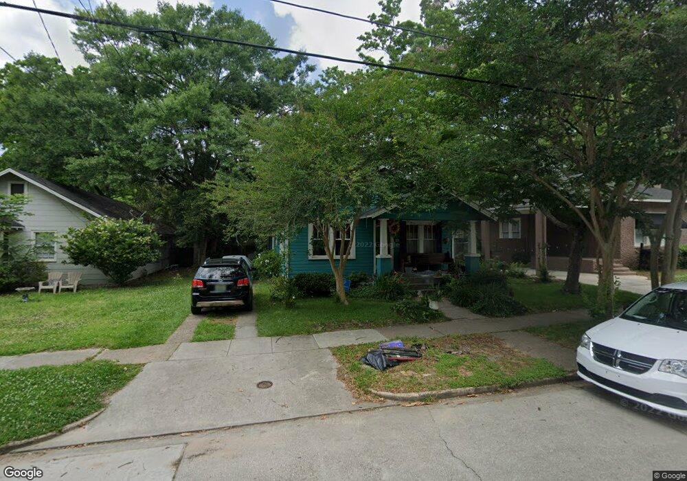
121 Margaret St Mobile, AL 36607
Midtown Mobile NeighborhoodEstimated Value: $176,705 - $263,000
3
Beds
2
Baths
1,400
Sq Ft
$156/Sq Ft
Est. Value
About This Home
This home is located at 121 Margaret St, Mobile, AL 36607 and is currently estimated at $218,676, approximately $156 per square foot. 121 Margaret St is a home located in Mobile County with nearby schools including Florence Howard Elementary School, Booker T. Washington Middle School, and Murphy High School.
Ownership History
Date
Name
Owned For
Owner Type
Purchase Details
Closed on
Jun 11, 2012
Sold by
Phillips Valenda and Carnes Phyllis
Bought by
Phillips Valenda and Carnes Phyllis
Current Estimated Value
Purchase Details
Closed on
Apr 18, 2007
Sold by
Blanton Wing W and Blanton John
Bought by
Phillips Valenda and Phillips Zane
Home Financials for this Owner
Home Financials are based on the most recent Mortgage that was taken out on this home.
Original Mortgage
$101,650
Interest Rate
6.17%
Mortgage Type
Purchase Money Mortgage
Purchase Details
Closed on
Dec 8, 1997
Sold by
Lenaghan John Gowan
Bought by
Blanton Wing W and Blanton John
Home Financials for this Owner
Home Financials are based on the most recent Mortgage that was taken out on this home.
Original Mortgage
$58,500
Interest Rate
7.19%
Create a Home Valuation Report for This Property
The Home Valuation Report is an in-depth analysis detailing your home's value as well as a comparison with similar homes in the area
Home Values in the Area
Average Home Value in this Area
Purchase History
| Date | Buyer | Sale Price | Title Company |
|---|---|---|---|
| Phillips Valenda | $44,500 | None Available | |
| Phillips Valenda | $107,000 | None Available | |
| Blanton Wing W | $65,000 | -- |
Source: Public Records
Mortgage History
| Date | Status | Borrower | Loan Amount |
|---|---|---|---|
| Previous Owner | Phillips Valenda | $101,650 | |
| Previous Owner | Blanton Wing W | $58,500 |
Source: Public Records
Tax History Compared to Growth
Tax History
| Year | Tax Paid | Tax Assessment Tax Assessment Total Assessment is a certain percentage of the fair market value that is determined by local assessors to be the total taxable value of land and additions on the property. | Land | Improvement |
|---|---|---|---|---|
| 2024 | $1,317 | $9,920 | $3,600 | $6,320 |
| 2023 | $1,270 | $9,080 | $3,000 | $6,080 |
| 2022 | $845 | $13,300 | $6,000 | $7,300 |
| 2021 | $664 | $5,230 | $1,500 | $3,730 |
| 2020 | $621 | $4,890 | $1,500 | $3,390 |
| 2019 | $615 | $9,680 | $0 | $0 |
| 2018 | $615 | $9,680 | $0 | $0 |
| 2017 | $615 | $9,680 | $0 | $0 |
| 2016 | $823 | $12,960 | $0 | $0 |
| 2013 | $399 | $12,900 | $0 | $0 |
Source: Public Records
Map
Nearby Homes
- 135 N Carlen St
- 152 Tuscaloosa St
- 2009 Old Shell Rd
- 115 Florence Place
- 120 Shell Road Place
- 2103 Upham Place
- 1813 Old Shell Rd
- 2105 Upham Place
- 4 Demouy Ave
- 17 van Heuval St
- 214 Upham St Unit 3B
- 214 Upham St Unit 16D
- 214 Upham St Unit 4C
- 2100 Springhill Ave
- 254 Woodlands Ave
- 20 Bienville Ave
- 56 S Fulton St
- 61 Glenwood St
- 64 Semmes Ave
- 7 Hannon Ave
- 119 Margaret St
- 123 Margaret St
- 117 Margaret St
- 125 Margaret St
- 127 Margaret St
- 115 Margaret St
- 120 Margaret St
- 129 Margaret St
- 113 Margaret St
- 118 Margaret St
- 124 Margaret St
- 116 Margaret St
- 126 Margaret St
- 131 Margaret St
- 111 Margaret St
- 114 Margaret St
- 128 Margaret St
- 109 Margaret St
- 133 Margaret St
- 112 Margaret St