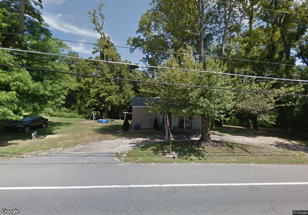
121 Monmouth Rd Wrightstown, NJ 08562
Estimated Value: $172,000 - $219,000
--
Bed
--
Bath
693
Sq Ft
$282/Sq Ft
Est. Value
About This Home
This home is located at 121 Monmouth Rd, Wrightstown, NJ 08562 and is currently estimated at $195,147, approximately $281 per square foot. 121 Monmouth Rd is a home located in Burlington County with nearby schools including C.B. Lamb Elementary School, North Hanover Township Upper Elementary School, and Northern Burlington County Regional Middle School.
Ownership History
Date
Name
Owned For
Owner Type
Purchase Details
Closed on
Nov 17, 2023
Sold by
Stevens Gary
Bought by
Spanier Morgan
Current Estimated Value
Home Financials for this Owner
Home Financials are based on the most recent Mortgage that was taken out on this home.
Original Mortgage
$10,000
Interest Rate
7.57%
Purchase Details
Closed on
Nov 15, 2023
Sold by
Stevens Rolinda R
Bought by
Stevens Gary
Home Financials for this Owner
Home Financials are based on the most recent Mortgage that was taken out on this home.
Original Mortgage
$10,000
Interest Rate
7.57%
Purchase Details
Closed on
Jan 2, 2002
Sold by
Stevens Lillian
Bought by
Stevens Gary and Grant Brenda S
Create a Home Valuation Report for This Property
The Home Valuation Report is an in-depth analysis detailing your home's value as well as a comparison with similar homes in the area
Home Values in the Area
Average Home Value in this Area
Purchase History
| Date | Buyer | Sale Price | Title Company |
|---|---|---|---|
| Spanier Morgan | $181,000 | Collegiate Title | |
| Spanier Morgan | $181,000 | Collegiate Title | |
| Stevens Gary | -- | Collegiate Title | |
| Stevens Gary | -- | Collegiate Title | |
| Stevens Gary | -- | Collegiate Title Corp | |
| Stevens Lillian | -- | Collegiate Title Corp |
Source: Public Records
Mortgage History
| Date | Status | Borrower | Loan Amount |
|---|---|---|---|
| Closed | Spanier Morgan | $10,000 | |
| Open | Spanier Morgan | $170,000 | |
| Closed | Spanier Morgan | $170,000 |
Source: Public Records
Tax History Compared to Growth
Tax History
| Year | Tax Paid | Tax Assessment Tax Assessment Total Assessment is a certain percentage of the fair market value that is determined by local assessors to be the total taxable value of land and additions on the property. | Land | Improvement |
|---|---|---|---|---|
| 2025 | $2,660 | $111,500 | $43,000 | $68,500 |
| 2024 | $2,464 | $111,500 | $43,000 | $68,500 |
| 2023 | $2,464 | $111,500 | $43,000 | $68,500 |
| 2022 | $2,474 | $111,500 | $43,000 | $68,500 |
| 2021 | $2,508 | $111,500 | $43,000 | $68,500 |
| 2020 | $2,501 | $111,500 | $43,000 | $68,500 |
| 2019 | $2,480 | $111,500 | $43,000 | $68,500 |
| 2018 | $2,368 | $111,500 | $43,000 | $68,500 |
| 2017 | $2,318 | $111,500 | $43,000 | $68,500 |
| 2016 | $2,311 | $111,500 | $43,000 | $68,500 |
| 2015 | $2,394 | $115,500 | $47,000 | $68,500 |
| 2014 | $2,255 | $115,500 | $47,000 | $68,500 |
Source: Public Records
Map
Nearby Homes
- 6 Marc Ln
- 229 and 225 Jacobstown New Egypt Rd
- 194 Jacobstown New Egypt Rd Unit 74
- 194 Jacobstown New Egypt Rd Unit 2
- 194 Jacobstown New Egypt Rd Unit 1
- 45 Jacobstown New Egypt Rd
- 0 Larrison Rd
- 166 Larrison Rd
- 619 Hanover Dr
- 92 Jacobstown Rd
- 347 Jacobstown Cookstown Rd
- 20 Belmont Rd
- 18 Chepstow Rd
- 56 Churchill Blvd
- 9 Saratoga Rd
- 55 Churchill Blvd
- 71 Jacobstown Rd
- 70-72 Jacobstown Rd
- 23 Gulfstream Rd
- 67 Aqueduct Blvd