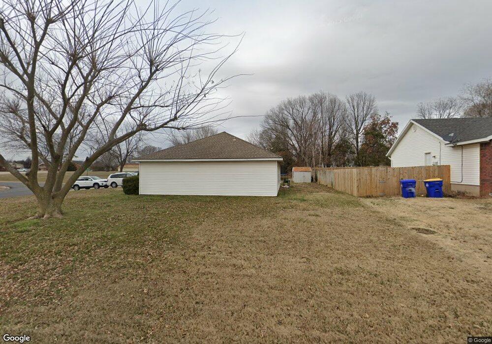
121 N Brandon St Lowell, AR 72745
Estimated Value: $263,000 - $279,000
3
Beds
2
Baths
1,250
Sq Ft
$216/Sq Ft
Est. Value
About This Home
This home is located at 121 N Brandon St, Lowell, AR 72745 and is currently estimated at $270,270, approximately $216 per square foot. 121 N Brandon St is a home located in Benton County with nearby schools including Lowell Elementary School, Kirksey Middle School, and Rogers High School.
Ownership History
Date
Name
Owned For
Owner Type
Purchase Details
Closed on
Sep 8, 2004
Bought by
Mcclane
Current Estimated Value
Purchase Details
Closed on
Aug 3, 2004
Bought by
Mcclane
Purchase Details
Closed on
Apr 4, 2003
Bought by
Sinclair
Purchase Details
Closed on
Jul 6, 2000
Bought by
Sinclair
Purchase Details
Closed on
Dec 3, 1999
Bought by
Comm-Chase Manhatten Mg Copr
Purchase Details
Closed on
Jul 10, 1998
Bought by
Jr Mcmillan
Purchase Details
Closed on
Aug 27, 1996
Bought by
Riggins
Purchase Details
Closed on
Mar 19, 1996
Bought by
Riggins 2P
Create a Home Valuation Report for This Property
The Home Valuation Report is an in-depth analysis detailing your home's value as well as a comparison with similar homes in the area
Home Values in the Area
Average Home Value in this Area
Purchase History
| Date | Buyer | Sale Price | Title Company |
|---|---|---|---|
| Mcclane | $113,000 | -- | |
| Mcclane | $113,000 | -- | |
| Sinclair | -- | -- | |
| Sinclair | $67,000 | -- | |
| Comm-Chase Manhatten Mg Copr | -- | -- | |
| Jr Mcmillan | $67,000 | -- | |
| Riggins | -- | -- | |
| Riggins 2P | $28,000 | -- |
Source: Public Records
Tax History Compared to Growth
Tax History
| Year | Tax Paid | Tax Assessment Tax Assessment Total Assessment is a certain percentage of the fair market value that is determined by local assessors to be the total taxable value of land and additions on the property. | Land | Improvement |
|---|---|---|---|---|
| 2025 | $1,820 | $44,043 | $15,200 | $28,843 |
| 2024 | $1,545 | $44,043 | $15,200 | $28,843 |
| 2023 | $1,405 | $27,440 | $7,200 | $20,240 |
| 2022 | $1,421 | $27,440 | $7,200 | $20,240 |
| 2021 | $1,298 | $27,440 | $7,200 | $20,240 |
| 2020 | $1,183 | $20,320 | $4,000 | $16,320 |
| 2019 | $1,152 | $20,320 | $4,000 | $16,320 |
| 2018 | $1,152 | $20,320 | $4,000 | $16,320 |
| 2017 | $1,081 | $20,320 | $4,000 | $16,320 |
| 2016 | $1,081 | $20,320 | $4,000 | $16,320 |
| 2015 | $679 | $19,340 | $4,400 | $14,940 |
| 2014 | $679 | $19,340 | $4,400 | $14,940 |
Source: Public Records
Map
Nearby Homes
- 122 N Michael St
- 615 Knight Ave
- 410 Homewood Place
- 0 Presidential Dr Unit 1317772
- 1105 Maclaren Ave
- 1101 Maclaren Ave
- 1103 Maclaren Ave
- 1116 Maclaren Ave
- 1102 Maclaren Ave
- 1123 Daylily Ave
- 1117 Daylily Ave
- 1107 Daylily Ave
- 1105 Daylily Ave
- 1103 Daylily Ave
- 1107 Calla Lily Ave
- 1102 Calla Lily Ave
- 1113 Calla Lily Ave
- 1110 Calla Lily Ave
- 1117 Calla Lily Ave
- 1103 Calla Lily Ave
- 512 Newlin Ave
- 115 N Brandon St
- 120 N Brandon St
- 116 N Brandon St
- 516 Newlin Ave
- 111 N Brandon St
- 515 Newlin Ave
- 112 N Brandon St
- 427 Adams Ave
- 112 N Melody St
- 107 N Brandon St
- 518 Newlin Ave
- 108 N Brandon St
- 108 N Melody St
- 105 N Brandon St
- 104 N Brandon St
- 117 N Melody St
- 115 N Melody St
- 419 Adams Ave
- 129 Jefferson St