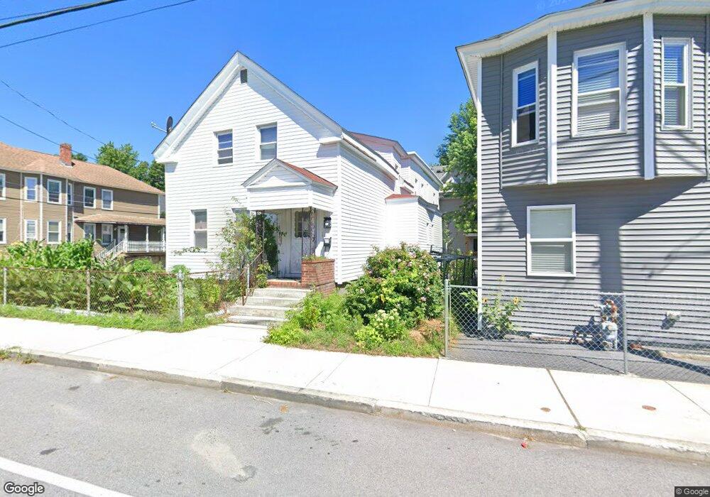
121 Pine St Lowell, MA 01851
Highlands NeighborhoodEstimated Value: $622,855 - $751,000
5
Beds
2
Baths
2,659
Sq Ft
$257/Sq Ft
Est. Value
About This Home
This home is located at 121 Pine St, Lowell, MA 01851 and is currently estimated at $682,714, approximately $256 per square foot. 121 Pine St is a home located in Middlesex County with nearby schools including Charles W. Morey Elementary School, Abraham Lincoln Elementary School, and Dr. Gertrude Bailey Elementary School.
Ownership History
Date
Name
Owned For
Owner Type
Purchase Details
Closed on
Jan 6, 2006
Sold by
Tian Hong and Wang Ning
Bought by
Mastroianni Heidi R and Mastroianni Vincent J
Current Estimated Value
Home Financials for this Owner
Home Financials are based on the most recent Mortgage that was taken out on this home.
Original Mortgage
$382,500
Outstanding Balance
$215,121
Interest Rate
6.28%
Mortgage Type
Purchase Money Mortgage
Estimated Equity
$467,593
Purchase Details
Closed on
Dec 1, 2003
Sold by
Leonard Arthur J and Leonard Earline A
Bought by
Sok Meng and Chuon Vanny
Home Financials for this Owner
Home Financials are based on the most recent Mortgage that was taken out on this home.
Original Mortgage
$219,900
Interest Rate
6.09%
Mortgage Type
Purchase Money Mortgage
Create a Home Valuation Report for This Property
The Home Valuation Report is an in-depth analysis detailing your home's value as well as a comparison with similar homes in the area
Home Values in the Area
Average Home Value in this Area
Purchase History
| Date | Buyer | Sale Price | Title Company |
|---|---|---|---|
| Mastroianni Heidi R | $525,000 | -- | |
| Sok Meng | $274,900 | -- | |
| Sok Meng | $274,900 | -- |
Source: Public Records
Mortgage History
| Date | Status | Borrower | Loan Amount |
|---|---|---|---|
| Open | Sok Meng | $382,500 | |
| Previous Owner | Sok Meng | $219,900 | |
| Previous Owner | Sok Meng | $80,000 | |
| Previous Owner | Sok Meng | $77,000 |
Source: Public Records
Tax History
| Year | Tax Paid | Tax Assessment Tax Assessment Total Assessment is a certain percentage of the fair market value that is determined by local assessors to be the total taxable value of land and additions on the property. | Land | Improvement |
|---|---|---|---|---|
| 2025 | $6,898 | $600,900 | $152,500 | $448,400 |
| 2024 | $6,431 | $540,000 | $143,800 | $396,200 |
| 2023 | $5,975 | $481,100 | $125,000 | $356,100 |
| 2022 | $5,528 | $435,600 | $113,700 | $321,900 |
| 2021 | $5,124 | $380,700 | $98,900 | $281,800 |
| 2020 | $4,719 | $353,200 | $93,500 | $259,700 |
| 2019 | $4,459 | $317,600 | $90,700 | $226,900 |
| 2018 | $4,166 | $289,500 | $86,400 | $203,100 |
| 2017 | $3,830 | $256,700 | $71,400 | $185,300 |
| 2016 | $3,760 | $248,000 | $68,000 | $180,000 |
| 2015 | $3,480 | $224,800 | $68,000 | $156,800 |
| 2013 | $2,984 | $198,800 | $79,500 | $119,300 |
Source: Public Records
Map
Nearby Homes
- 137 Pine St Unit 11
- 11 Warwick St Unit 3
- 23 Burtt St
- 17 Edson St
- 67 S Loring St
- 312 Wilder St
- 18 Burgess St
- 30 Grace St
- 234 Foster St
- 173 Princeton Blvd
- 710 School St
- 45 Harvard St Unit 5 3rd fl
- 3 Butman Place
- 85 B St
- 49 Marginal St
- 68 Smith St
- 15 Barclay St
- 118 Sanders Ave
- 1311 Middlesex St
- 42 Branch St
- 117 Pine St
- 11 Wesley St Unit 3
- 9 Wesley St
- 127 Pine St Unit Right
- 127 Pine St
- 129 Pine Street 2nd Floor Unit Left
- 127 -129 Pine St
- 429 Wilder St
- 435 Wilder St
- 10 Wesley St
- 427 Wilder St
- 421 Wilder St
- 450 Westford St Unit C
- 450 Westford St Unit A
- 450 Westford St Unit B
- 450 Westford St
- 450 Westford St Unit 1
- 450 Westford St Unit 2
- 450 Westford St Unit 3
- 137 Pine St
Your Personal Tour Guide
Ask me questions while you tour the home.