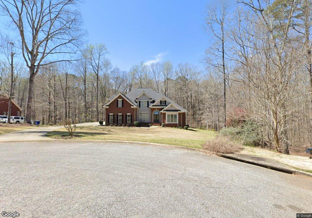
121 Red Oak Trail Lagrange, GA 30240
Estimated Value: $602,000 - $696,000
6
Beds
5
Baths
5,069
Sq Ft
$127/Sq Ft
Est. Value
About This Home
This home is located at 121 Red Oak Trail, Lagrange, GA 30240 and is currently estimated at $644,886, approximately $127 per square foot. 121 Red Oak Trail is a home located in Troup County with nearby schools including Franklin Forest Elementary School, Hollis Hand Elementary School, and Ethel W. Kight Elementary School.
Ownership History
Date
Name
Owned For
Owner Type
Purchase Details
Closed on
Apr 19, 2019
Sold by
Harman Christopher W
Bought by
Fidahussein Salman S and Fidahussein Munira A
Current Estimated Value
Home Financials for this Owner
Home Financials are based on the most recent Mortgage that was taken out on this home.
Original Mortgage
$389,000
Outstanding Balance
$251,849
Interest Rate
4.2%
Mortgage Type
New Conventional
Estimated Equity
$393,037
Purchase Details
Closed on
Oct 8, 2003
Sold by
Ben H Parham Inc
Bought by
Christopher Harman
Purchase Details
Closed on
Jul 30, 1996
Sold by
Broadwater Dev Corp
Bought by
Ben H Parham Inc
Purchase Details
Closed on
Apr 1, 1996
Bought by
Broadwater Dev Corp
Create a Home Valuation Report for This Property
The Home Valuation Report is an in-depth analysis detailing your home's value as well as a comparison with similar homes in the area
Home Values in the Area
Average Home Value in this Area
Purchase History
| Date | Buyer | Sale Price | Title Company |
|---|---|---|---|
| Fidahussein Salman S | $389,000 | -- | |
| Christopher Harman | $50,000 | -- | |
| Ben H Parham Inc | -- | -- | |
| Broadwater Dev Corp | -- | -- |
Source: Public Records
Mortgage History
| Date | Status | Borrower | Loan Amount |
|---|---|---|---|
| Open | Fidahussein Salman S | $389,000 |
Source: Public Records
Tax History Compared to Growth
Tax History
| Year | Tax Paid | Tax Assessment Tax Assessment Total Assessment is a certain percentage of the fair market value that is determined by local assessors to be the total taxable value of land and additions on the property. | Land | Improvement |
|---|---|---|---|---|
| 2024 | $5,648 | $207,080 | $19,800 | $187,280 |
| 2023 | $5,580 | $204,600 | $19,800 | $184,800 |
| 2022 | $5,399 | $193,440 | $19,800 | $173,640 |
| 2021 | $4,792 | $158,880 | $19,800 | $139,080 |
| 2020 | $4,693 | $158,880 | $19,800 | $139,080 |
| 2019 | $5,269 | $176,680 | $18,000 | $158,680 |
| 2018 | $5,269 | $176,680 | $18,000 | $158,680 |
| 2017 | $5,269 | $176,680 | $18,000 | $158,680 |
| 2016 | $5,223 | $175,153 | $18,000 | $157,153 |
| 2015 | $5,232 | $175,153 | $18,000 | $157,153 |
| 2014 | $5,142 | $171,913 | $18,000 | $153,913 |
| 2013 | -- | $153,028 | $20,000 | $133,028 |
Source: Public Records
Map
Nearby Homes
- 127 Oakmont Dr
- 104 Hidden Branches Ln
- 118 Moss Creek Dr
- LOT 106 River Oaks Dr
- 209 River Oaks Dr
- 107 Windridge
- 109 Windridge
- 91 Richmond Dr
- 117 Woodchase
- 105 Ridgeview Dr
- 127 Ashling Dr
- 1784 New Franklin Rd
- 129 Sunny Point Cir
- 89 Chase Rd
- 100 Creekside Dr Unit LOT 60A
- 107 Dixie Creek Dr
- 106 S Chilton Crescent
- 201 S Chilton Crescent
- 203 S Chilton Crescent
- 100 Canterbury Dr
- 119 Red Oak Trail
- 123 Red Oak Trail
- 124 Red Oak Trail
- 124 Red Oak Trail Unit 7
- 117 Red Oak Trail
- 120 Red Oak Trail
- 122 Red Oak Trail
- 312 High Pointe Dr Unit 84
- 312 High Pointe Dr
- 227 Ashford Cir
- 118 Red Oak Trail
- 229 Ashford Cir
- 225 Ashford Cir
- 116 Red Oak Trail
- 115 Red Oak Trail
- 115 Red Oak Trail Unit 2
- 96 Windridge
- 114 Red Oak Trail
- 223 Ashford Cir
- 222 Ashford Cir