Estimated Value: $230,000 - $268,000
4
Beds
2
Baths
1,232
Sq Ft
$202/Sq Ft
Est. Value
About This Home
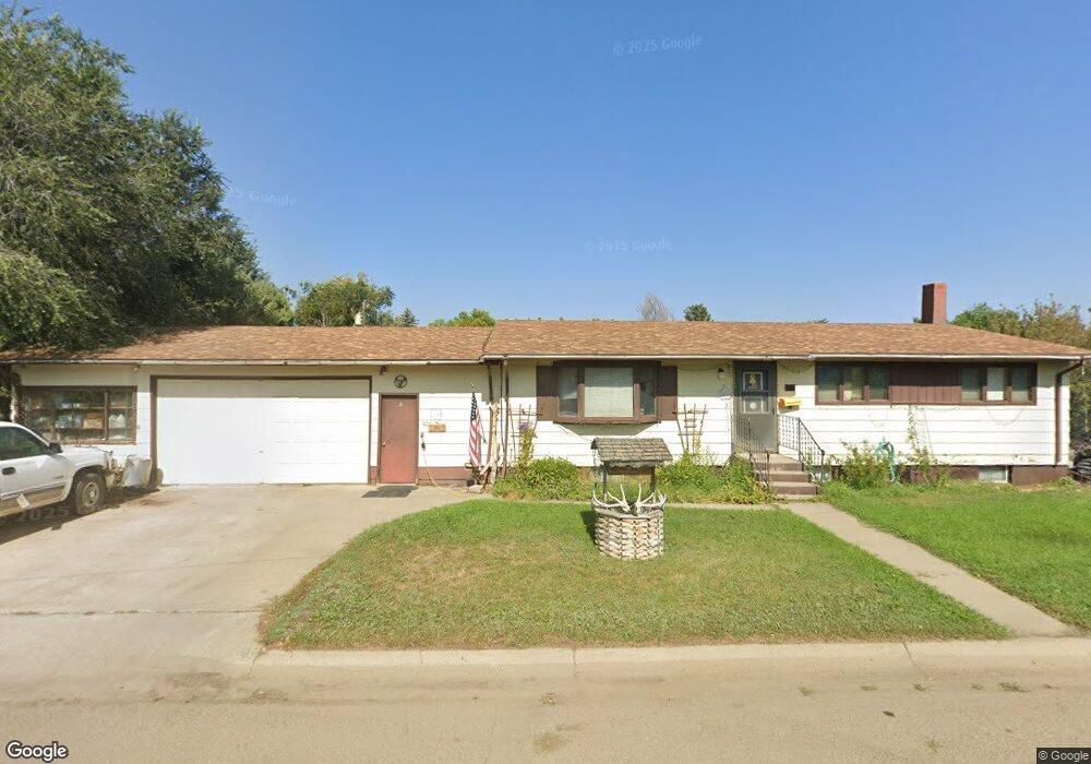
This home is located at 121 S 10th St E, Malta, MT 59538 and is currently estimated at $249,332, approximately $202 per square foot. 121 S 10th St E is a home located in Phillips County with nearby schools including Malta Elementary School, Loring Colony School, and Malta Middle School.
Ownership History
Date
Name
Owned For
Owner Type
Purchase Details
Closed on
Jan 7, 2008
Bought by
Knudsen Earline
Current Estimated Value
Create a Home Valuation Report for This Property
The Home Valuation Report is an in-depth analysis detailing your home's value as well as a comparison with similar homes in the area
Purchase History
| Date | Buyer | Sale Price | Title Company |
|---|---|---|---|
| Knudsen Earline | -- | -- |
Source: Public Records
Tax History
| Year | Tax Paid | Tax Assessment Tax Assessment Total Assessment is a certain percentage of the fair market value that is determined by local assessors to be the total taxable value of land and additions on the property. | Land | Improvement |
|---|---|---|---|---|
| 2025 | $869 | $239,600 | $0 | $0 |
| 2024 | $1,000 | $223,200 | $0 | $0 |
| 2023 | $1,199 | $223,200 | $0 | $0 |
| 2022 | $2,744 | $203,800 | $0 | $0 |
| 2021 | $2,063 | $203,800 | $0 | $0 |
| 2020 | $2,370 | $182,074 | $0 | $0 |
| 2019 | $2,361 | $182,074 | $0 | $0 |
| 2018 | $2,315 | $180,100 | $0 | $0 |
| 2017 | $2,185 | $180,100 | $0 | $0 |
| 2016 | $2,081 | $157,900 | $0 | $0 |
| 2015 | $1,653 | $157,900 | $0 | $0 |
| 2014 | $1,277 | $70,755 | $0 | $0 |
Source: Public Records
Map
Nearby Homes
- 216 & 216 1/2 S 8th St E
- 11 S 12th St E
- 15 S 12th St E
- 814 S 5th Ave E
- 331 S 6th St E
- 111 Ruby Ave
- 502 S Central Ave
- 20 S 4th St E
- 337 S 4th St E
- 108 S 4th St W
- 532 S 4th Ave W
- 328 S 5th St W
- 550 S 2nd St E
- 7011 Us Hwy 191 S
- 3330 Strater Rd
- 146 Acres Secondary State Highway 363
- Rd
- NHN Assiniboine Rd
- 9021 S Wagner Rd
- Assiniboine Rd
- 921 S 1st Ave E
- 100 S 9th St E
- 130 S 9th St E
- 920 S 1st Ave E
- 13 S 11th St E
- 50 S 9th St E
- 215 S 10th St E
- 1000 S 1st Ave E
- 214 S 9th St E
- 17 S 11th St E
- 123 S 9th St E
- 45 S 10th St E
- 131 S 9th St E
- 44 S 9th St E
- 207 S 9th St E
- 838 S 1st Ave E
- 1030 S 1st Ave E
- 39 S 10th St E
- 215 S 9th St E
- 40 S 9th St E
Your Personal Tour Guide
Ask me questions while you tour the home.