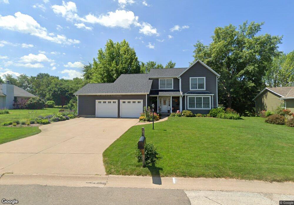
121 Shawnee Cir Eldridge, IA 52748
Estimated Value: $313,948 - $408,000
4
Beds
3
Baths
2,222
Sq Ft
$168/Sq Ft
Est. Value
About This Home
This home is located at 121 Shawnee Cir, Eldridge, IA 52748 and is currently estimated at $373,737, approximately $168 per square foot. 121 Shawnee Cir is a home located in Scott County with nearby schools including Neil Armstrong Elementary School, North Scott Junior High School, and North Scott Senior High School.
Ownership History
Date
Name
Owned For
Owner Type
Purchase Details
Closed on
Jul 18, 2016
Sold by
Vanderflught Gray D and Vanderflught Janet H
Bought by
Krzyzanowski David R and Krzyzanowski Saran E
Current Estimated Value
Create a Home Valuation Report for This Property
The Home Valuation Report is an in-depth analysis detailing your home's value as well as a comparison with similar homes in the area
Home Values in the Area
Average Home Value in this Area
Purchase History
| Date | Buyer | Sale Price | Title Company |
|---|---|---|---|
| Krzyzanowski David R | $272,500 | None Available |
Source: Public Records
Tax History Compared to Growth
Tax History
| Year | Tax Paid | Tax Assessment Tax Assessment Total Assessment is a certain percentage of the fair market value that is determined by local assessors to be the total taxable value of land and additions on the property. | Land | Improvement |
|---|---|---|---|---|
| 2025 | $2,984 | $320,300 | $25,200 | $295,100 |
| 2024 | $2,928 | $283,200 | $25,200 | $258,000 |
| 2023 | $3,002 | $283,200 | $25,200 | $258,000 |
| 2022 | $2,968 | $249,260 | $25,150 | $224,110 |
| 2021 | $2,968 | $249,260 | $25,150 | $224,110 |
| 2020 | $2,990 | $238,650 | $25,150 | $213,500 |
| 2019 | $2,990 | $228,480 | $25,150 | $203,330 |
| 2018 | $3,064 | $228,480 | $25,150 | $203,330 |
| 2017 | $1,271 | $228,480 | $25,150 | $203,330 |
| 2016 | $3,008 | $223,020 | $0 | $0 |
| 2015 | $3,008 | $0 | $0 | $0 |
| 2014 | $2,918 | $213,130 | $0 | $0 |
| 2013 | $2,880 | $0 | $0 | $0 |
| 2012 | -- | $215,210 | $25,150 | $190,060 |
Source: Public Records
Map
Nearby Homes
- 119 Shawnee Cir
- 201 Blackhawk Dr
- 4 Blackhawk Ct
- 6 Blackhawk Ct
- 116 Shawnee Cir
- 117 Shawnee Cir
- 118 Shawnee Cir
- 205 Blackhawk Dr
- 114 Shawnee Cir
- 115 Shawnee Cir
- 8 Blackhawk Ct
- 200 Blackhawk Dr
- 202 Blackhawk Dr
- 112 Shawnee Cir
- 115 Blackhawk Dr
- 204 Blackhawk Dr
- 120 Blackhawk Dr
- 7 Blackhawk Ct
- 203 Shawnee Cir
- 5 Blackhawk Ct