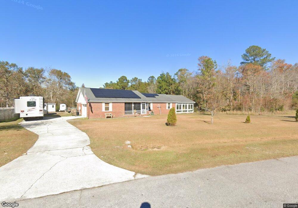
121 Wheelstone Way Guyton, GA 31312
Estimated Value: $391,000 - $437,000
--
Bed
1
Bath
1,683
Sq Ft
$243/Sq Ft
Est. Value
About This Home
This home is located at 121 Wheelstone Way, Guyton, GA 31312 and is currently estimated at $408,737, approximately $242 per square foot. 121 Wheelstone Way is a home located in Effingham County with nearby schools including South Effingham Elementary School, South Effingham Middle School, and South Effingham High School.
Ownership History
Date
Name
Owned For
Owner Type
Purchase Details
Closed on
Jan 28, 2008
Sold by
Ralph Rancis O
Bought by
Ralph Earl F and Ralph Elizabeth C
Current Estimated Value
Create a Home Valuation Report for This Property
The Home Valuation Report is an in-depth analysis detailing your home's value as well as a comparison with similar homes in the area
Home Values in the Area
Average Home Value in this Area
Purchase History
| Date | Buyer | Sale Price | Title Company |
|---|---|---|---|
| Ralph Earl F | -- | -- |
Source: Public Records
Tax History Compared to Growth
Tax History
| Year | Tax Paid | Tax Assessment Tax Assessment Total Assessment is a certain percentage of the fair market value that is determined by local assessors to be the total taxable value of land and additions on the property. | Land | Improvement |
|---|---|---|---|---|
| 2024 | $4,491 | $215,073 | $22,800 | $192,273 |
| 2023 | $2,992 | $162,678 | $17,600 | $145,078 |
| 2022 | $3,361 | $137,538 | $16,000 | $121,538 |
| 2021 | $3,024 | $109,216 | $14,000 | $95,216 |
| 2020 | $3,042 | $112,741 | $14,000 | $98,741 |
| 2019 | $3,067 | $114,088 | $14,000 | $100,088 |
| 2018 | $2,945 | $106,825 | $14,000 | $92,825 |
| 2017 | $2,814 | $98,857 | $14,000 | $84,857 |
| 2016 | $2,722 | $92,090 | $14,000 | $78,090 |
| 2015 | -- | $79,938 | $14,000 | $65,938 |
| 2014 | -- | $75,938 | $10,000 | $65,938 |
| 2013 | -- | $43,697 | $5,600 | $38,097 |
Source: Public Records
Map
Nearby Homes
- 108 Settlers Point Dr
- 105 Homestead Ct
- 137 Scholar Rd
- 120 Annie Dr
- 438 Kessler Loop
- 125 Annie Dr
- 1257 Noel C Conaway Rd
- 102 Sam's Dr
- 275 Caribbean Village Dr
- 104 Sams Dr
- 276 Caribbean Village Dr
- 119 Sams Dr
- 139 Sams Dr
- 144 Tobago Cir
- 178 Tobago Cir
- 138 Sams Dr
- 146 Nease Rd
- 126 Tobago Cir
- 548 Amsonia Cir
- 225 Caribbean Village Dr
- 110 Wheelstone Way
- 119 Wheelstone Way
- 117 Wheelstone Way
- 108 Wheelstone Way
- 123 Wheelstone Way
- 112 Wheelstone Way
- 106 Wheelstone Way
- 115 Wheelstone Way
- 125 Wheelstone Way
- 119 Olde Manor Ln
- 114 Wheelstone Way
- 104 Wheelstone Way
- 121 Olde Manor Ln
- 127 Wheelstone Way
- 111 Wheelstone Way
- 112 Winnai Ln
- 113 Wheelstone Way
- 117 Olde Manor Ln
- 109 Wheelstone Way
- 102 Wheelstone Way