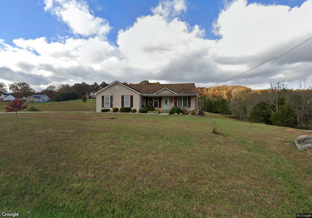
1210 Fordtown Rd Jonesborough, TN 37659
Estimated Value: $410,419 - $434,000
3
Beds
2
Baths
1,445
Sq Ft
$292/Sq Ft
Est. Value
About This Home
This home is located at 1210 Fordtown Rd, Jonesborough, TN 37659 and is currently estimated at $421,605, approximately $291 per square foot. 1210 Fordtown Rd is a home located in Washington County with nearby schools including Gray Elementary School and Daniel Boone High School.
Ownership History
Date
Name
Owned For
Owner Type
Purchase Details
Closed on
Jul 30, 2019
Sold by
Byrne Dan N and Byrne Frances H
Bought by
Rogers Toby J and Rogers Carrie A
Current Estimated Value
Purchase Details
Closed on
Oct 3, 2014
Sold by
Mcdonald Kelly D
Bought by
Byrne Dan N and Byrne Frances H
Home Financials for this Owner
Home Financials are based on the most recent Mortgage that was taken out on this home.
Original Mortgage
$144,982
Interest Rate
4.17%
Mortgage Type
New Conventional
Purchase Details
Closed on
Jun 12, 2014
Sold by
Myers David W
Bought by
Mcdonald Kelly D and Mcdonald Stephanie M
Home Financials for this Owner
Home Financials are based on the most recent Mortgage that was taken out on this home.
Original Mortgage
$178,192
Interest Rate
4.23%
Mortgage Type
VA
Create a Home Valuation Report for This Property
The Home Valuation Report is an in-depth analysis detailing your home's value as well as a comparison with similar homes in the area
Home Values in the Area
Average Home Value in this Area
Purchase History
| Date | Buyer | Sale Price | Title Company |
|---|---|---|---|
| Rogers Toby J | -- | None Available | |
| Byrne Dan N | $179,000 | -- | |
| Mcdonald Kelly D | $172,500 | -- |
Source: Public Records
Mortgage History
| Date | Status | Borrower | Loan Amount |
|---|---|---|---|
| Previous Owner | Byrne Dan N | $144,982 | |
| Previous Owner | Mcdonald Kelly D | $178,192 |
Source: Public Records
Tax History Compared to Growth
Tax History
| Year | Tax Paid | Tax Assessment Tax Assessment Total Assessment is a certain percentage of the fair market value that is determined by local assessors to be the total taxable value of land and additions on the property. | Land | Improvement |
|---|---|---|---|---|
| 2024 | $1,429 | $83,575 | $7,450 | $76,125 |
| 2022 | $1,044 | $48,550 | $5,325 | $43,225 |
| 2021 | $1,044 | $48,550 | $5,325 | $43,225 |
| 2020 | $1,044 | $48,550 | $5,325 | $43,225 |
| 2019 | $1,026 | $48,550 | $5,325 | $43,225 |
| 2018 | $1,026 | $43,125 | $5,325 | $37,800 |
| 2017 | $1,026 | $43,125 | $5,325 | $37,800 |
| 2016 | $1,026 | $43,125 | $5,325 | $37,800 |
| 2015 | $854 | $43,125 | $5,325 | $37,800 |
| 2014 | $854 | $43,125 | $5,325 | $37,800 |
Source: Public Records
Map
Nearby Homes
- 1238 Fordtown Rd
- 140 Hulse Rd
- 00 Rd
- Tbd Tranquil Ct
- 3149 Phillips Way
- 2919 Southbridge Rd
- 3324 Cottage Green Ct
- 3323 Joshua Ln
- Lot 14 Steepleview Ct
- Lot 19 Steepleview Ct
- 110 Rhetts Way
- 3069 Calton Hill
- 3137 London Rd
- Lot 15 Steepleview Ct
- Lot 9 Larkins Farm Dr
- 694 Saint Andrews Dr
- Lot 10 Larkins Farm Dr
- 690 Saint Andrews Dr
- 686 Saint Andrews Dr
- 687 Saint Andrews Dr